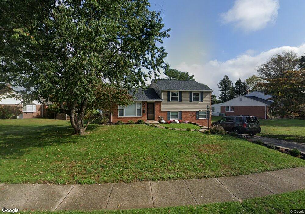
564 Maddock Rd Springfield, PA 19064
Estimated Value: $485,614 - $583,000
3
Beds
2
Baths
1,983
Sq Ft
$264/Sq Ft
Est. Value
About This Home
This home is located at 564 Maddock Rd, Springfield, PA 19064 and is currently estimated at $522,904, approximately $263 per square foot. 564 Maddock Rd is a home located in Delaware County with nearby schools including Springfield High School, St Francis Of Assisi School, and Cardinal O'Hara High School.
Ownership History
Date
Name
Owned For
Owner Type
Purchase Details
Closed on
Aug 15, 2014
Sold by
Graci Joseph C and Marino Rita E
Bought by
Neill Valerie A O and Neill Iv James F O
Current Estimated Value
Home Financials for this Owner
Home Financials are based on the most recent Mortgage that was taken out on this home.
Original Mortgage
$266,000
Outstanding Balance
$202,900
Interest Rate
4.12%
Mortgage Type
New Conventional
Estimated Equity
$320,004
Purchase Details
Closed on
May 13, 2005
Sold by
Cavanaugh Margaret
Bought by
Graci Joseph C and Marino Rita E
Home Financials for this Owner
Home Financials are based on the most recent Mortgage that was taken out on this home.
Original Mortgage
$37,500
Interest Rate
5.94%
Mortgage Type
Credit Line Revolving
Create a Home Valuation Report for This Property
The Home Valuation Report is an in-depth analysis detailing your home's value as well as a comparison with similar homes in the area
Home Values in the Area
Average Home Value in this Area
Purchase History
| Date | Buyer | Sale Price | Title Company |
|---|---|---|---|
| Neill Valerie A O | $280,000 | None Available | |
| Graci Joseph C | $250,000 | Germantown Title Co |
Source: Public Records
Mortgage History
| Date | Status | Borrower | Loan Amount |
|---|---|---|---|
| Open | Neill Valerie A O | $266,000 | |
| Previous Owner | Graci Joseph C | $37,500 | |
| Previous Owner | Graci Joseph C | $200,000 |
Source: Public Records
Tax History
| Year | Tax Paid | Tax Assessment Tax Assessment Total Assessment is a certain percentage of the fair market value that is determined by local assessors to be the total taxable value of land and additions on the property. | Land | Improvement |
|---|---|---|---|---|
| 2025 | $7,775 | $276,640 | $113,990 | $162,650 |
| 2024 | $7,775 | $276,640 | $113,990 | $162,650 |
| 2023 | $7,487 | $276,640 | $113,990 | $162,650 |
| 2022 | $7,325 | $276,640 | $113,990 | $162,650 |
| 2021 | $11,344 | $276,640 | $113,990 | $162,650 |
| 2020 | $7,323 | $161,600 | $54,800 | $106,800 |
| 2019 | $7,151 | $161,600 | $54,800 | $106,800 |
| 2018 | $7,048 | $161,600 | $0 | $0 |
| 2017 | $6,885 | $161,600 | $0 | $0 |
| 2016 | $887 | $161,600 | $0 | $0 |
| 2015 | $905 | $161,600 | $0 | $0 |
| 2014 | $887 | $161,600 | $0 | $0 |
Source: Public Records
Map
Nearby Homes
- 641 W Sproul Rd
- 436 Kerr Ln
- 359 Spring Valley Rd
- 499 Collins Dr
- 249 Gleaves Rd
- 606 W Springfield Rd
- 364 S Rolling Rd
- 1291 Country Club Dr Unit Q137
- 412 Foster Dr
- 1363 Palmer Dr Unit O122
- 493 Wheatsheaf Rd
- 231 E Woodland Ave
- 264 Pancoast Ave
- 1588 Nicklaus Dr Unit H65
- 120 W Springfield Rd
- 501 Flora Cir
- 109 Jackdaw Aly
- 208 Jackdaw Aly
- 509 Beatty Rd
- 253 Saxer Ave
- 570 Maddock Rd
- 554 Maddock Rd
- 544 Maddock Rd
- 574 Maddock Rd
- 563 Maddock Rd
- 575 Maddock Rd
- 567 Maddock Rd
- 571 Maddock Rd
- 534 Maddock Rd
- 559 Maddock Rd
- 516 Maddock Rd
- 512 Maddock Rd
- 524 Maddock Rd
- 578 Maddock Rd
- 555 Maddock Rd
- 453 Kennerly Rd
- 508 Maddock Rd
- 551 Maddock Rd
- 547 Maddock Rd
- 582 Maddock Rd
Your Personal Tour Guide
Ask me questions while you tour the home.