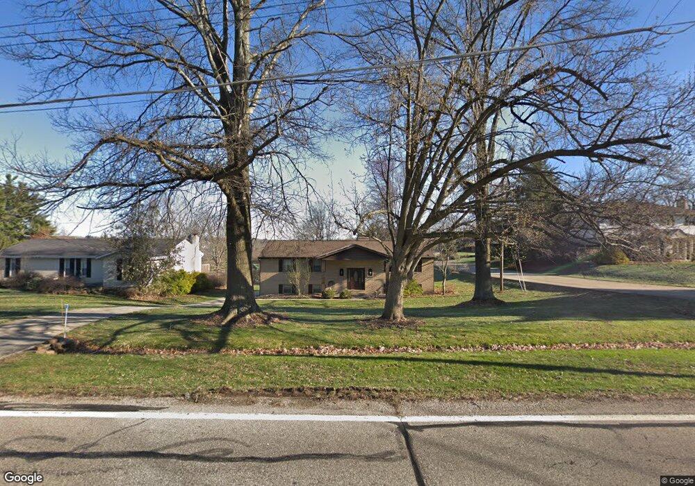
5642 Jessup Rd Cincinnati, OH 45247
White Oak West NeighborhoodEstimated Value: $345,002 - $484,000
4
Beds
3
Baths
2,520
Sq Ft
$154/Sq Ft
Est. Value
About This Home
This home is located at 5642 Jessup Rd, Cincinnati, OH 45247 and is currently estimated at $388,751, approximately $154 per square foot. 5642 Jessup Rd is a home located in Hamilton County with nearby schools including Monfort Heights Elementary School, White Oak Middle School, and Colerain High School.
Ownership History
Date
Name
Owned For
Owner Type
Purchase Details
Closed on
Jan 19, 2000
Sold by
Rizzo John J and Rizzo Linda L
Bought by
Eads John and Eads Sue
Current Estimated Value
Home Financials for this Owner
Home Financials are based on the most recent Mortgage that was taken out on this home.
Original Mortgage
$137,700
Interest Rate
7.81%
Create a Home Valuation Report for This Property
The Home Valuation Report is an in-depth analysis detailing your home's value as well as a comparison with similar homes in the area
Home Values in the Area
Average Home Value in this Area
Purchase History
| Date | Buyer | Sale Price | Title Company |
|---|---|---|---|
| Eads John | $153,000 | -- |
Source: Public Records
Mortgage History
| Date | Status | Borrower | Loan Amount |
|---|---|---|---|
| Closed | Eads John | $137,700 |
Source: Public Records
Tax History
| Year | Tax Paid | Tax Assessment Tax Assessment Total Assessment is a certain percentage of the fair market value that is determined by local assessors to be the total taxable value of land and additions on the property. | Land | Improvement |
|---|---|---|---|---|
| 2025 | $4,702 | $86,685 | $14,441 | $72,244 |
| 2023 | $4,619 | $86,685 | $14,441 | $72,244 |
| 2022 | $4,211 | $64,537 | $15,162 | $49,375 |
| 2021 | $4,028 | $64,537 | $15,162 | $49,375 |
| 2020 | $3,899 | $64,537 | $15,162 | $49,375 |
| 2019 | $4,098 | $61,464 | $14,441 | $47,023 |
| 2018 | $3,649 | $61,464 | $14,441 | $47,023 |
| 2017 | $3,449 | $61,464 | $14,441 | $47,023 |
| 2016 | $3,341 | $58,633 | $14,298 | $44,335 |
| 2015 | $3,371 | $58,633 | $14,298 | $44,335 |
| 2014 | $3,377 | $58,633 | $14,298 | $44,335 |
| 2013 | $3,190 | $59,224 | $14,441 | $44,783 |
Source: Public Records
Map
Nearby Homes
- 5547 Hubble Rd
- 6051 Shelrich Ct
- 5876 Sutters Mill Dr
- 6670 Gaines Rd
- 5080 Jessup Rd
- 6707 Weiss Rd
- 5588 W Fork Rd
- 6150 Wilmer Rd
- Site 1 Brierly Creek Rd
- 5563 Haft Rd
- 6130 Wilmer Rd
- 4643 Whispering Oak Trail
- 4357 Hubble Rd
- 5804 Cedaridge Dr
- 4600 Farcrest Ct
- 3964 Hubble Rd
- 4192 Timberpoint Dr
- 5339 Race Rd
- 6020 Sheed Rd
- 4021 Hanley Rd
- 5642 Jessup Rd
- 5650 Jessup Rd
- 5626 Jessup Rd
- 6104 Rose Petal Dr
- 19 Rose Petal Dr
- 17 Rose Petal Dr
- 5649 Jessup Rd
- 5651 Jessup Rd
- 5672 Jessup Rd
- 6110 Rose Petal Dr
- 6105 Rose Petal Dr
- 5623 Jessup Rd
- 5657 Jessup Rd
- 6109 Rose Petal Dr
- 5613 Jessup Rd
- 5634 Jessup Rd
- 5684 Jessup Rd
- 6116 Rose Petal Dr Unit 19
- 6116 Rose Petal Dr
- 4 Rose Petal #4 Dr
Your Personal Tour Guide
Ask me questions while you tour the home.