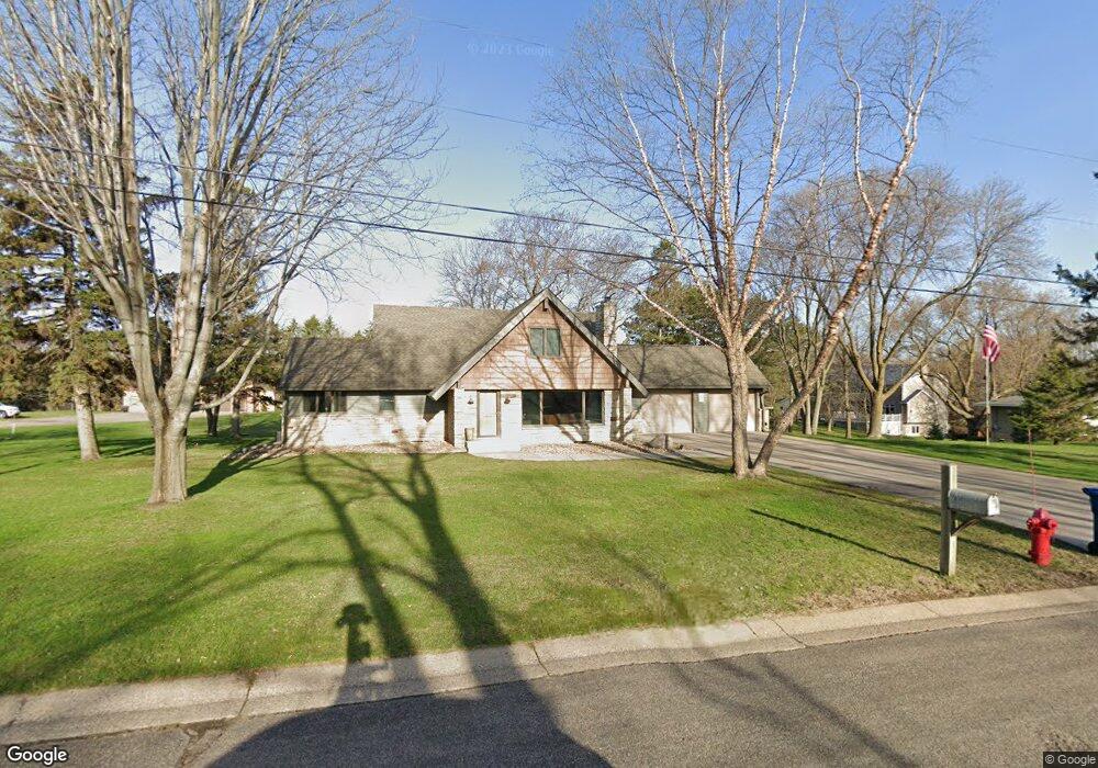
5645 Annette Ave E Inver Grove Heights, MN 55077
Estimated Value: $481,000 - $717,000
5
Beds
3
Baths
3,794
Sq Ft
$145/Sq Ft
Est. Value
About This Home
This home is located at 5645 Annette Ave E, Inver Grove Heights, MN 55077 and is currently estimated at $552,015, approximately $145 per square foot. 5645 Annette Ave E is a home located in Dakota County with nearby schools including Salem Hills Elementary School, Inver Grove Heights Middle School, and Simley Senior High School.
Ownership History
Date
Name
Owned For
Owner Type
Purchase Details
Closed on
Mar 31, 2010
Sold by
Dahn Jeffrey and Dahn Patricia
Bought by
Dahn Luke
Current Estimated Value
Home Financials for this Owner
Home Financials are based on the most recent Mortgage that was taken out on this home.
Original Mortgage
$200,000
Interest Rate
5.03%
Mortgage Type
New Conventional
Purchase Details
Closed on
Mar 23, 2009
Sold by
Not Provided
Bought by
Dahn Jeffrey P and Dahn Patricia A
Create a Home Valuation Report for This Property
The Home Valuation Report is an in-depth analysis detailing your home's value as well as a comparison with similar homes in the area
Home Values in the Area
Average Home Value in this Area
Purchase History
| Date | Buyer | Sale Price | Title Company |
|---|---|---|---|
| Dahn Luke | $250,000 | -- | |
| Dahn Jeffrey P | $400,000 | -- |
Source: Public Records
Mortgage History
| Date | Status | Borrower | Loan Amount |
|---|---|---|---|
| Closed | Dahn Luke | $200,000 |
Source: Public Records
Tax History Compared to Growth
Tax History
| Year | Tax Paid | Tax Assessment Tax Assessment Total Assessment is a certain percentage of the fair market value that is determined by local assessors to be the total taxable value of land and additions on the property. | Land | Improvement |
|---|---|---|---|---|
| 2024 | $4,732 | $448,200 | $76,100 | $372,100 |
| 2023 | $4,732 | $457,900 | $74,100 | $383,800 |
| 2022 | $4,182 | $446,300 | $74,100 | $372,200 |
| 2021 | $4,122 | $377,900 | $64,400 | $313,500 |
| 2020 | $3,866 | $366,900 | $61,300 | $305,600 |
| 2019 | $3,919 | $344,700 | $58,400 | $286,300 |
| 2018 | $3,461 | $326,700 | $55,600 | $271,100 |
| 2017 | $3,471 | $289,900 | $53,000 | $236,900 |
| 2016 | $3,402 | $284,100 | $50,500 | $233,600 |
| 2015 | $3,555 | $267,306 | $47,070 | $220,236 |
| 2014 | -- | $265,126 | $45,303 | $219,823 |
| 2013 | -- | $251,937 | $41,974 | $209,963 |
Source: Public Records
Map
Nearby Homes
- 5875 Asher Ave
- 6090 Babcock Trail
- 1855 63rd St E
- 6320 Baker Ave
- 4825 Babcock Trail Unit 2005
- 6426 Agate Trail
- 260 Salem Church Rd
- 240 Salem Church Rd
- 6495 Beckman Ave
- 2116 65th St E
- 6680 S Robert Trail
- 4739 Blaine Ave Unit 506
- 357 Salem Church Rd
- 5870 Blackberry Bridge Path
- 4898 Bitterman Path Unit 9101
- 4680 Bloomberg Ln
- 4570 Blaylock Way Unit 4202
- 4552 Blaylock Way
- 6494 Bonner Ct
- 6421 Bowman Cir
- 5645 Annette Ave
- 1455 56th St E
- 5625 Annette Ave
- 5685 Annette Ave
- 1435 56th St E
- 5615 Annette Ave
- 5615 Annette Ave E
- 5592 Angus Ave
- 5595 Annette Ave
- 1445 56th St E
- 5735 Annette Ave
- 1425 56th St E
- 5575 Annette Ave
- 5580 Angus Ave
- 1366 56th St E
- 1470 Upper 55th St E
- 1444 Upper 55th St E
- 1490 Upper 55th St E
- 5525 Annette Ave
- 5555 Angus Ave