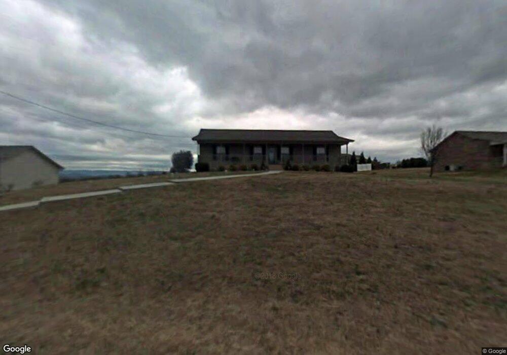
5647 Remmington Dr Russellville, TN 37860
Estimated Value: $253,000 - $325,000
--
Bed
2
Baths
1,300
Sq Ft
$226/Sq Ft
Est. Value
About This Home
This home is located at 5647 Remmington Dr, Russellville, TN 37860 and is currently estimated at $293,301, approximately $225 per square foot. 5647 Remmington Dr is a home located in Hamblen County with nearby schools including Russellville Elementary School, East Ridge Middle School, and Morristown East High School.
Ownership History
Date
Name
Owned For
Owner Type
Purchase Details
Closed on
Aug 28, 2007
Sold by
Henry Mccoart
Bought by
Gibbs Manda
Current Estimated Value
Home Financials for this Owner
Home Financials are based on the most recent Mortgage that was taken out on this home.
Original Mortgage
$141,200
Outstanding Balance
$99,820
Interest Rate
6.62%
Estimated Equity
$193,481
Purchase Details
Closed on
Aug 11, 2005
Sold by
Witt John Richard
Bought by
Mccoart Henry
Purchase Details
Closed on
Aug 16, 2000
Sold by
Carlyle Timothy G
Bought by
Richard Witt John
Purchase Details
Closed on
Apr 3, 2000
Sold by
Carlyle Timothy
Bought by
Kennith Reed
Purchase Details
Closed on
Nov 14, 1952
Bought by
Byrd James and Byrd Litha
Create a Home Valuation Report for This Property
The Home Valuation Report is an in-depth analysis detailing your home's value as well as a comparison with similar homes in the area
Home Values in the Area
Average Home Value in this Area
Purchase History
| Date | Buyer | Sale Price | Title Company |
|---|---|---|---|
| Gibbs Manda | $140,000 | -- | |
| Mccoart Henry | $125,500 | -- | |
| Richard Witt John | $99,500 | -- | |
| Kennith Reed | $14,900 | -- | |
| Byrd James | -- | -- |
Source: Public Records
Mortgage History
| Date | Status | Borrower | Loan Amount |
|---|---|---|---|
| Open | Byrd James | $141,200 |
Source: Public Records
Tax History Compared to Growth
Tax History
| Year | Tax Paid | Tax Assessment Tax Assessment Total Assessment is a certain percentage of the fair market value that is determined by local assessors to be the total taxable value of land and additions on the property. | Land | Improvement |
|---|---|---|---|---|
| 2024 | $724 | $36,750 | $6,725 | $30,025 |
| 2023 | $724 | $36,750 | $0 | $0 |
| 2022 | $724 | $36,750 | $6,725 | $30,025 |
| 2021 | $724 | $36,750 | $6,725 | $30,025 |
| 2020 | $724 | $36,750 | $6,725 | $30,025 |
| 2019 | $650 | $30,500 | $4,125 | $26,375 |
| 2018 | $650 | $30,500 | $4,125 | $26,375 |
| 2017 | $650 | $30,500 | $4,125 | $26,375 |
| 2016 | $607 | $30,500 | $4,125 | $26,375 |
| 2015 | $564 | $30,500 | $4,125 | $26,375 |
| 2014 | -- | $30,500 | $4,125 | $26,375 |
| 2013 | -- | $32,325 | $0 | $0 |
Source: Public Records
Map
Nearby Homes
- 1607 Weatherby Ct
- 5659 Browning Way
- 5556 Denton Dr
- 770 Harvey Dr
- 505 Mary St
- 2551 Cedar Creek Rd
- 5601 Brights Pike
- 354 Volunteer Dr
- 5110 Anne Cir
- 233 Harvey Dr
- 2145 Fall Creek Rd
- 1708 Boardwalk Cir
- 5085 Old Kentucky Rd
- 5790 N 2nd St
- 5740 Dodson Ferry Rd
- 4475 Copeland Dr
- 4561 Birchwood Cir
- 6312 Turners Pond Trail
- 6350 Turners Pond Trail
- 6358 Turners Pond Trail
- 5653 Remmington Dr
- 5618 Browning Way
- 5639 Remmington Dr
- 5626 Browning Way
- 5648 Remmington Dr
- 5642 Remmington Dr
- 1613 Weatherby Ct
- 5654 Remmington Dr
- 5611 Browning Way
- 5636 Remmington Dr
- 5607 Browning Way
- 5632 Browning Way
- 5660 Remmington Dr
- 5617 Browning Way
- 5628 Remmington Dr
- 5623 Browning Way
- 1619 Weatherby Ct
- 5621 Remmington Dr
- 5668 Remmington Dr
- 5629 Browning Way