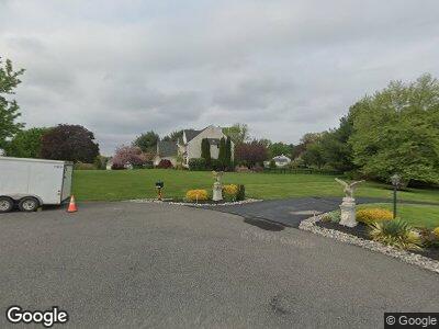
565 Deer Pointe Rd West Chester, PA 19382
Thornbury NeighborhoodEstimated Value: $1,036,000 - $1,271,000
5
Beds
5
Baths
4,272
Sq Ft
$267/Sq Ft
Est. Value
About This Home
This home is located at 565 Deer Pointe Rd, West Chester, PA 19382 and is currently estimated at $1,139,433, approximately $266 per square foot. 565 Deer Pointe Rd is a home located in Chester County with nearby schools including Westtown-Thornbury Elementary School, Stetson Middle School, and Bayard Rustin High School.
Ownership History
Date
Name
Owned For
Owner Type
Purchase Details
Closed on
Sep 8, 2009
Sold by
Mulholland Terrence J and Mulholland Jacqueline T Farrell
Bought by
Holgate Gregg W and Colley Holgate Gina M
Current Estimated Value
Home Financials for this Owner
Home Financials are based on the most recent Mortgage that was taken out on this home.
Original Mortgage
$103,000
Interest Rate
5.12%
Mortgage Type
Future Advance Clause Open End Mortgage
Purchase Details
Closed on
Sep 5, 1997
Sold by
Clompus Richard and Clompus Linnea R
Bought by
Clompus Richard and Clompus Linnea
Home Financials for this Owner
Home Financials are based on the most recent Mortgage that was taken out on this home.
Original Mortgage
$440,000
Interest Rate
7.31%
Create a Home Valuation Report for This Property
The Home Valuation Report is an in-depth analysis detailing your home's value as well as a comparison with similar homes in the area
Home Values in the Area
Average Home Value in this Area
Purchase History
| Date | Buyer | Sale Price | Title Company |
|---|---|---|---|
| Holgate Gregg W | $650,000 | None Available | |
| Clompus Richard | -- | -- |
Source: Public Records
Mortgage History
| Date | Status | Borrower | Loan Amount |
|---|---|---|---|
| Open | Holgate Gregg W | $317,000 | |
| Closed | Holgate Gregg W | $417,000 | |
| Closed | Holgate Gregg W | $103,000 | |
| Closed | Holgate Gregg W | $417,000 | |
| Previous Owner | Mulholland Terrence J | $571,500 | |
| Previous Owner | Mulholland Terrence J | $190,000 | |
| Previous Owner | Clompus Richard | $440,000 |
Source: Public Records
Tax History Compared to Growth
Tax History
| Year | Tax Paid | Tax Assessment Tax Assessment Total Assessment is a certain percentage of the fair market value that is determined by local assessors to be the total taxable value of land and additions on the property. | Land | Improvement |
|---|---|---|---|---|
| 2024 | $10,370 | $370,600 | $103,590 | $267,010 |
| 2023 | $10,370 | $370,600 | $103,590 | $267,010 |
| 2022 | $10,231 | $370,600 | $103,590 | $267,010 |
| 2021 | $10,083 | $370,600 | $103,590 | $267,010 |
| 2020 | $10,016 | $370,600 | $103,590 | $267,010 |
| 2019 | $9,871 | $370,600 | $103,590 | $267,010 |
| 2018 | $9,653 | $370,600 | $103,590 | $267,010 |
| 2017 | $9,436 | $370,600 | $103,590 | $267,010 |
| 2016 | $7,900 | $370,600 | $103,590 | $267,010 |
| 2015 | $7,900 | $370,600 | $103,590 | $267,010 |
| 2014 | $7,900 | $370,600 | $103,590 | $267,010 |
Source: Public Records
Map
Nearby Homes
- 1275 Southgate Rd
- 603 S Westbourne Rd
- 1174 Blenheim Rd
- 3 Zachary Dr
- 1 Huntrise Ln
- 222 Green Tree Dr
- 1261 Buck Ln
- 123 E Street Rd
- 855 Meadow Croft Cir
- 1109 Fielding Dr
- 1030 Carolyn Dr
- 113 Forelock Ct
- 1054 Kerwood Rd
- 186 Dilworthtown Rd
- 119 Augusta Dr
- 131 Stirrup Cir
- 129 Stirrup Cir
- 235 Caleb Dr Unit 19
- 4 Judith Ln
- 120 Gilpin Dr
- 565 Deer Pointe Rd
- 0 Crows Nest Cir
- 1 Crows Nest Cir
- 555 Deer Pointe Rd
- 1232 Northgate Rd
- 550 Deer Pointe Rd
- 2 Crows Nest Cir
- 1240 Northgate Rd
- 1250 Southgate Rd
- 1220 Northgate Rd
- 560 Deer Pointe Rd
- 1210 Fieldstone Dr
- 575 Deer Pointe Rd
- 530 Deer Pointe Rd
- 1260 Southgate Rd
- 545 Deer Pointe Rd
- 535 Deer Pointe Rd
- 525 Day Spring Ln
- 1245 Northgate Rd
- 1235 Northgate Rd