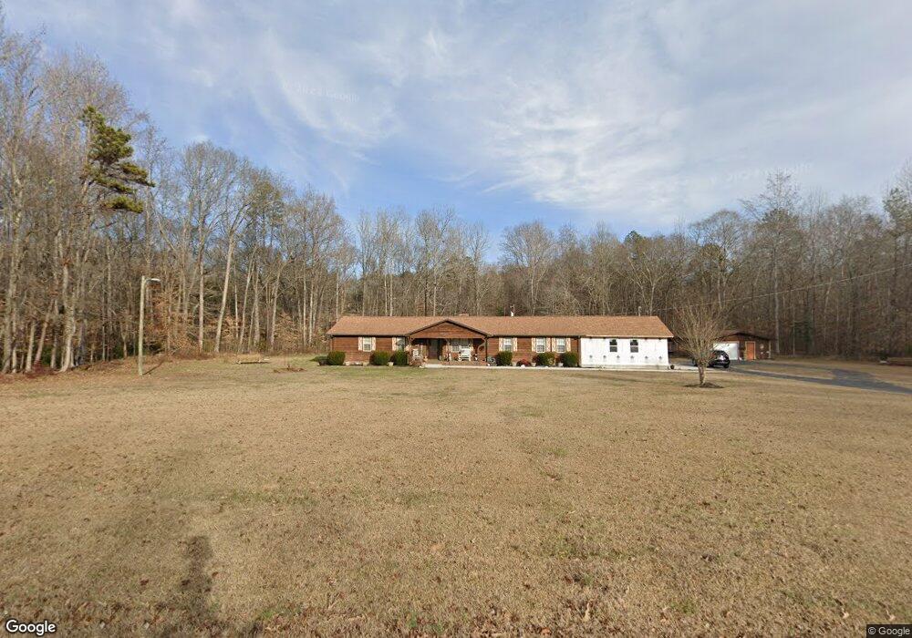
565 Independence Dr Roebuck, SC 29376
Estimated Value: $261,000 - $425,000
4
Beds
2
Baths
2,676
Sq Ft
$138/Sq Ft
Est. Value
About This Home
This home is located at 565 Independence Dr, Roebuck, SC 29376 and is currently estimated at $368,683, approximately $137 per square foot. 565 Independence Dr is a home located in Spartanburg County with nearby schools including Dorman High School Freshman Campus and Dorman High School.
Ownership History
Date
Name
Owned For
Owner Type
Purchase Details
Closed on
Aug 3, 2011
Sold by
Hudsoncross Reo Funding Viii Llc
Bought by
Franklin Marilyn T
Current Estimated Value
Purchase Details
Closed on
Mar 30, 2010
Sold by
Clark Carol L and Morgan Paul E
Bought by
Hudsoncross Reo Funding Viii Llc
Purchase Details
Closed on
Jun 11, 1999
Sold by
Walton David
Bought by
Clark Carol
Create a Home Valuation Report for This Property
The Home Valuation Report is an in-depth analysis detailing your home's value as well as a comparison with similar homes in the area
Home Values in the Area
Average Home Value in this Area
Purchase History
| Date | Buyer | Sale Price | Title Company |
|---|---|---|---|
| Franklin Marilyn T | $129,900 | -- | |
| Hudsoncross Reo Funding Viii Llc | $100,144 | -- | |
| Clark Carol | $170,000 | -- |
Source: Public Records
Tax History Compared to Growth
Tax History
| Year | Tax Paid | Tax Assessment Tax Assessment Total Assessment is a certain percentage of the fair market value that is determined by local assessors to be the total taxable value of land and additions on the property. | Land | Improvement |
|---|---|---|---|---|
| 2025 | $1,792 | $9,522 | $1,115 | $8,407 |
| 2024 | $1,792 | $9,522 | $1,115 | $8,407 |
| 2023 | $1,792 | $9,522 | $1,115 | $8,407 |
| 2022 | $1,614 | $8,280 | $1,200 | $7,080 |
| 2021 | $1,595 | $8,280 | $1,200 | $7,080 |
| 2020 | $1,559 | $8,280 | $1,200 | $7,080 |
| 2019 | $1,583 | $8,653 | $1,136 | $7,517 |
| 2018 | $1,589 | $8,653 | $1,136 | $7,517 |
| 2017 | $1,370 | $7,524 | $1,000 | $6,524 |
| 2016 | $1,750 | $9,468 | $1,000 | $8,468 |
| 2015 | $1,716 | $8,780 | $1,000 | $7,780 |
| 2014 | $1,546 | $8,780 | $1,000 | $7,780 |
Source: Public Records
Map
Nearby Homes
- 0 Independence Ct
- 365 Guernsey Ln
- 583 Chattooga Rd
- 707 Tallulah Ct
- 129 John Lancaster Rd
- 511 Chattooga Rd
- 408 Congaree Rd
- 387 Congaree Rd
- 635 Mcabee Rd
- 0 Stone Station Rd
- 120 State Road S-42-9962
- 409 Balfour Rd
- 310 Templeton Dr
- 221 Brookfield Rd
- 375 N Timm Creek Ave
- 379 Lawtonwood Ln
- 811 S Edisto River Dr
- 212 Reedy River Ct
- 118 Myrna Dr
- 215 Reedy River Ct
- 560 Independence Dr
- 519 Independence Dr
- 550 Independence Dr
- 540 Independence Dr
- 599 Independence Dr
- 530 Independence Dr
- 509 Independence Dr
- 520 Independence Dr
- 199 Patriot Rd
- 510 Independence Dr
- 170 Freedom Trail
- 625 Independence Dr
- 200 Freedom Trail
- 500 Independence Dr
- 150 Patriot Rd
- 981 Mcabee Rd
- 135 Guernsey Ln
- 112 Guernsey Ln
- 155 State Road S-42-2908
- 155 Guernsey Ln