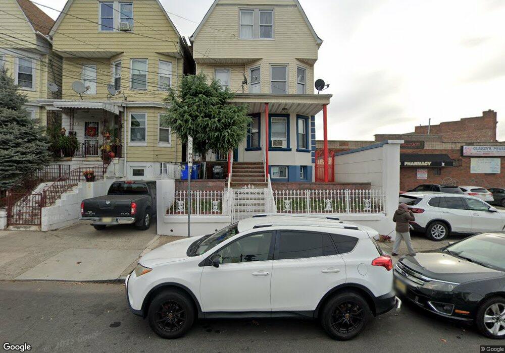
565 N 7th St Newark, NJ 07107
Upper Roseville NeighborhoodEstimated Value: $281,000 - $455,000
7
Beds
3
Baths
993
Sq Ft
$370/Sq Ft
Est. Value
About This Home
This home is located at 565 N 7th St, Newark, NJ 07107 and is currently estimated at $367,568, approximately $370 per square foot. 565 N 7th St is a home located in Essex County with nearby schools including First Avenue Elementary School, Dr. William H. Horton School, and Rafael Hernandez School.
Ownership History
Date
Name
Owned For
Owner Type
Purchase Details
Closed on
Nov 19, 2010
Sold by
Salas Leyo and Salas Wendy Soto
Bought by
Salas Leyo
Current Estimated Value
Purchase Details
Closed on
Aug 9, 2001
Sold by
Hung Elizabeth
Bought by
Salas Leyo and Salas Wendy Soto
Home Financials for this Owner
Home Financials are based on the most recent Mortgage that was taken out on this home.
Original Mortgage
$152,250
Outstanding Balance
$58,703
Interest Rate
6.99%
Mortgage Type
FHA
Estimated Equity
$308,865
Create a Home Valuation Report for This Property
The Home Valuation Report is an in-depth analysis detailing your home's value as well as a comparison with similar homes in the area
Home Values in the Area
Average Home Value in this Area
Purchase History
| Date | Buyer | Sale Price | Title Company |
|---|---|---|---|
| Salas Leyo | -- | None Available | |
| Salas Leyo | $165,000 | -- |
Source: Public Records
Mortgage History
| Date | Status | Borrower | Loan Amount |
|---|---|---|---|
| Open | Salas Leyo | $152,250 |
Source: Public Records
Tax History Compared to Growth
Tax History
| Year | Tax Paid | Tax Assessment Tax Assessment Total Assessment is a certain percentage of the fair market value that is determined by local assessors to be the total taxable value of land and additions on the property. | Land | Improvement |
|---|---|---|---|---|
| 2025 | $4,503 | $120,800 | $45,100 | $75,700 |
| 2024 | $4,503 | $120,800 | $45,100 | $75,700 |
| 2022 | $4,513 | $120,800 | $45,100 | $75,700 |
| 2021 | $4,511 | $120,800 | $45,100 | $75,700 |
| 2020 | $4,590 | $120,800 | $45,100 | $75,700 |
| 2019 | $4,543 | $120,800 | $45,100 | $75,700 |
| 2018 | $4,461 | $120,800 | $45,100 | $75,700 |
| 2017 | $4,300 | $120,800 | $45,100 | $75,700 |
| 2016 | $4,156 | $120,800 | $45,100 | $75,700 |
| 2015 | $3,997 | $120,800 | $45,100 | $75,700 |
| 2014 | $3,746 | $120,800 | $45,100 | $75,700 |
Source: Public Records
Map
Nearby Homes
- 600 N 6th St Unit 1103
- 600 N 6th St Unit B3
- 600 N 6th St
- 575 N 6th St
- 575 N 6th St Unit 4
- 191 1st Ave W
- 582 3rd St Unit 584
- 582 3rd St
- 504 N 7th St Unit 506
- 580 3rd St
- 504-506 N 7th St
- 150 S 10th St
- 277 2nd Ave W Unit 2
- 277 2nd Ave W
- 489 N 11th St Unit 491
- 682 N 7th St
- 457 N 7th St
- 684 N 7th St
- 108 Davenport Ave
- 727 N 6th St
- 567 N 7th St
- 569 N 7th St
- 571 N 7th St
- 588 N 6th St
- 573 N 7th St
- 575 N 7th St
- 399-401 Bloomfield Ave
- 399 Bloomfield Ave
- 576 N 6th St Unit 586
- 592 N 6th St Unit 7A
- 592 N 6th St Unit 4-B
- 592 N 6th St Unit 94
- 592 N 6th St Unit 94
- 592 N 6th St Unit 94
- 592 N 6th St Unit 94
- 592 N 6th St Unit 94
- 592 N 6th St Unit 94
- 592 N 6th St Unit 94
- 592 N 6th St Unit 94
- 592 N 6th St Unit 2