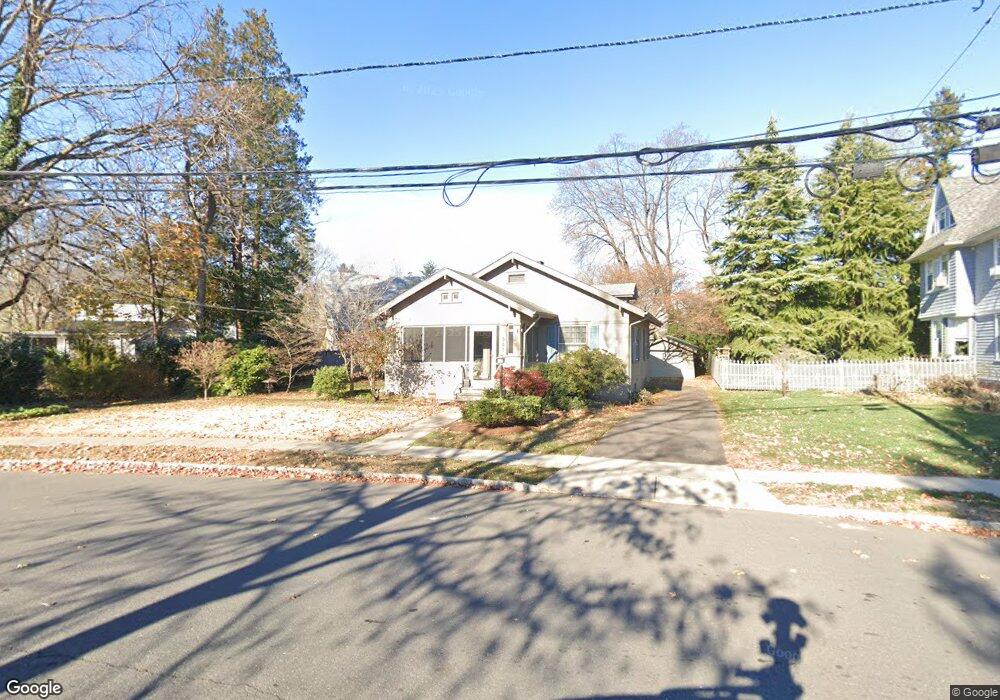
565 Watchung Rd Bound Brook, NJ 08805
Estimated Value: $448,662 - $551,000
Studio
--
Bath
1,112
Sq Ft
$448/Sq Ft
Est. Value
About This Home
This home is located at 565 Watchung Rd, Bound Brook, NJ 08805 and is currently estimated at $498,666, approximately $448 per square foot. 565 Watchung Rd is a home located in Somerset County with nearby schools including LaMonte Annex Elementary School, Lafayette Elementary School, and Bound Brook High School.
Ownership History
Date
Name
Owned For
Owner Type
Purchase Details
Closed on
Nov 7, 2000
Sold by
Reed June
Bought by
Ackerman Doris
Current Estimated Value
Home Financials for this Owner
Home Financials are based on the most recent Mortgage that was taken out on this home.
Original Mortgage
$112,500
Outstanding Balance
$41,247
Interest Rate
7.81%
Estimated Equity
$457,419
Purchase Details
Closed on
Aug 1, 1988
Sold by
Blanton Robert S and Blanton Reed,June L
Bought by
Blanton Robert S and Blanton Reed,June L
Create a Home Valuation Report for This Property
The Home Valuation Report is an in-depth analysis detailing your home's value as well as a comparison with similar homes in the area
Home Values in the Area
Average Home Value in this Area
Purchase History
| Date | Buyer | Sale Price | Title Company |
|---|---|---|---|
| Ackerman Doris | $168,000 | -- | |
| Blanton Robert S | -- | -- |
Source: Public Records
Mortgage History
| Date | Status | Borrower | Loan Amount |
|---|---|---|---|
| Open | Ackerman Doris | $112,500 |
Source: Public Records
Tax History
| Year | Tax Paid | Tax Assessment Tax Assessment Total Assessment is a certain percentage of the fair market value that is determined by local assessors to be the total taxable value of land and additions on the property. | Land | Improvement |
|---|---|---|---|---|
| 2025 | $8,772 | $411,200 | $244,500 | $166,700 |
| 2024 | $8,772 | $386,600 | $224,500 | $162,100 |
Source: Public Records
Map
Nearby Homes
Your Personal Tour Guide
Ask me questions while you tour the home.