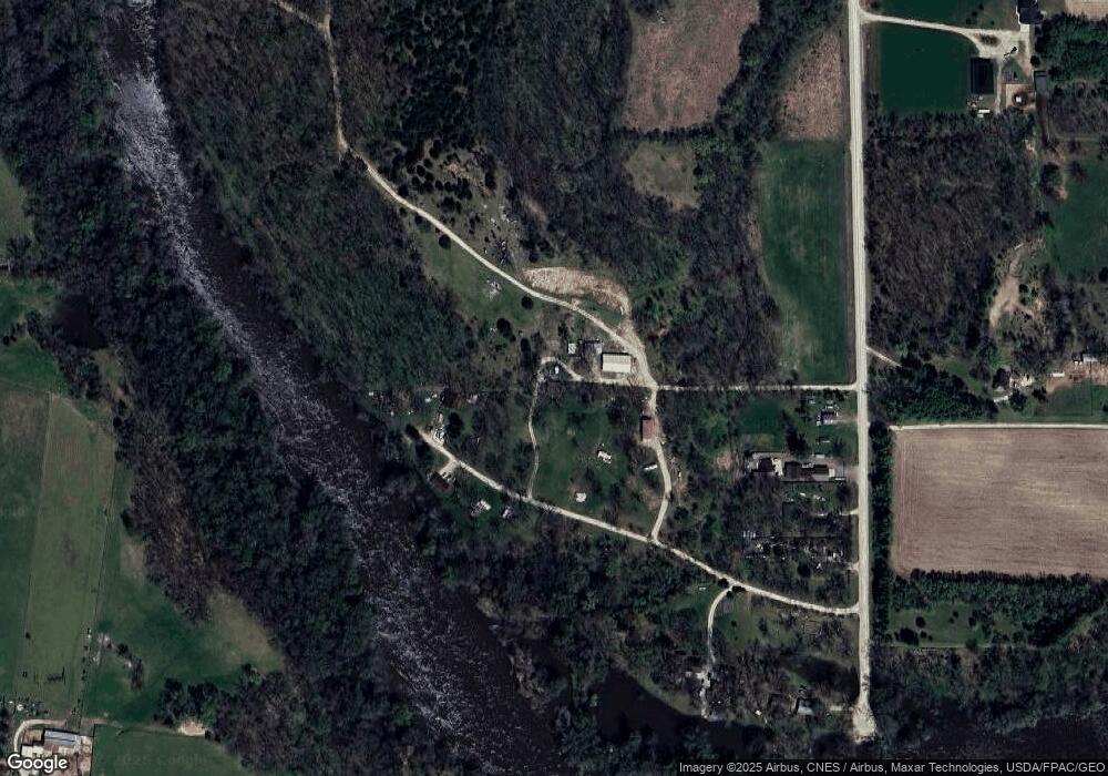
5650 Dix Rd Coggon, IA 52218
Estimated Value: $182,000 - $289,000
2
Beds
1
Bath
748
Sq Ft
$315/Sq Ft
Est. Value
About This Home
This home is located at 5650 Dix Rd, Coggon, IA 52218 and is currently estimated at $235,904, approximately $315 per square foot. 5650 Dix Rd is a home with nearby schools including North Linn Elementary School, North-Linn Middle School, and North-Linn Senior High School.
Ownership History
Date
Name
Owned For
Owner Type
Purchase Details
Closed on
Jun 8, 2016
Sold by
Florence E Hiepler
Bought by
Daniels Rufus and Daniels Nancy
Current Estimated Value
Home Financials for this Owner
Home Financials are based on the most recent Mortgage that was taken out on this home.
Original Mortgage
$106,374
Interest Rate
3.66%
Purchase Details
Closed on
Sep 28, 1998
Sold by
Loomis William J and Loomis Debbie M
Bought by
Buckley Florence E
Home Financials for this Owner
Home Financials are based on the most recent Mortgage that was taken out on this home.
Original Mortgage
$250,000
Interest Rate
6.83%
Create a Home Valuation Report for This Property
The Home Valuation Report is an in-depth analysis detailing your home's value as well as a comparison with similar homes in the area
Home Values in the Area
Average Home Value in this Area
Purchase History
| Date | Buyer | Sale Price | Title Company |
|---|---|---|---|
| Daniels Rufus | -- | -- | |
| Buckley Florence E | $21,500 | -- |
Source: Public Records
Mortgage History
| Date | Status | Borrower | Loan Amount |
|---|---|---|---|
| Previous Owner | Daniels Rufus | $106,374 | |
| Previous Owner | Daniels Rufus | -- | |
| Previous Owner | Buckley Florence E | $250,000 |
Source: Public Records
Tax History Compared to Growth
Tax History
| Year | Tax Paid | Tax Assessment Tax Assessment Total Assessment is a certain percentage of the fair market value that is determined by local assessors to be the total taxable value of land and additions on the property. | Land | Improvement |
|---|---|---|---|---|
| 2025 | $2,342 | $233,100 | $94,300 | $138,800 |
| 2024 | $2,340 | $207,100 | $102,500 | $104,600 |
| 2023 | $2,340 | $198,900 | $94,300 | $104,600 |
| 2022 | $2,350 | $179,200 | $102,500 | $76,700 |
| 2021 | $1,878 | $179,200 | $102,500 | $76,700 |
| 2020 | $1,878 | $133,300 | $59,700 | $73,600 |
| 2019 | $1,026 | $70,800 | $8,600 | $62,200 |
| 2018 | $1,036 | $70,800 | $8,600 | $62,200 |
| 2017 | $1,203 | $81,600 | $21,400 | $60,200 |
| 2016 | $1,203 | $81,600 | $21,400 | $60,200 |
| 2015 | $1,169 | $79,600 | $18,000 | $61,600 |
| 2014 | $1,022 | $79,600 | $18,000 | $61,600 |
| 2013 | $1,004 | $79,600 | $18,000 | $61,600 |
Source: Public Records
Map
Nearby Homes
- 0 Parcel: 03104-02001-00000 Unit 2502368
- 5555 Troy Mills Rd
- 3296 Union Ave
- 0 Stewart Ave
- 00 Stewart Ave
- 4682 Reamer Rd
- 3338 Troy Mills Blvd
- 110 E Linn St
- 113 E Vinton St
- 215 2nd St N
- 403 3rd St S
- 321 3rd St S
- 130 3rd Ave E
- 104 5th Ave Ct
- 517 E Linn St
- 100 5th Ave Ct
- 531 E Linn St
- 5050 Shady Oak Ave
- 1900 Maine Ridge Rd
- 4889 Valley Farm Rd
- 2771 Chesmore Beach Ln
- 2779 Chesmore Beach Ln
- 2783 Chesmore Beach Ln
- 2785 Chesmore Beach Ln
- 2767 Chesmore Beach Ln
- 2784 Chesmore Beach Ln
- 2782 Chesmore Beach Ln
- 2780 Chesmore Beach Ln
- 5642 Dix Rd
- 5646 Dix Rd
- 5638 Dix Rd
- 2770 Chesmore Beach Ln
- 5636 Dix Rd
- 2762 Chesmore Beach Ln
- 2760 Chesmore Beach Ln
- 2754 Chesmore Beach Ln
- 5653 Dix Rd
- 2744 Chesmore Beach Ln
- 5689 Dix Rd
- 2837 Campfire Rd
