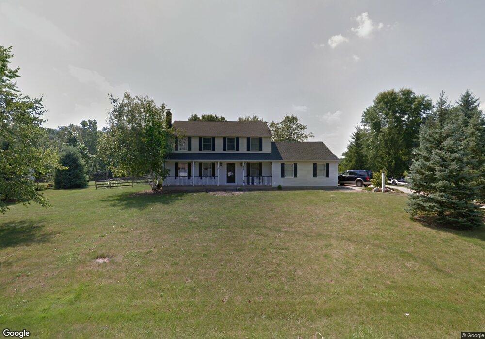
5652 Humelsine Dr Hudson, OH 44236
Estimated Value: $379,600 - $441,000
4
Beds
3
Baths
2,016
Sq Ft
$199/Sq Ft
Est. Value
About This Home
This home is located at 5652 Humelsine Dr, Hudson, OH 44236 and is currently estimated at $400,900, approximately $198 per square foot. 5652 Humelsine Dr is a home located in Summit County with nearby schools including Ellsworth Hill Elementary School, East Woods Intermediate School, and Hudson Middle School.
Ownership History
Date
Name
Owned For
Owner Type
Purchase Details
Closed on
Dec 1, 2006
Sold by
Powers Norman and Powers Kay
Bought by
Boicey Todd J and Boicey Laura A
Current Estimated Value
Home Financials for this Owner
Home Financials are based on the most recent Mortgage that was taken out on this home.
Original Mortgage
$236,292
Outstanding Balance
$142,523
Interest Rate
6.47%
Mortgage Type
FHA
Estimated Equity
$258,377
Purchase Details
Closed on
Jul 7, 2006
Sold by
Astoria Federal Savings
Bought by
Powers Norman
Purchase Details
Closed on
May 3, 2006
Sold by
Finch Jack M
Bought by
Astoria Federal Savings
Purchase Details
Closed on
Aug 29, 1997
Sold by
Cacciola Joseph C
Bought by
Sponseller
Home Financials for this Owner
Home Financials are based on the most recent Mortgage that was taken out on this home.
Original Mortgage
$172,900
Interest Rate
7.57%
Mortgage Type
New Conventional
Create a Home Valuation Report for This Property
The Home Valuation Report is an in-depth analysis detailing your home's value as well as a comparison with similar homes in the area
Home Values in the Area
Average Home Value in this Area
Purchase History
| Date | Buyer | Sale Price | Title Company |
|---|---|---|---|
| Boicey Todd J | $240,000 | First American Title Akron | |
| Powers Norman | $136,000 | Miller Examining Service Inc | |
| Astoria Federal Savings | $155,000 | None Available | |
| Sponseller | $182,000 | -- |
Source: Public Records
Mortgage History
| Date | Status | Borrower | Loan Amount |
|---|---|---|---|
| Open | Boicey Todd J | $236,292 | |
| Previous Owner | Sponseller | $172,900 |
Source: Public Records
Tax History
| Year | Tax Paid | Tax Assessment Tax Assessment Total Assessment is a certain percentage of the fair market value that is determined by local assessors to be the total taxable value of land and additions on the property. | Land | Improvement |
|---|---|---|---|---|
| 2024 | $5,490 | $106,397 | $20,419 | $85,978 |
| 2023 | $5,490 | $106,397 | $20,419 | $85,978 |
| 2022 | $5,049 | $87,210 | $16,737 | $70,473 |
| 2021 | $5,058 | $87,210 | $16,737 | $70,473 |
| 2020 | $4,970 | $87,210 | $16,740 | $70,470 |
| 2019 | $4,593 | $74,450 | $16,970 | $57,480 |
| 2018 | $4,577 | $74,450 | $16,970 | $57,480 |
| 2017 | $4,386 | $74,450 | $16,970 | $57,480 |
| 2016 | $4,417 | $69,290 | $16,970 | $52,320 |
| 2015 | $4,386 | $69,290 | $16,970 | $52,320 |
| 2014 | $4,398 | $69,290 | $16,970 | $52,320 |
| 2013 | $4,710 | $72,600 | $16,970 | $55,630 |
Source: Public Records
Map
Nearby Homes
- 5518 Pond Ct
- 5361 Diana Lynn Dr
- 1995 Weston Dr
- 5163 Beckett Ridge
- 5150 Bayside Lake Blvd
- V/L Norton Rd
- 5091 Ridge Meadow Dr
- 2221 Crockett Cir
- 2352 Becket Cir
- 5123 Sodalite Dr
- 2279 Becket Cir
- 2353 W Hale Dr
- 5866 Ogilby Dr
- 1525 Spruce Hill Dr
- 4534 Foresthill Rd
- 4623 Cox Dr
- 4424 Timberdale Dr Unit 4428
- 2344 Echo Valley Dr
- 4556 Fishcreek Rd
- 4544 Fishcreek Rd
- 5638 Humelsine Dr
- 5666 Humelsine Dr
- 5628 Humelsine Dr
- 5645 Humelsine Dr
- 5659 Humelsine Dr
- 5674 Humelsine Dr
- 5618 Humelsine Dr
- 2455 Cottager Dr
- 5728 Young Rd
- 5718 Young Rd
- 5623 Humelsine Dr
- 5706 Young Rd
- 5608 Humelsine Dr
- 2546 Barlow Rd
- 5694 Young Rd
- 5609 Humelsine Dr
- 2456 Cottager Dr
- 2536 Barlow Rd
- 5682 Young Rd
- 5596 Humelsine Dr
Your Personal Tour Guide
Ask me questions while you tour the home.