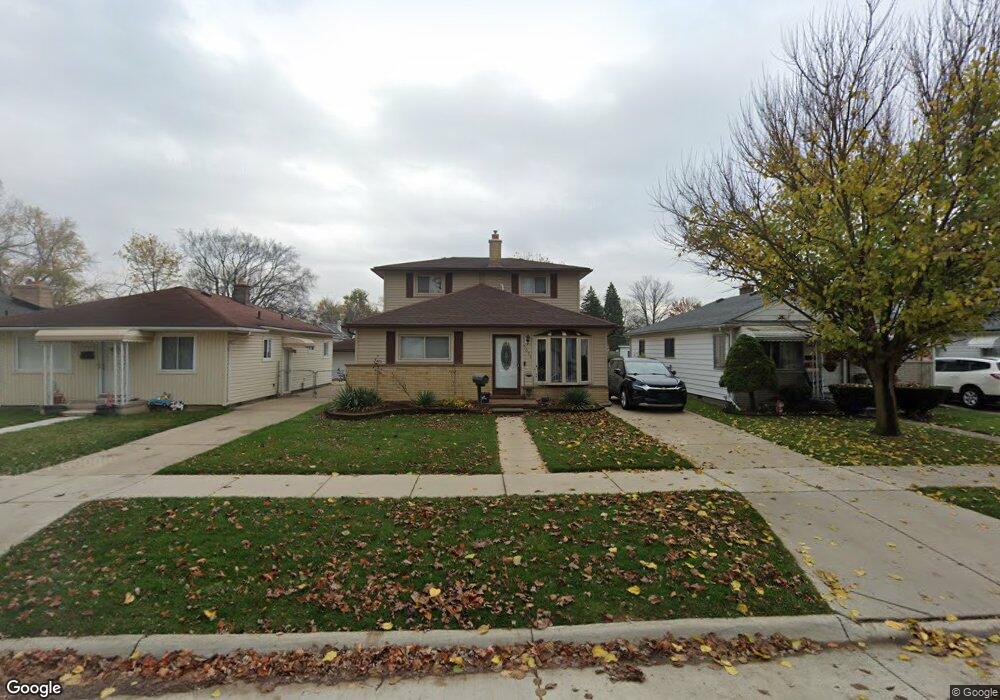
5653 Harding St Dearborn Heights, MI 48125
Estimated Value: $166,000 - $185,000
--
Bed
1
Bath
1,512
Sq Ft
$116/Sq Ft
Est. Value
About This Home
This home is located at 5653 Harding St, Dearborn Heights, MI 48125 and is currently estimated at $174,667, approximately $115 per square foot. 5653 Harding St is a home located in Wayne County with nearby schools including Polk Elementary School, Bedford School, and Pardee School.
Ownership History
Date
Name
Owned For
Owner Type
Purchase Details
Closed on
Feb 27, 2017
Sold by
Thomsberry Buster
Bought by
Thornsberry Buster
Current Estimated Value
Home Financials for this Owner
Home Financials are based on the most recent Mortgage that was taken out on this home.
Original Mortgage
$838,978
Interest Rate
4.19%
Mortgage Type
New Conventional
Create a Home Valuation Report for This Property
The Home Valuation Report is an in-depth analysis detailing your home's value as well as a comparison with similar homes in the area
Home Values in the Area
Average Home Value in this Area
Purchase History
| Date | Buyer | Sale Price | Title Company |
|---|---|---|---|
| Thornsberry Buster | -- | Title Source Inc |
Source: Public Records
Mortgage History
| Date | Status | Borrower | Loan Amount |
|---|---|---|---|
| Closed | Thornsberry Buster | $838,978 |
Source: Public Records
Tax History Compared to Growth
Tax History
| Year | Tax Paid | Tax Assessment Tax Assessment Total Assessment is a certain percentage of the fair market value that is determined by local assessors to be the total taxable value of land and additions on the property. | Land | Improvement |
|---|---|---|---|---|
| 2025 | $1,521 | $87,100 | $0 | $0 |
| 2024 | $1,521 | $78,600 | $0 | $0 |
| 2023 | $1,438 | $69,300 | $0 | $0 |
| 2022 | $3,207 | $59,400 | $0 | $0 |
| 2021 | $2,874 | $50,900 | $0 | $0 |
| 2019 | $1,938 | $44,100 | $0 | $0 |
| 2018 | $3,040 | $36,600 | $0 | $0 |
| 2017 | $1,172 | $35,000 | $0 | $0 |
| 2016 | $2,730 | $34,700 | $0 | $0 |
| 2015 | $3,300 | $33,000 | $0 | $0 |
| 2013 | $3,380 | $35,300 | $0 | $0 |
| 2010 | -- | $44,800 | $0 | $0 |
Source: Public Records
Map
Nearby Homes
- 5621 Merrick St
- 5381 Merrick St
- 5648 Hipp St
- 5660 Hipp St
- 5873 Merrick St
- 5869 Hipp St
- 21302 Powers Ave
- 21334 Powers Ave
- 20425 Powers Ave
- 4913 Campbell St
- 5455 Mayfair St
- 5642 Weddel St
- 21543 Powers Ave
- 5939 Mayfair St
- 6056 Clippert St
- 4924 Huron St
- 5709 Weddell St
- 4644 Gertrude St
- 5373 Katherine St
- 5977 Weddel St
- 5665 Harding St
- 5643 Harding St
- 5635 Harding St
- 5677 Harding St
- 5689 Harding St
- 5715 Harding St
- 5652 Merrick St
- 5644 Merrick St
- 5660 Merrick St
- 5735 Harding St Unit Bldg-Unit
- 5735 Harding St
- 5652 Harding St
- 5664 Harding St
- 5642 Harding St
- 5676 Harding St
- 5634 Harding St
- 5626 Merrick St
- 5676 Merrick St
- 5688 Harding St
- 5684 Merrick St