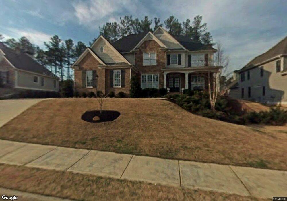
5654 Westhorpe Ln Hiram, GA 30141
West Cobb NeighborhoodEstimated Value: $654,130 - $779,000
5
Beds
6
Baths
3,492
Sq Ft
$203/Sq Ft
Est. Value
About This Home
This home is located at 5654 Westhorpe Ln, Hiram, GA 30141 and is currently estimated at $710,533, approximately $203 per square foot. 5654 Westhorpe Ln is a home located in Cobb County with nearby schools including Kemp Elementary School, Lost Mountain Middle School, and Hillgrove High School.
Ownership History
Date
Name
Owned For
Owner Type
Purchase Details
Closed on
Aug 5, 2003
Sold by
Valor Properties Llc
Bought by
Fisher Michael P and Fisher Tammy
Current Estimated Value
Home Financials for this Owner
Home Financials are based on the most recent Mortgage that was taken out on this home.
Original Mortgage
$334,475
Outstanding Balance
$144,985
Interest Rate
5.52%
Mortgage Type
New Conventional
Estimated Equity
$565,548
Create a Home Valuation Report for This Property
The Home Valuation Report is an in-depth analysis detailing your home's value as well as a comparison with similar homes in the area
Home Values in the Area
Average Home Value in this Area
Purchase History
| Date | Buyer | Sale Price | Title Company |
|---|---|---|---|
| Fisher Michael P | $393,500 | -- |
Source: Public Records
Mortgage History
| Date | Status | Borrower | Loan Amount |
|---|---|---|---|
| Open | Fisher Michael P | $334,475 |
Source: Public Records
Tax History Compared to Growth
Tax History
| Year | Tax Paid | Tax Assessment Tax Assessment Total Assessment is a certain percentage of the fair market value that is determined by local assessors to be the total taxable value of land and additions on the property. | Land | Improvement |
|---|---|---|---|---|
| 2025 | $7,358 | $294,628 | $52,000 | $242,628 |
| 2024 | $7,364 | $294,628 | $52,000 | $242,628 |
| 2023 | $5,658 | $241,008 | $46,000 | $195,008 |
| 2022 | $6,247 | $241,008 | $46,000 | $195,008 |
| 2021 | $5,053 | $186,440 | $46,000 | $140,440 |
| 2020 | $5,053 | $186,440 | $46,000 | $140,440 |
| 2019 | $4,717 | $171,084 | $46,000 | $125,084 |
| 2018 | $4,717 | $171,084 | $46,000 | $125,084 |
| 2017 | $4,495 | $170,824 | $46,000 | $124,824 |
| 2016 | $4,306 | $162,116 | $43,200 | $118,916 |
| 2015 | $4,124 | $149,324 | $42,560 | $106,764 |
| 2014 | $3,112 | $113,576 | $0 | $0 |
Source: Public Records
Map
Nearby Homes
- 5584 Cathers Creek Dr
- 171 Pickens Bluff Ln
- 155 Pickens Bluff Ln
- 258 Pickens Bluff Ln
- 201 Pickens Bluff Ln
- 294 Pickens Bluff Ln
- 140 Pickens Bluff Ln
- 215 Pickens Bluff Ln
- 40 Willow Bend Rd
- Glynn Plan at Pickens Bluff
- Atkinson Plan at Pickens Bluff
- Warren Plan at Pickens Bluff
- Charlton Plan at Pickens Bluff
- Madison Plan at Pickens Bluff
- Baldwin Plan at Pickens Bluff
- Emerson Plan at Pickens Bluff
- 34 Poplar Springs Ct
- 95 Heartwood Crossing
- 1288 Gate Post Ln
- 195 Hickory Grove Ln
- 5583 Cathers Creek Dr
- 5656 Westhorpe Ln
- 5581 Cathers Creek Dr
- 5658 Westhorpe Ln Unit 1
- 5660 Westhorpe Ln
- 5652 Westhorpe Ln SW
- 5652 Westhorpe Ln
- 5585 Cathers Creek Dr
- 0 Westhorpe Ln SW Unit 8718201
- 0 Westhorpe Ln SW Unit 8352070
- 0 Westhorpe Ln SW Unit 7291212
- 0 Westhorpe Ln SW Unit 7517152
- 0 Westhorpe Ln SW Unit 7603179
- 0 Westhorpe Ln SW Unit 8016197
- 5585 Cathers Creek Dr Unit 1
- 0 Thorley Ridge Dr SW Unit 8439886
- 5580 Cathers Creek Dr
- 5655 Westhorpe Ln
- 5659 Westhorpe Ln
- 5658 Westhorpe Ln SW