Estimated Value: $253,630 - $313,000
3
Beds
2
Baths
1,262
Sq Ft
$228/Sq Ft
Est. Value
About This Home
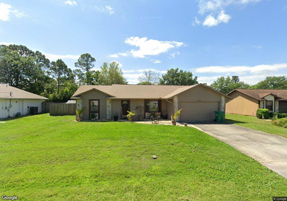
This home is located at 5655 Hemsing St, Cocoa, FL 32927 and is currently estimated at $287,658, approximately $227 per square foot. 5655 Hemsing St is a home located in Brevard County with nearby schools including Enterprise Elementary School, Space Coast Junior/Senior High School, and East Atlantic Prep of Brevard County.
Ownership History
Date
Name
Owned For
Owner Type
Purchase Details
Closed on
Apr 30, 2008
Sold by
Turner Charles A and Turner Barbara A
Bought by
Sullivan Amber L and Shear Edward J
Current Estimated Value
Home Financials for this Owner
Home Financials are based on the most recent Mortgage that was taken out on this home.
Original Mortgage
$137,928
Outstanding Balance
$87,075
Interest Rate
5.82%
Estimated Equity
$200,583
Purchase Details
Closed on
Apr 28, 2000
Sold by
Robinson Robert E and Robinson Vicki A
Bought by
Turner Charles A and Turner Barbara A
Home Financials for this Owner
Home Financials are based on the most recent Mortgage that was taken out on this home.
Original Mortgage
$50,000
Interest Rate
8.23%
Create a Home Valuation Report for This Property
The Home Valuation Report is an in-depth analysis detailing your home's value as well as a comparison with similar homes in the area
Home Values in the Area
Average Home Value in this Area
Purchase History
| Date | Buyer | Sale Price | Title Company |
|---|---|---|---|
| Sullivan Amber L | $139,500 | Fidelity Natl Title Ins Co | |
| Turner Charles A | $71,900 | -- |
Source: Public Records
Mortgage History
| Date | Status | Borrower | Loan Amount |
|---|---|---|---|
| Open | Sullivan Amber L | $137,928 | |
| Previous Owner | Turner Charles A | $50,000 |
Source: Public Records
Tax History
| Year | Tax Paid | Tax Assessment Tax Assessment Total Assessment is a certain percentage of the fair market value that is determined by local assessors to be the total taxable value of land and additions on the property. | Land | Improvement |
|---|---|---|---|---|
| 2025 | $3,129 | $207,590 | -- | -- |
| 2024 | $3,044 | $211,490 | -- | -- |
| 2023 | $3,044 | $208,950 | $0 | $0 |
| 2022 | $2,766 | $199,400 | $0 | $0 |
| 2021 | $2,516 | $149,840 | $42,000 | $107,840 |
| 2020 | $2,322 | $134,660 | $40,000 | $94,660 |
| 2019 | $832 | $60,660 | $0 | $0 |
| 2018 | $832 | $59,530 | $0 | $0 |
| 2017 | $833 | $58,310 | $0 | $0 |
| 2016 | $839 | $57,120 | $18,000 | $39,120 |
| 2015 | $845 | $56,730 | $15,000 | $41,730 |
| 2014 | $849 | $56,280 | $11,000 | $45,280 |
Source: Public Records
Map
Nearby Homes
- 5680 Brandon St
- 5555 Brandon St
- 7065 Hundred Acre Dr
- 7200 Oakwood Ave
- 6643 Emil Ave
- 6990 Bryant Rd
- 7230 Venus Ave
- 6815 Bryant Rd
- 6581 Bancroft Ave
- 6615 Dock Ave
- 6760 Cairo Rd
- 7735 Fringe Place
- 7368 Crepe Myrtle Ct
- 5551 Cinnamon Fern Blvd
- 7635 Fringe Place
- 7419 Hackberry Rd
- 5165 Patricia St
- 5155 Mayflower St
- 7429 Hackberry Rd
- 7606 Fringe Place
- 5645 Hemsing St
- 5665 Hemsing St
- 5650 Brandon St
- 5660 Brandon St
- 5635 Hemsing St
- 5675 Hemsing St
- 5650 Hemsing St
- 5660 Hemsing St
- 5640 Hemsing St
- 5670 Hemsing St
- 5625 Hemsing St
- 5630 Hemsing St
- 5685 Hemsing St
- 5680 Hemsing St
- 5655 Brandon St
- 5655 Graham St
- 5620 Hemsing St
- 5665 Graham St
- 5645 Brandon St
- 5665 Brandon St
Your Personal Tour Guide
Ask me questions while you tour the home.