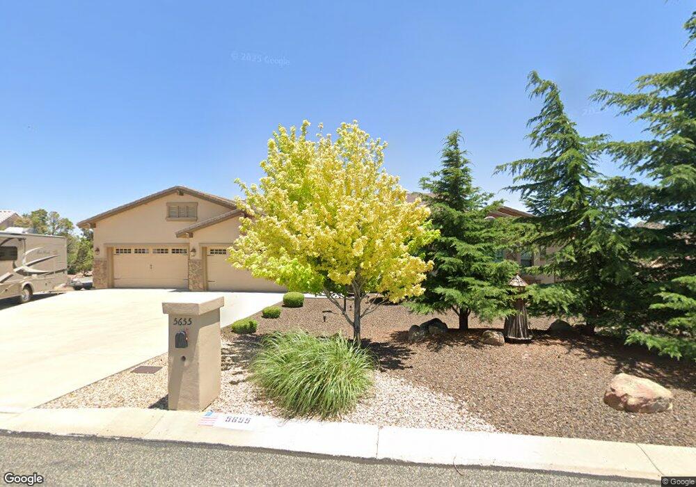
5655 Thistle Dr Prescott, AZ 86305
Estimated Value: $836,000 - $1,257,000
--
Bed
--
Bath
4,110
Sq Ft
$264/Sq Ft
Est. Value
About This Home
This home is located at 5655 Thistle Dr, Prescott, AZ 86305 and is currently estimated at $1,083,321, approximately $263 per square foot. 5655 Thistle Dr is a home located in Yavapai County with nearby schools including Granite Mountain Middle School, Abia Judd Elementary School, and Prescott Mile High Middle School.
Ownership History
Date
Name
Owned For
Owner Type
Purchase Details
Closed on
Apr 12, 2016
Sold by
Ohm John R and Ohm Linda M
Bought by
Jolo Family Trust
Current Estimated Value
Purchase Details
Closed on
Oct 23, 2007
Sold by
Anderson John L and Anderson Christel M
Bought by
Ohm John R and Ohm Linda M
Purchase Details
Closed on
Aug 8, 2001
Sold by
Howey Keith B and Howey Jacquelyn R
Bought by
Anderson John L and Anderson Christel M
Purchase Details
Closed on
Oct 20, 1999
Sold by
Yavapai Coconino Title Agency Inc
Bought by
Howey Keith B and Howey Jacquelyn R
Home Financials for this Owner
Home Financials are based on the most recent Mortgage that was taken out on this home.
Original Mortgage
$40,400
Interest Rate
7.86%
Mortgage Type
New Conventional
Create a Home Valuation Report for This Property
The Home Valuation Report is an in-depth analysis detailing your home's value as well as a comparison with similar homes in the area
Home Values in the Area
Average Home Value in this Area
Purchase History
| Date | Buyer | Sale Price | Title Company |
|---|---|---|---|
| Jolo Family Trust | -- | None Available | |
| Ohm John R | $200,000 | Yavapai Title Agency Inc | |
| Anderson John L | $62,000 | Chicago Title Insurance Co | |
| Howey Keith B | $53,900 | Yavapai Coconino Title Agenc |
Source: Public Records
Mortgage History
| Date | Status | Borrower | Loan Amount |
|---|---|---|---|
| Previous Owner | Howey Keith B | $40,400 |
Source: Public Records
Tax History Compared to Growth
Tax History
| Year | Tax Paid | Tax Assessment Tax Assessment Total Assessment is a certain percentage of the fair market value that is determined by local assessors to be the total taxable value of land and additions on the property. | Land | Improvement |
|---|---|---|---|---|
| 2026 | $4,107 | $107,137 | -- | -- |
| 2024 | $4,010 | $112,527 | -- | -- |
| 2023 | $4,010 | $93,239 | $0 | $0 |
| 2022 | $3,919 | $80,016 | $6,952 | $73,064 |
| 2021 | $4,111 | $76,664 | $6,815 | $69,849 |
| 2020 | $4,119 | $0 | $0 | $0 |
| 2019 | $4,059 | $0 | $0 | $0 |
| 2018 | $3,894 | $0 | $0 | $0 |
| 2017 | $3,687 | $0 | $0 | $0 |
| 2016 | $3,714 | $0 | $0 | $0 |
| 2015 | $3,542 | $0 | $0 | $0 |
| 2014 | $3,551 | $0 | $0 | $0 |
Source: Public Records
Map
Nearby Homes
- 5750 Columbine Rd
- 1033 Lupine Ln
- 5892 Honeysuckle Rd
- 5730 Symphony Dr
- 958 Grapevine Ln
- 5900 Willow Creek Rd
- 830 Panicum Dr
- 5898 Symphony Dr
- 790 Panicum Dr
- 1239 Cattle Trail Unit 56
- 1243 Cattle Trail
- The Malibu Plan at South Ranch - Destination Collection
- The Coronado Plan at South Ranch - Destination Collection
- The Newport A Plan at South Ranch - Destination Collection
- The Frontier II Plan at South Ranch - Western Collection
- The Boulder II Plan at South Ranch - Western Collection
- The Nantucket A Plan at South Ranch - Destination Collection
- The Durango II Plan at South Ranch - Western Collection
- The Sheridan II F Plan at South Ranch - Western Collection
- 1240 Cattle Trail
- 5645 Thistle Dr
- 9105 Snapdragon Ln
- 5667 Thistle Dr
- 5673 Thistle Dr
- 5754 Columbine Rd
- 5656 Thistle Dr
- 5656 Thistle Dr Unit 3
- 5740 Columbine Rd
- 5669 Thistle Dr
- 5650 Thistle Dr
- 5758 Columbine Rd
- 5633 Thistle Dr
- 5636 Thistle Dr
- 5732 Columbine Rd
- 5732 Columbine Rd Unit 3
- 5711 Snapdragon Ln
- 5670 Thistle Dr
- 5701 Snapdragon Ln
- 5760 Columbine Rd
- 5749 Columbine Rd