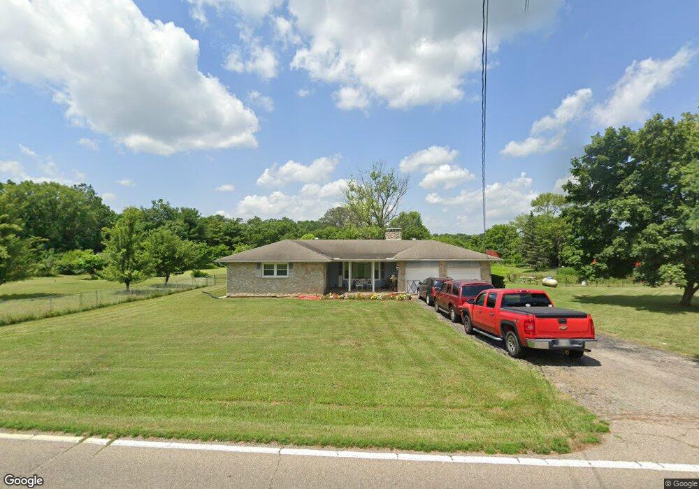
5657 Union Rd Franklin, OH 45005
Estimated Value: $266,000 - $349,086
3
Beds
2
Baths
1,652
Sq Ft
$189/Sq Ft
Est. Value
About This Home
This home is located at 5657 Union Rd, Franklin, OH 45005 and is currently estimated at $312,522, approximately $189 per square foot. 5657 Union Rd is a home located in Warren County with nearby schools including Franklin High School, Summit Academy Community School for Alternative Learners - Middletown, and Summit Academy Secondary School - Middletown.
Ownership History
Date
Name
Owned For
Owner Type
Purchase Details
Closed on
Apr 26, 2022
Sold by
Coffey Philip G
Bought by
Coffey Phillip Gregory and Coffey Tammi Lynn
Current Estimated Value
Purchase Details
Closed on
Apr 6, 1992
Sold by
Coffey Coffey and Coffey Phillip G
Bought by
Coffey Coffey and Coffey Phillip G
Purchase Details
Closed on
Jul 1, 1986
Sold by
R. Fryman and R. Wm.
Bought by
Coffey Coffey and Coffey Phillip G
Create a Home Valuation Report for This Property
The Home Valuation Report is an in-depth analysis detailing your home's value as well as a comparison with similar homes in the area
Home Values in the Area
Average Home Value in this Area
Purchase History
| Date | Buyer | Sale Price | Title Company |
|---|---|---|---|
| Coffey Phillip Gregory | -- | Hassman Robert C | |
| Coffey Coffey | $37,000 | -- | |
| Coffey Coffey | $74,000 | -- |
Source: Public Records
Tax History
| Year | Tax Paid | Tax Assessment Tax Assessment Total Assessment is a certain percentage of the fair market value that is determined by local assessors to be the total taxable value of land and additions on the property. | Land | Improvement |
|---|---|---|---|---|
| 2025 | $4,423 | $100,070 | $34,650 | $65,420 |
| 2024 | $4,423 | $100,070 | $34,650 | $65,420 |
| 2023 | $3,867 | $78,799 | $20,807 | $57,991 |
| 2022 | $3,783 | $78,799 | $20,808 | $57,992 |
| 2021 | $3,571 | $78,799 | $20,808 | $57,992 |
| 2020 | $3,300 | $64,064 | $16,916 | $47,149 |
| 2019 | $2,981 | $64,064 | $16,916 | $47,149 |
| 2018 | $2,976 | $64,064 | $16,916 | $47,149 |
| 2017 | $2,793 | $54,586 | $16,048 | $38,539 |
| 2016 | $2,853 | $54,586 | $16,048 | $38,539 |
| 2015 | $2,853 | $54,586 | $16,048 | $38,539 |
| 2014 | $2,671 | $49,810 | $15,090 | $34,720 |
| 2013 | $2,271 | $58,930 | $16,920 | $42,010 |
Source: Public Records
Map
Nearby Homes
- 5744 Lynn St
- 5839 Shaker Rd
- 5845 Manchester Rd
- 25 Timber Creek Dr
- 65 Timber Creek Dr
- 100 Pleasant Hill Blvd
- 6633 Rivulet Dr
- 5865 Hayden Dr
- 6759 Manchester Rd
- 6777 Crystal Harbour Dr
- 4650 Shaker Rd
- 4640 Shaker Rd
- 6006 Tributary Park
- 5684 Olive Rd
- 6891 Riverview Ave
- 6510 Ohio 123
- 6510 State Route 123
- 5019 Waterford Dr
- 5019 Waterford Ln
- 5017 Waterford Ln
- 5691 Union Rd
- 5707 Union Rd
- 5593 Union Rd
- 5723 Union Rd
- 5742 Union Rd
- 5769 Union Rd
- 5782 Union Rd
- 5774 Union Rd
- 5803 Union Rd
- 5804 Union Rd
- 5763 Shaker Rd
- 5819 Union Rd
- 5716 Manchester Rd
- 5777 Shaker Rd
- 5731 Shaker Rd
- 0 St Rt 123 Unit 1437733
- 27 Tama Lot 27 Ln
- 29 Tama Lot 29 Ln
- 0 Lot #93 Angelas Cove Unit 579848
- 0 Lot #91 Angelas Cove Unit 579847
Your Personal Tour Guide
Ask me questions while you tour the home.