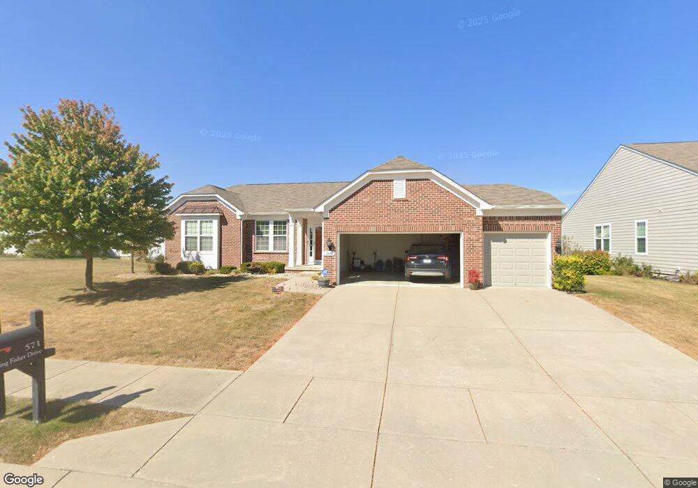
566 King Fisher Dr Brownsburg, IN 46112
Estimated Value: $433,539 - $475,000
3
Beds
3
Baths
2,198
Sq Ft
$204/Sq Ft
Est. Value
About This Home
This home is located at 566 King Fisher Dr, Brownsburg, IN 46112 and is currently estimated at $447,385, approximately $203 per square foot. 566 King Fisher Dr is a home with nearby schools including Eagle Elementary School, Brownsburg West Middle School, and Brownsburg High School.
Ownership History
Date
Name
Owned For
Owner Type
Purchase Details
Closed on
Dec 22, 2011
Sold by
Pulte Homes Of Indiana Llc
Bought by
Eubanks Beth A and Eubanks Jimmie D
Current Estimated Value
Home Financials for this Owner
Home Financials are based on the most recent Mortgage that was taken out on this home.
Original Mortgage
$244,820
Outstanding Balance
$167,313
Interest Rate
3.99%
Mortgage Type
New Conventional
Estimated Equity
$280,072
Create a Home Valuation Report for This Property
The Home Valuation Report is an in-depth analysis detailing your home's value as well as a comparison with similar homes in the area
Home Values in the Area
Average Home Value in this Area
Purchase History
| Date | Buyer | Sale Price | Title Company |
|---|---|---|---|
| Eubanks Beth A | -- | None Available |
Source: Public Records
Mortgage History
| Date | Status | Borrower | Loan Amount |
|---|---|---|---|
| Open | Eubanks Beth A | $244,820 |
Source: Public Records
Tax History Compared to Growth
Tax History
| Year | Tax Paid | Tax Assessment Tax Assessment Total Assessment is a certain percentage of the fair market value that is determined by local assessors to be the total taxable value of land and additions on the property. | Land | Improvement |
|---|---|---|---|---|
| 2024 | $4,232 | $423,200 | $63,200 | $360,000 |
| 2023 | $4,068 | $406,800 | $60,200 | $346,600 |
| 2022 | $3,768 | $376,800 | $58,300 | $318,500 |
| 2021 | $3,238 | $323,800 | $58,300 | $265,500 |
| 2020 | $3,162 | $316,200 | $58,300 | $257,900 |
| 2019 | $3,001 | $300,100 | $56,300 | $243,800 |
| 2018 | $2,984 | $298,400 | $56,300 | $242,100 |
| 2017 | $2,822 | $282,200 | $53,600 | $228,600 |
| 2016 | $2,738 | $273,800 | $53,600 | $220,200 |
| 2014 | $2,636 | $263,600 | $52,000 | $211,600 |
Source: Public Records
Map
Nearby Homes
- 751 Fish Hawk Ct
- Glacier II Plan at Auburn Ridge - Legacy Series
- Ainsley II Plan at Auburn Ridge - Prestige Series
- Berkeley Basement Plan at Auburn Ridge - Prestige Series
- Kentmore Basement Plan at Auburn Ridge - Prestige Series
- Ainsley II Basement Plan at Auburn Ridge - Prestige Series
- Glendale Basement Plan at Auburn Ridge - Prestige Series
- Columbia Basement Plan at Auburn Ridge - Prestige Series
- Andes II Plan at Auburn Ridge - Legacy Series
- Cheswicke II Plan at Auburn Ridge - Prestige Series
- Drake Plan at Auburn Ridge - Prestige Series
- Olympic II Plan at Auburn Ridge - Legacy Series
- Cascade II Plan at Auburn Ridge - Legacy Series
- Drake Basement Plan at Auburn Ridge - Prestige Series
- Glendale Plan at Auburn Ridge - Prestige Series
- Kensington Plan at Auburn Ridge - Prestige Series
- Cheswicke II Basement Plan at Auburn Ridge - Prestige Series
- Kensington Basement Plan at Auburn Ridge - Prestige Series
- Kentmore Plan at Auburn Ridge - Prestige Series
- 4986 Carmine Ct
- 574 King Fisher Dr
- 547 King Fisher Dr
- 539 King Fisher Dr
- 582 King Fisher Dr
- 563 King Fisher Dr
- 571 King Fisher Dr
- 579 King Fisher Dr
- 555 Kingfisher Dr
- 531 King Fisher Dr
- 760 Pigeon Dr
- 590 King Fisher Dr
- 587 King Fisher Dr
- 542 King Fisher Dr
- 754 Pigeon Dr
- 550 King Fisher Dr
- 534 King Fisher Dr
- 523 King Fisher Dr
- 595 King Fisher Dr
- 746 Pigeon Dr
- 526 Kingfisher Dr