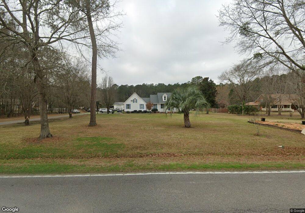
566 Lazy Hill Rd Moncks Corner, SC 29461
Estimated Value: $513,000 - $644,000
3
Beds
2
Baths
2,177
Sq Ft
$276/Sq Ft
Est. Value
About This Home
This home is located at 566 Lazy Hill Rd, Moncks Corner, SC 29461 and is currently estimated at $600,878, approximately $276 per square foot. 566 Lazy Hill Rd is a home located in Berkeley County with nearby schools including Whitesville Elementary School, Berkeley Middle School, and Berkeley High School.
Ownership History
Date
Name
Owned For
Owner Type
Purchase Details
Closed on
Dec 23, 2022
Sold by
Stone Maxie E
Bought by
Stone Maxie E and Stone Elizabeth
Current Estimated Value
Purchase Details
Closed on
Oct 10, 2005
Sold by
Baker Glenn N and Baker Alicia J
Bought by
Stone Maxie E and Stone Donna A
Home Financials for this Owner
Home Financials are based on the most recent Mortgage that was taken out on this home.
Original Mortgage
$300,000
Interest Rate
5.66%
Mortgage Type
Future Advance Clause Open End Mortgage
Purchase Details
Closed on
Jul 30, 2001
Sold by
Creel Suesette M and Marion Creel
Bought by
Baker Glenn N and Baker Alicia J
Create a Home Valuation Report for This Property
The Home Valuation Report is an in-depth analysis detailing your home's value as well as a comparison with similar homes in the area
Home Values in the Area
Average Home Value in this Area
Purchase History
| Date | Buyer | Sale Price | Title Company |
|---|---|---|---|
| Stone Maxie E | -- | -- | |
| Stone Maxie E | $375,000 | None Available | |
| Baker Glenn N | $237,000 | -- |
Source: Public Records
Mortgage History
| Date | Status | Borrower | Loan Amount |
|---|---|---|---|
| Previous Owner | Stone Maxie E | $300,000 |
Source: Public Records
Tax History Compared to Growth
Tax History
| Year | Tax Paid | Tax Assessment Tax Assessment Total Assessment is a certain percentage of the fair market value that is determined by local assessors to be the total taxable value of land and additions on the property. | Land | Improvement |
|---|---|---|---|---|
| 2025 | $1,532 | $403,535 | $118,039 | $285,496 |
| 2024 | $1,473 | $16,142 | $4,722 | $11,420 |
| 2023 | $1,473 | $16,142 | $4,722 | $11,420 |
| 2022 | $1,453 | $21,054 | $4,464 | $16,590 |
| 2021 | $1,491 | $14,040 | $2,976 | $11,060 |
| 2020 | $1,511 | $14,036 | $2,976 | $11,060 |
| 2019 | $1,500 | $14,036 | $2,976 | $11,060 |
| 2018 | $1,405 | $12,672 | $2,976 | $9,696 |
| 2017 | $1,306 | $12,672 | $2,976 | $9,696 |
| 2016 | $1,339 | $12,680 | $2,980 | $9,700 |
| 2015 | $1,229 | $12,680 | $2,980 | $9,700 |
| 2014 | $1,404 | $12,680 | $2,980 | $9,700 |
| 2013 | -- | $12,680 | $2,980 | $9,700 |
Source: Public Records
Map
Nearby Homes
- 607 Lazy Hill Rd
- 240 Groomsville Rd
- Emerson Plan at High Point at Foxbank
- 508 Eagleview Dr
- 519 Eagleview Dr
- 117 Forest Springs Rd
- 221 Old Grove Ave
- 327 Hillman Trail Dr
- 426 Treeline Dr
- 661 Black Pine Rd
- 312 Red Leaf Blvd
- 659 Black Pine Rd
- 342 Silverleaf Ln
- 655 Black Pine Rd
- 420 Eagleview Dr
- 293 Red Leaf Blvd
- 627 Black Pine Rd
- 408 Treeline Dr
- 575 Pendleton Dr
- 141 Ancestry Ln
- 556 Lazy Hill Rd
- 600 Lazy Hill Rd
- 546 Lazy Hill Rd
- 565 Lazy Hill Rd
- 551 Lazy Hill Rd
- 540 Lazy Hill Rd
- 119 Melinda Dr
- 541 Lazy Hill Rd
- 530 Lazy Hill Rd
- 216 Blackstone Dr
- 531 Lazy Hill Rd
- 125 Melinda Dr
- 517 Lazy Hill Rd
- 625 E Lionel Rd
- 308 Winford Ct
- 622 E Lionel Rd
- 310 Winford Ct
- 306 Winford Ct
- 623 E Lionel Rd
- 346 Winford Ct