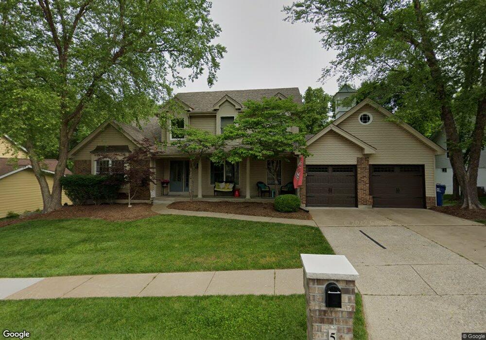
566 McBride Pointe Dr Ballwin, MO 63011
Estimated Value: $528,897 - $599,000
4
Beds
4
Baths
2,872
Sq Ft
$197/Sq Ft
Est. Value
About This Home
This home is located at 566 McBride Pointe Dr, Ballwin, MO 63011 and is currently estimated at $565,224, approximately $196 per square foot. 566 McBride Pointe Dr is a home located in St. Louis County with nearby schools including Babler Elementary School, Rockwood Valley Middle School, and Lafayette High School.
Ownership History
Date
Name
Owned For
Owner Type
Purchase Details
Closed on
May 28, 2013
Sold by
Borchers Bruce T and Borchers Shannon B
Bought by
Power Kevin C and Power Sarah J
Current Estimated Value
Home Financials for this Owner
Home Financials are based on the most recent Mortgage that was taken out on this home.
Original Mortgage
$295,766
Outstanding Balance
$209,111
Interest Rate
3.43%
Mortgage Type
New Conventional
Estimated Equity
$356,113
Purchase Details
Closed on
Jun 8, 2011
Sold by
Kahn Robert
Bought by
Borchers Bruce T and Borchers Sharnnon B
Home Financials for this Owner
Home Financials are based on the most recent Mortgage that was taken out on this home.
Original Mortgage
$228,800
Interest Rate
4.81%
Mortgage Type
New Conventional
Purchase Details
Closed on
Feb 12, 2002
Sold by
Kahn Robert and Kahn June
Bought by
Kahn Robert
Home Financials for this Owner
Home Financials are based on the most recent Mortgage that was taken out on this home.
Original Mortgage
$65,000
Interest Rate
6.81%
Create a Home Valuation Report for This Property
The Home Valuation Report is an in-depth analysis detailing your home's value as well as a comparison with similar homes in the area
Home Values in the Area
Average Home Value in this Area
Purchase History
| Date | Buyer | Sale Price | Title Company |
|---|---|---|---|
| Power Kevin C | $311,333 | Netco | |
| Borchers Bruce T | $286,000 | None Available | |
| Kahn Robert | -- | -- |
Source: Public Records
Mortgage History
| Date | Status | Borrower | Loan Amount |
|---|---|---|---|
| Open | Power Kevin C | $295,766 | |
| Previous Owner | Borchers Bruce T | $228,800 | |
| Previous Owner | Kahn Robert | $65,000 |
Source: Public Records
Tax History
| Year | Tax Paid | Tax Assessment Tax Assessment Total Assessment is a certain percentage of the fair market value that is determined by local assessors to be the total taxable value of land and additions on the property. | Land | Improvement |
|---|---|---|---|---|
| 2025 | $5,555 | $81,740 | $25,610 | $56,130 |
| 2024 | $5,555 | $79,890 | $23,160 | $56,730 |
| 2023 | $5,551 | $79,890 | $23,160 | $56,730 |
| 2022 | $5,002 | $66,860 | $15,450 | $51,410 |
| 2021 | $4,965 | $66,860 | $15,450 | $51,410 |
| 2020 | $5,166 | $66,330 | $15,350 | $50,980 |
| 2019 | $5,186 | $66,330 | $15,350 | $50,980 |
| 2018 | $4,531 | $54,640 | $15,350 | $39,290 |
| 2017 | $4,423 | $54,640 | $15,350 | $39,290 |
| 2016 | $4,839 | $57,490 | $15,350 | $42,140 |
Source: Public Records
Map
Nearby Homes
- 1839 Sullivan Pointe Dr
- 16537 Clayton Rd
- 1800 Wade Ct
- 16404 Clayton Rd
- 2470 Indian Tree Cir
- 2525 Peppermill Ridge Dr
- 16641 Wycliffe Place Dr
- 1504 Englebrook Dr
- 519 Black Canyon Ct
- 220 Timber Meadow Dr
- 1635 Clayton Spur Ct
- 215 Cobblefield Ct
- 16277 Autumn View Terrace Dr
- 1605 Ridge Bend Dr
- 2209 Ridgley Woods Dr
- 17824 Valley View Ln
- 101 Strecker Rd
- 16532 Branchwood Dr
- 16839 Kehrsbrooke Ct
- 2319 Paradise Peak Cir
- 570 McBride Pointe Dr
- 562 McBride Pointe Dr
- 574 McBride Pointe Dr
- 558 McBride Pointe Dr
- 567 McBride Pointe Dr
- 563 McBride Pointe Dr
- 571 McBride Pointe Dr
- 559 McBride Pointe Dr
- 1852 Sullivan Pointe Dr
- 1856 Sullivan Pointe Dr
- 621 Taylor Pointe Ct
- 617 Taylor Pointe Ct
- 1860 Sullivan Pointe Dr
- 1921 Gastorf Pointe Ct
- 555 McBride Pointe Dr
- 1915 Gastorf Pointe Ct
- 1927 Gastorf Pointe Ct
- 579 McBride Pointe Dr
- 613 Taylor Pointe Ct
- 550 McBride Pointe Dr
Your Personal Tour Guide
Ask me questions while you tour the home.