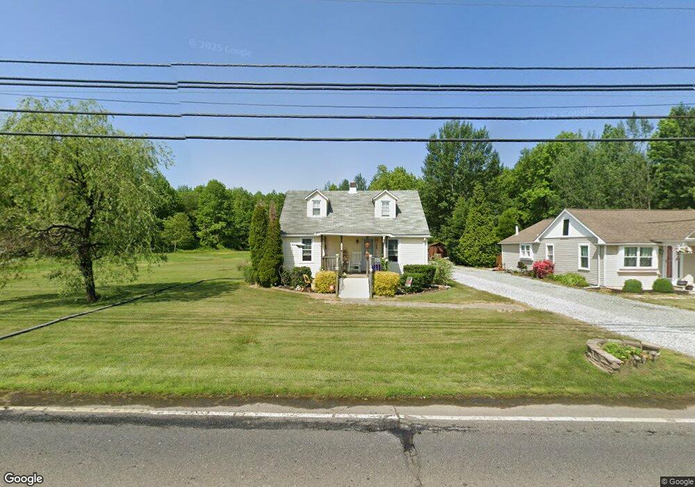
566 Paulsboro Rd Swedesboro, NJ 08085
Logan Township NeighborhoodEstimated Value: $206,000 - $333,466
3
Beds
2
Baths
1,245
Sq Ft
$218/Sq Ft
Est. Value
About This Home
This home is located at 566 Paulsboro Rd, Swedesboro, NJ 08085 and is currently estimated at $271,117, approximately $217 per square foot. 566 Paulsboro Rd is a home located in Gloucester County with nearby schools including Logan Township Elementary School.
Ownership History
Date
Name
Owned For
Owner Type
Purchase Details
Closed on
Aug 27, 2010
Sold by
Yurgin Philip
Bought by
Hilditch Theresa
Current Estimated Value
Home Financials for this Owner
Home Financials are based on the most recent Mortgage that was taken out on this home.
Original Mortgage
$152,940
Outstanding Balance
$98,030
Interest Rate
3.87%
Mortgage Type
FHA
Estimated Equity
$173,087
Purchase Details
Closed on
Apr 16, 2004
Sold by
Robinson Dennis H and Estate Of Julia Lee Robinson
Bought by
Yurgin Philip
Purchase Details
Closed on
Oct 24, 1996
Sold by
Nationscredit Financial Services Corp
Bought by
Anderson Kevin
Home Financials for this Owner
Home Financials are based on the most recent Mortgage that was taken out on this home.
Original Mortgage
$64,800
Interest Rate
13.5%
Create a Home Valuation Report for This Property
The Home Valuation Report is an in-depth analysis detailing your home's value as well as a comparison with similar homes in the area
Home Values in the Area
Average Home Value in this Area
Purchase History
| Date | Buyer | Sale Price | Title Company |
|---|---|---|---|
| Hilditch Theresa | $155,000 | Group 21 Title Agency | |
| Yurgin Philip | $20,000 | West Jersey Title | |
| Anderson Kevin | $72,000 | -- |
Source: Public Records
Mortgage History
| Date | Status | Borrower | Loan Amount |
|---|---|---|---|
| Open | Hilditch Theresa | $152,940 | |
| Previous Owner | Anderson Kevin | $64,800 |
Source: Public Records
Tax History Compared to Growth
Tax History
| Year | Tax Paid | Tax Assessment Tax Assessment Total Assessment is a certain percentage of the fair market value that is determined by local assessors to be the total taxable value of land and additions on the property. | Land | Improvement |
|---|---|---|---|---|
| 2025 | $3,219 | $247,600 | $57,400 | $190,200 |
| 2024 | $2,722 | $247,600 | $57,400 | $190,200 |
| 2023 | $2,722 | $135,400 | $33,200 | $102,200 |
| 2022 | $2,829 | $135,400 | $33,200 | $102,200 |
| 2021 | $2,801 | $135,400 | $33,200 | $102,200 |
| 2020 | $2,945 | $135,400 | $33,200 | $102,200 |
| 2019 | $2,941 | $135,400 | $33,200 | $102,200 |
| 2018 | $2,860 | $135,400 | $33,200 | $102,200 |
| 2017 | $3,515 | $140,200 | $31,800 | $108,400 |
| 2016 | $3,457 | $140,200 | $31,800 | $108,400 |
| 2015 | $3,056 | $140,200 | $31,800 | $108,400 |
| 2014 | $2,964 | $140,200 | $31,800 | $108,400 |
Source: Public Records
Map
Nearby Homes
- 159 Mill Rd
- 347 Paulsboro Rd
- 788 Paulsboro Rd
- 792 Paulsboro Rd
- 50 Mill Rd
- 43 45 Repaupo Station Rd
- 126 Repaupo Station Rd
- 0 Rd Unit NJGL2061600
- 123 W Tomlin Station Rd
- 2153 Route 322
- 71 W Tomlin Station Rd
- 78 W Tomlin Station Rd
- 48 Garwin Rd
- 26 Garwin Rd
- 163 Erica Ct
- 155 Erica Ct
- 112 Jules Dr
- 23 Regals Ct
- 218 Dominics Ct
- 71 Main St
- 568 Paulsboro Rd
- 562 Paulsboro Rd
- 576 Paulsboro Rd
- 558 Paulsboro Rd
- 598 Paulsboro Rd
- 596 Paulsboro Rd
- 548 Paulsboro Rd
- 580 Paulsboro Rd
- 582 Paulsboro Rd
- 544 Paulsboro Rd
- 536 Paulsboro Rd
- 225 Hendrickson Mill Rd
- 217 Hendrickson Mill Rd
- 215 Hendrickson Mill Rd
- 213 Hendrickson Mill Rd
- 207 Hendrickson Mill Rd
- 201 Hendrickson Mill Rd
- 191 Hendrickson Mill Rd
- 620 Stone Meeting House Rd
- 181 Hendrickson Mill Rd