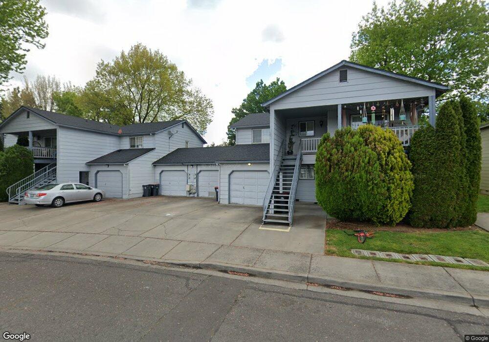
566 Village Dr Unit F23 Central Point, OR 97502
Estimated Value: $218,000 - $273,000
2
Beds
2
Baths
1,014
Sq Ft
$233/Sq Ft
Est. Value
About This Home
This home is located at 566 Village Dr Unit F23, Central Point, OR 97502 and is currently estimated at $235,764, approximately $232 per square foot. 566 Village Dr Unit F23 is a home located in Jackson County with nearby schools including Central Point Elementary School, Scenic Middle School, and Crater High School.
Ownership History
Date
Name
Owned For
Owner Type
Purchase Details
Closed on
Nov 21, 2005
Sold by
Conrad Diane T
Bought by
Schmelzer Jacob V
Current Estimated Value
Home Financials for this Owner
Home Financials are based on the most recent Mortgage that was taken out on this home.
Original Mortgage
$134,400
Outstanding Balance
$75,695
Interest Rate
6.5%
Mortgage Type
Fannie Mae Freddie Mac
Estimated Equity
$160,069
Purchase Details
Closed on
Dec 11, 2000
Sold by
Robbins Carolyn Zowada
Bought by
Conrad Diane T
Home Financials for this Owner
Home Financials are based on the most recent Mortgage that was taken out on this home.
Original Mortgage
$73,600
Interest Rate
7.67%
Create a Home Valuation Report for This Property
The Home Valuation Report is an in-depth analysis detailing your home's value as well as a comparison with similar homes in the area
Home Values in the Area
Average Home Value in this Area
Purchase History
| Date | Buyer | Sale Price | Title Company |
|---|---|---|---|
| Schmelzer Jacob V | $168,000 | First American | |
| Conrad Diane T | $77,500 | Amerititle |
Source: Public Records
Mortgage History
| Date | Status | Borrower | Loan Amount |
|---|---|---|---|
| Open | Schmelzer Jacob V | $134,400 | |
| Previous Owner | Conrad Diane T | $73,600 |
Source: Public Records
Tax History Compared to Growth
Tax History
| Year | Tax Paid | Tax Assessment Tax Assessment Total Assessment is a certain percentage of the fair market value that is determined by local assessors to be the total taxable value of land and additions on the property. | Land | Improvement |
|---|---|---|---|---|
| 2025 | $1,806 | $108,650 | -- | $108,650 |
| 2024 | $1,806 | $105,490 | -- | $105,490 |
| 2023 | $1,748 | $102,420 | $0 | $102,420 |
| 2022 | $1,708 | $102,420 | $0 | $102,420 |
| 2021 | $1,659 | $99,440 | $0 | $99,440 |
| 2020 | $1,611 | $96,550 | $0 | $96,550 |
| 2019 | $1,571 | $91,010 | $0 | $91,010 |
| 2018 | $1,523 | $57,790 | $0 | $57,790 |
| 2017 | $946 | $57,790 | $0 | $57,790 |
| 2016 | $821 | $49,840 | $0 | $49,840 |
| 2015 | $769 | $46,990 | $0 | $46,990 |
| 2014 | $756 | $46,060 | $0 | $46,060 |
Source: Public Records
Map
Nearby Homes
- 928 Brandi Way
- 851 Juanita Way
- 921 Pittview Ave
- 571 Briarwood Dr
- 1017 Fairfield Ave
- 1025 Fairfield Ave
- 3364 Bursell Rd
- 301 Freeman Rd Unit 100
- 301 Freeman Rd Unit 23
- 555 Freeman Rd Unit 128
- 555 Freeman Rd Unit 254
- 555 Freeman Rd Unit 105
- 555 Freeman Rd Unit 204
- 555 Freeman Rd Unit 209
- 959 Westrop Dr
- 3358 Bursell Rd
- 230 Peninger Rd
- 460 Federal Way
- 1065 Edwina Ave
- 1600 E Pine St
- 568 Village Dr Unit 24
- 564 Village Dr Unit 22
- 562 Village Dr Unit F21
- 582 Village Dr Unit G25
- 584 Village Dr Unit G26
- 561 Brittni Ln
- 559 Brittni Ln
- 544 Village Dr Unit E18
- 586 Village Dr
- 542 Village Dr Unit 17
- 557 Brittni Ln
- 548 Village Dr Unit E20
- 902 Brandi Way
- 546 Village Dr Unit E19
- 588 Village Dr Unit G28
- 931 Hopkins Rd
- 575 Village Dr
- 567 Village Dr
- 553 Brittni Ln
- 52729 Village Dr