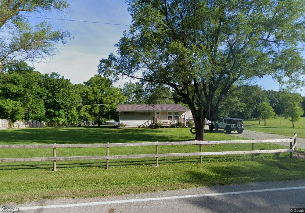
5665 Dry Branch Rd Saint Clair, MO 63077
Estimated Value: $187,996 - $432,000
3
Beds
1
Bath
1,120
Sq Ft
$257/Sq Ft
Est. Value
About This Home
This home is located at 5665 Dry Branch Rd, Saint Clair, MO 63077 and is currently estimated at $287,665, approximately $256 per square foot. 5665 Dry Branch Rd is a home located in Franklin County with nearby schools including St. Clair Elementary School, Edgar Murray Elementary School, and St. Clair Junior High School.
Ownership History
Date
Name
Owned For
Owner Type
Purchase Details
Closed on
Jun 29, 2021
Sold by
Beaulieu Joshua C and Beaulieu Amber
Bought by
Beaulieu Joshua C and Beaulieu Amber
Current Estimated Value
Purchase Details
Closed on
Jul 8, 2011
Sold by
Wideman Robert D
Bought by
Beaulieu Joshua C
Home Financials for this Owner
Home Financials are based on the most recent Mortgage that was taken out on this home.
Original Mortgage
$33,500
Outstanding Balance
$2,035
Interest Rate
4.65%
Mortgage Type
FHA
Estimated Equity
$285,630
Purchase Details
Closed on
Oct 30, 2007
Sold by
Whitley Melody
Bought by
Wideman Robert D
Home Financials for this Owner
Home Financials are based on the most recent Mortgage that was taken out on this home.
Original Mortgage
$27,000
Interest Rate
6.37%
Mortgage Type
FHA
Create a Home Valuation Report for This Property
The Home Valuation Report is an in-depth analysis detailing your home's value as well as a comparison with similar homes in the area
Home Values in the Area
Average Home Value in this Area
Purchase History
| Date | Buyer | Sale Price | Title Company |
|---|---|---|---|
| Beaulieu Joshua C | -- | None Available | |
| Beaulieu Joshua C | -- | None Available | |
| Wideman Robert D | -- | None Available |
Source: Public Records
Mortgage History
| Date | Status | Borrower | Loan Amount |
|---|---|---|---|
| Open | Beaulieu Joshua C | $33,500 | |
| Previous Owner | Wideman Robert D | $27,000 |
Source: Public Records
Tax History
| Year | Tax Paid | Tax Assessment Tax Assessment Total Assessment is a certain percentage of the fair market value that is determined by local assessors to be the total taxable value of land and additions on the property. | Land | Improvement |
|---|---|---|---|---|
| 2025 | $1,414 | $23,362 | $0 | $0 |
| 2024 | $1,414 | $21,369 | $0 | $0 |
| 2023 | $1,165 | $21,369 | $0 | $0 |
| 2022 | $1,025 | $18,745 | $0 | $0 |
| 2021 | $1,024 | $18,745 | $0 | $0 |
| 2020 | $958 | $16,821 | $0 | $0 |
| 2019 | $949 | $16,821 | $0 | $0 |
| 2018 | $937 | $16,397 | $0 | $0 |
| 2017 | $936 | $16,397 | $0 | $0 |
| 2016 | $927 | $16,211 | $0 | $0 |
| 2015 | $851 | $16,211 | $0 | $0 |
| 2014 | $864 | $16,408 | $0 | $0 |
Source: Public Records
Map
Nearby Homes
- 5546 Dry Branch Rd
- 481 Family Rd
- 1232 W Springfield Rd
- 0 Perkins Rd Unit MIS26002042
- 0 St Clair Station Ln Unit MIS25068128
- 1322 Reiker Ford Rd
- 0 Peacock Rd
- 1675 Peacock Rd
- 0 Oakridge Estate Block 2 Lot 40 Unit MIS25078527
- 231 Hart Dr
- 2707 N Service Rd W
- 1362 Oakwood Dr
- 347 Roller Rd
- 0 Oakwood Dr
- 421 Lake Shore Dr
- 440 Lake Shore Dr
- 315 W Oak St
- 5 Lots Mosley Ave
- 208 Mosley Ave
- 445 Lakeshore Dr
- 5675 Dry Branch Rd
- 5672 Dry Branch Rd
- 5634 Dry Branch Rd
- 5768 Dry Branch Rd
- 5710 Dry Branch Rd
- 5595 Dry Branch Rd
- 5572 Dry Branch Rd
- 5579 Dry Branch Rd
- 5750 Dry Branch Rd
- 5545 Dry Branch Rd
- 5564 Dry Branch Rd
- 0 Turkey Ridge Rd Unit 12023415
- 0 Turkey Ridge Rd Unit 12023444
- 0 Turkey Ridge Rd Unit 14054017
- 0 Tracts 7 & 8 Turkey Ridge Rd Unit 20075914
- 5556 Dry Branch Rd
- 5543 Dry Branch Rd
- 291 Bird Song Ln
- 0 16+ - Acres Dry Branch Rd
- 244 Quail Ranch Rd
Your Personal Tour Guide
Ask me questions while you tour the home.