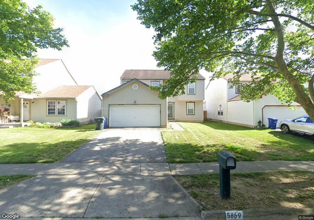
5669 Matuka Dr Columbus, OH 43232
East Columbus-White Ash NeighborhoodEstimated Value: $281,283 - $327,000
3
Beds
3
Baths
1,734
Sq Ft
$173/Sq Ft
Est. Value
About This Home
This home is located at 5669 Matuka Dr, Columbus, OH 43232 and is currently estimated at $300,321, approximately $173 per square foot. 5669 Matuka Dr is a home located in Franklin County with nearby schools including Liberty Elementary School, Yorktown Middle School, and Independence High School.
Ownership History
Date
Name
Owned For
Owner Type
Purchase Details
Closed on
Apr 30, 2002
Sold by
Maronda Homes Inc Of Ohio
Bought by
Hawkins Rosland L
Current Estimated Value
Home Financials for this Owner
Home Financials are based on the most recent Mortgage that was taken out on this home.
Original Mortgage
$135,527
Outstanding Balance
$55,501
Interest Rate
7.07%
Mortgage Type
FHA
Estimated Equity
$244,820
Create a Home Valuation Report for This Property
The Home Valuation Report is an in-depth analysis detailing your home's value as well as a comparison with similar homes in the area
Home Values in the Area
Average Home Value in this Area
Purchase History
| Date | Buyer | Sale Price | Title Company |
|---|---|---|---|
| Hawkins Rosland L | $136,700 | -- |
Source: Public Records
Mortgage History
| Date | Status | Borrower | Loan Amount |
|---|---|---|---|
| Open | Hawkins Rosland L | $135,527 |
Source: Public Records
Tax History
| Year | Tax Paid | Tax Assessment Tax Assessment Total Assessment is a certain percentage of the fair market value that is determined by local assessors to be the total taxable value of land and additions on the property. | Land | Improvement |
|---|---|---|---|---|
| 2025 | $3,831 | $85,370 | $23,280 | $62,090 |
| 2024 | $3,831 | $85,370 | $23,280 | $62,090 |
| 2023 | $3,782 | $85,365 | $23,275 | $62,090 |
| 2022 | $2,683 | $51,730 | $5,250 | $46,480 |
| 2021 | $2,688 | $51,730 | $5,250 | $46,480 |
| 2020 | $2,691 | $51,730 | $5,250 | $46,480 |
| 2019 | $2,604 | $42,920 | $4,380 | $38,540 |
| 2018 | $2,557 | $42,920 | $4,380 | $38,540 |
| 2017 | $2,687 | $42,920 | $4,380 | $38,540 |
| 2016 | $2,771 | $41,830 | $5,670 | $36,160 |
| 2015 | $2,529 | $41,830 | $5,670 | $36,160 |
| 2014 | $2,522 | $41,830 | $5,670 | $36,160 |
| 2013 | $1,463 | $49,210 | $6,685 | $42,525 |
Source: Public Records
Map
Nearby Homes
- 5691 Matuka Dr
- 5882 Abernathy Ln Unit 5882F
- St Martin Plan at Chatterton Commons
- 3310 Joshstock Dr
- 3304 Joshstock Dr
- 3298 Joshstock Dr
- 5944 Abernathy Ln
- 5946 Abernathy Ln
- 5960 Abernathy Ln
- 5962 Abernathy Ln
- 5968 Abernathy Ln
- 5970 Abernathy Ln
- 5976 Abernathy Ln
- 5999 Bears Run Rd
- 5373 Spire Ln
- 5361 Parkline Dr
- 3302 Everson Rd E
- 3057 Lamptonridge Dr
- 5414 Paladim Rd
- 5326 Adderley Ave
Your Personal Tour Guide
Ask me questions while you tour the home.