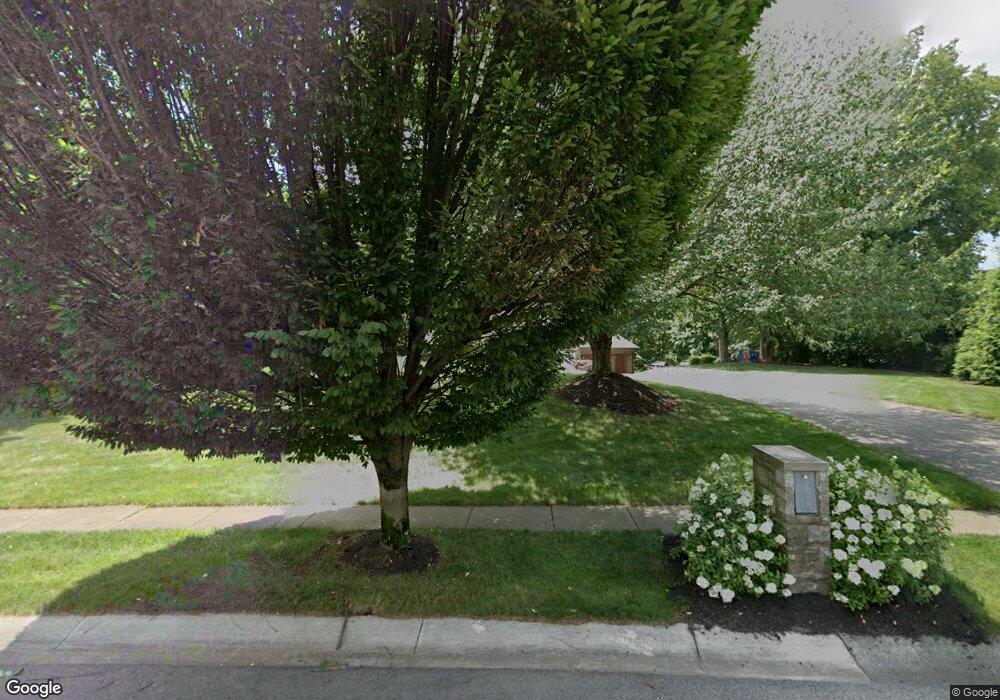
567 Laurel Ridge Dr Columbus, OH 43230
Estimated Value: $751,000 - $860,473
4
Beds
4
Baths
3,098
Sq Ft
$260/Sq Ft
Est. Value
About This Home
This home is located at 567 Laurel Ridge Dr, Columbus, OH 43230 and is currently estimated at $805,824, approximately $260 per square foot. 567 Laurel Ridge Dr is a home located in Franklin County with nearby schools including Jefferson Elementary School, Gahanna East Middle School, and Lincoln High School.
Ownership History
Date
Name
Owned For
Owner Type
Purchase Details
Closed on
Dec 30, 2014
Sold by
Groner Barbara I
Bought by
Groner Family Trust
Current Estimated Value
Purchase Details
Closed on
Feb 28, 2001
Sold by
Hoskins Rodney D and Hoskins Maggie J
Bought by
Groner Barbara I
Purchase Details
Closed on
Aug 1, 1996
Sold by
Coulter Lonie C
Bought by
Hoskins Rodney D and Hoskins Maggie J
Home Financials for this Owner
Home Financials are based on the most recent Mortgage that was taken out on this home.
Original Mortgage
$350,000
Interest Rate
7.75%
Mortgage Type
New Conventional
Purchase Details
Closed on
Dec 29, 1986
Create a Home Valuation Report for This Property
The Home Valuation Report is an in-depth analysis detailing your home's value as well as a comparison with similar homes in the area
Home Values in the Area
Average Home Value in this Area
Purchase History
| Date | Buyer | Sale Price | Title Company |
|---|---|---|---|
| Groner Family Trust | -- | None Available | |
| Groner Barbara I | $470,000 | Chicago Title West | |
| Hoskins Rodney D | $639,000 | -- | |
| -- | $58,500 | -- |
Source: Public Records
Mortgage History
| Date | Status | Borrower | Loan Amount |
|---|---|---|---|
| Previous Owner | Hoskins Rodney D | $350,000 |
Source: Public Records
Tax History Compared to Growth
Tax History
| Year | Tax Paid | Tax Assessment Tax Assessment Total Assessment is a certain percentage of the fair market value that is determined by local assessors to be the total taxable value of land and additions on the property. | Land | Improvement |
|---|---|---|---|---|
| 2024 | $13,293 | $225,370 | $48,930 | $176,440 |
| 2023 | $13,127 | $225,365 | $48,930 | $176,435 |
| 2022 | $18,352 | $245,600 | $32,620 | $212,980 |
| 2021 | $17,750 | $245,600 | $32,620 | $212,980 |
| 2020 | $17,601 | $245,600 | $32,620 | $212,980 |
| 2019 | $14,637 | $203,780 | $27,200 | $176,580 |
| 2018 | $13,839 | $198,070 | $17,500 | $180,570 |
| 2017 | $13,048 | $198,070 | $17,500 | $180,570 |
| 2016 | $13,554 | $187,400 | $35,600 | $151,800 |
| 2015 | $13,565 | $187,400 | $35,600 | $151,800 |
| 2014 | $13,460 | $187,400 | $35,600 | $151,800 |
| 2013 | $6,684 | $187,390 | $35,595 | $151,795 |
Source: Public Records
Map
Nearby Homes
- 211 Crossing Creek N
- 108 Walcreek Dr W
- 302 Zander Ln Unit 302
- 642 Ridenour Rd
- 111 Nob Hill Dr N
- 365 Sycamore Woods Ln Unit 365
- 206 Lintner St
- 536 Springwood Lake Dr
- 219 N Hamilton Rd
- 641 Sycamore Mill Dr
- 388 Elkwood Place
- 402 Bluestem Ave
- 657 Picadilly Ct
- 0 Beecher Crossing
- 638 Thistle Ave
- 4220 E Johnstown Rd
- 488 Three Oaks Ct Unit 488
- 135 Serran Dr
- 804 Riva Ridge Blvd
- 491 Daventry Ln
- 581 Laurel Ridge Dr
- 76 Walnut Woods Ct
- 565 Laurel Ridge Dr
- 70 Walnut Woods Ct
- 597 Laurel Ridge Dr
- 566 Laurel Ridge Dr
- 75 Walnut Woods Ct
- 88 Walnut Woods Ct
- 592 Laurel Ridge Dr
- 563 Laurel Ridge Dr
- 611 Laurel Ridge Dr
- 100 Walnut Woods Ct
- 4821 Laurel Ridge Dr
- 91 Walnut Woods Ct
- 618 Laurel Ridge Ct
- 564 Laurel Ridge Dr
- 110 Walnut Woods Ct
- 625 Laurel Ridge Dr
- 101 Walnut Woods Ct
- 0 Walnut Woods Ct Unit L0T2
