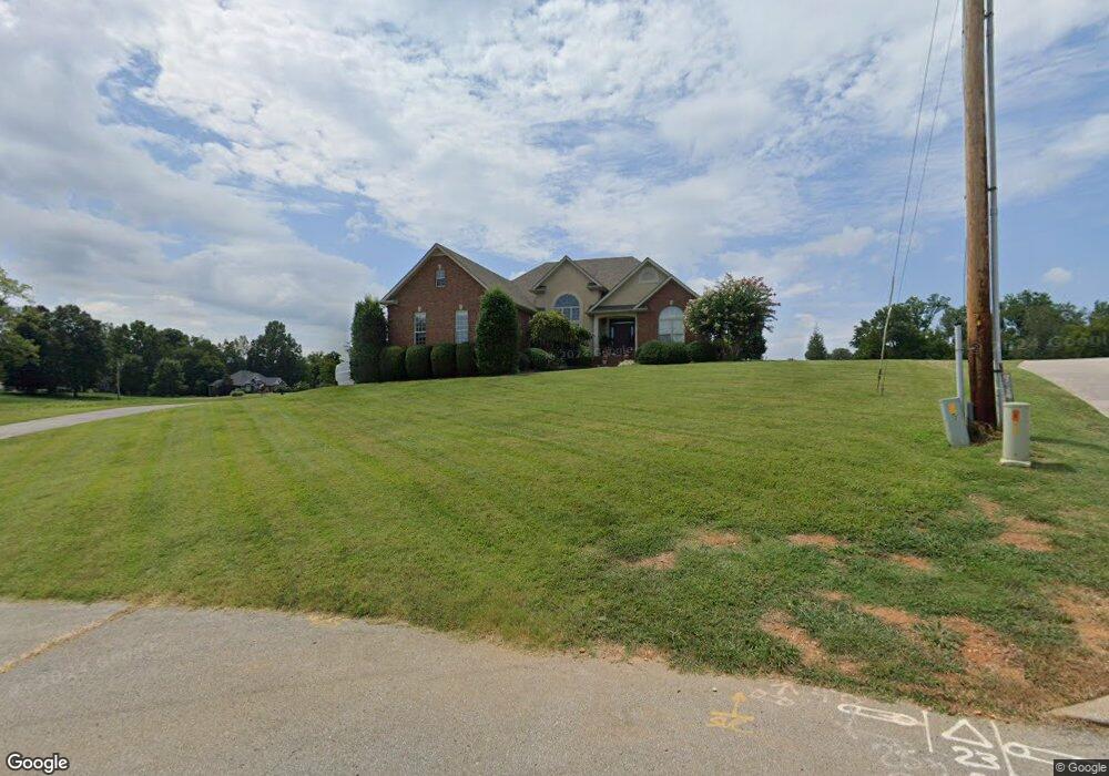
567 Oakland Dr Sparta, TN 38583
Estimated Value: $370,810 - $444,000
--
Bed
2
Baths
1,964
Sq Ft
$206/Sq Ft
Est. Value
About This Home
This home is located at 567 Oakland Dr, Sparta, TN 38583 and is currently estimated at $405,453, approximately $206 per square foot. 567 Oakland Dr is a home located in White County with nearby schools including Findlay Elementary School, White County Middle School, and White County High School.
Ownership History
Date
Name
Owned For
Owner Type
Purchase Details
Closed on
Jul 18, 2005
Sold by
Robert Oakes
Bought by
Austin Jeremy K
Current Estimated Value
Home Financials for this Owner
Home Financials are based on the most recent Mortgage that was taken out on this home.
Original Mortgage
$70,000
Interest Rate
5.66%
Purchase Details
Closed on
Oct 2, 2001
Bought by
Oakes Robert and Oakes Sylinia
Create a Home Valuation Report for This Property
The Home Valuation Report is an in-depth analysis detailing your home's value as well as a comparison with similar homes in the area
Home Values in the Area
Average Home Value in this Area
Purchase History
| Date | Buyer | Sale Price | Title Company |
|---|---|---|---|
| Austin Jeremy K | $220,000 | -- | |
| Oakes Robert | $15,500 | -- |
Source: Public Records
Mortgage History
| Date | Status | Borrower | Loan Amount |
|---|---|---|---|
| Closed | Oakes Robert | $70,000 |
Source: Public Records
Tax History Compared to Growth
Tax History
| Year | Tax Paid | Tax Assessment Tax Assessment Total Assessment is a certain percentage of the fair market value that is determined by local assessors to be the total taxable value of land and additions on the property. | Land | Improvement |
|---|---|---|---|---|
| 2025 | -- | $121,875 | $0 | $0 |
| 2024 | -- | $68,775 | $7,500 | $61,275 |
| 2023 | $2,042 | $68,775 | $7,500 | $61,275 |
| 2022 | $2,042 | $68,775 | $7,500 | $61,275 |
| 2021 | $2,041 | $68,775 | $7,500 | $61,275 |
| 2020 | $2,042 | $68,775 | $7,500 | $61,275 |
| 2019 | $1,806 | $58,250 | $6,000 | $52,250 |
| 2018 | $1,806 | $58,250 | $6,000 | $52,250 |
| 2017 | $1,806 | $58,250 | $6,000 | $52,250 |
| 2016 | $1,806 | $58,250 | $6,000 | $52,250 |
| 2015 | $1,689 | $58,250 | $6,000 | $52,250 |
| 2014 | -- | $58,250 | $6,000 | $52,250 |
| 2013 | -- | $55,850 | $6,000 | $49,850 |
Source: Public Records
Map
Nearby Homes
- 147 Sunrise Ridge Dr
- 0 N Main St
- 311 Officer Dr
- 210 Gillen Dr
- 202 Gillen Dr
- Lot 3 & 4 Harbor Green Place
- 0 Oakwood St
- 227 Oakwood St
- 119 Walker St
- 7 Marshall St
- 301 W Everett St
- 112 N Church St
- 107 N Main St
- 319 Burton Rd
- 105 N Church St
- 115 Baker St
- 18 N Church St
- 249 N Spring St
- 0 E Bockman Way
- 560 Harley's Ridge
- 549 Oakland Dr
- 523 Oakland Dr
- 661 Oakland Dr
- 0 Circle Dr Unit 616605
- 0 Circle Dr Unit 613430
- 00 Deer Circle Dr
- LOT 6 Deer Circle Dr
- 180 Deer Circle Dr
- 134 Sunrise Ridge Dr
- 409 Gillen Dr
- 765 Oakland Dr
- 423 Oakland Dr
- 678 Oakland Dr
- 0 Sunrise Ridge Dr
- 410 Gillen Dr
- 150 Sunrise Ridge Dr
- 748 Oakland Dr
- 776 Oakland Dr
- 454 Oakland Dr
- 438 Oakland Dr