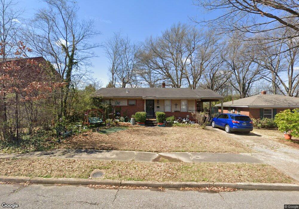
567 Sabine St Memphis, TN 38117
Audubon Park NeighborhoodEstimated Value: $133,817 - $168,000
3
Beds
1
Bath
916
Sq Ft
$166/Sq Ft
Est. Value
About This Home
This home is located at 567 Sabine St, Memphis, TN 38117 and is currently estimated at $151,704, approximately $165 per square foot. 567 Sabine St is a home located in Shelby County with nearby schools including Richland Elementary School, White Station Middle, and White Station High.
Ownership History
Date
Name
Owned For
Owner Type
Purchase Details
Closed on
Jun 2, 1998
Sold by
Pierpoali Joseph E
Bought by
Radefield Vivian E
Current Estimated Value
Home Financials for this Owner
Home Financials are based on the most recent Mortgage that was taken out on this home.
Original Mortgage
$56,970
Outstanding Balance
$11,496
Interest Rate
7.15%
Mortgage Type
FHA
Estimated Equity
$140,208
Create a Home Valuation Report for This Property
The Home Valuation Report is an in-depth analysis detailing your home's value as well as a comparison with similar homes in the area
Home Values in the Area
Average Home Value in this Area
Purchase History
| Date | Buyer | Sale Price | Title Company |
|---|---|---|---|
| Radefield Vivian E | $56,000 | -- |
Source: Public Records
Mortgage History
| Date | Status | Borrower | Loan Amount |
|---|---|---|---|
| Open | Radefield Vivian E | $56,970 | |
| Closed | Radefield Vivian E | $2,570 |
Source: Public Records
Tax History Compared to Growth
Tax History
| Year | Tax Paid | Tax Assessment Tax Assessment Total Assessment is a certain percentage of the fair market value that is determined by local assessors to be the total taxable value of land and additions on the property. | Land | Improvement |
|---|---|---|---|---|
| 2025 | $725 | $31,725 | $7,500 | $24,225 |
| 2024 | $725 | $21,375 | $4,775 | $16,600 |
| 2023 | $1,302 | $21,375 | $4,775 | $16,600 |
| 2022 | $1,302 | $21,375 | $4,775 | $16,600 |
| 2021 | $1,317 | $21,375 | $4,775 | $16,600 |
| 2020 | $1,051 | $14,500 | $3,975 | $10,525 |
| 2019 | $1,051 | $14,500 | $3,975 | $10,525 |
| 2018 | $1,051 | $14,500 | $3,975 | $10,525 |
| 2017 | $596 | $14,500 | $3,975 | $10,525 |
| 2016 | $624 | $14,275 | $0 | $0 |
| 2014 | $624 | $14,275 | $0 | $0 |
Source: Public Records
Map
Nearby Homes
- 557 Sabine St Unit 557
- 4991 Shifri Ave
- 5009 Henry Heights Dr
- 4950 Princeton Rd
- 5017 Henry Heights Dr
- 4931 Princeton Grove
- 5033 Henry Heights Dr
- 4865 Princeton Rd
- 5119 Tarrytown Dr
- 416 Elwood Ln
- 5176 White Cliff Dr
- 5137 Whitehall Ave
- 4864 Bowen Ave
- 551 N White Station Rd
- 352 Leonora Dr
- 5121 Lynbar Ave
- 346 Leonora Dr
- 529 Fleda Rd
- 448 N White Station Rd
- 4730 Sequoia Rd
- 565 Sabine St Unit 565
- 563 Sabine St Unit 563
- 573 Sabine St
- 561 Sabine St
- 561 Sabine St Unit 561
- 563 E Mendenview Dr Unit 563
- 559 Sabine St Unit 559
- 579 Sabine St
- 559 E Mendenview Dr Unit 559
- 561 E Mendenview Dr
- 4932 Shifri Ave Unit 4932
- 569 E Mendenview Dr Unit 569
- 567 E Mendenview Dr Unit 567
- 4930 Shifri Ave Unit 4930
- 4934 Shifri Ave
- 571 E Mendenview Dr Unit 571
- 564 Sabine St
- 562 Sabine St
- 4928 Shifri Ave
- 560 Sabine St