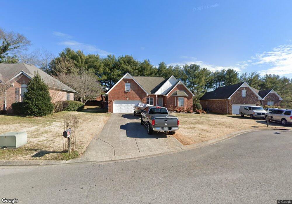
568 Forrest Pointe Dr Murfreesboro, TN 37130
Estimated Value: $355,018 - $452,000
Studio
2
Baths
1,886
Sq Ft
$224/Sq Ft
Est. Value
About This Home
This home is located at 568 Forrest Pointe Dr, Murfreesboro, TN 37130 and is currently estimated at $421,755, approximately $223 per square foot. 568 Forrest Pointe Dr is a home located in Rutherford County with nearby schools including Black Fox Elementary School, Christiana Middle School, and Riverdale High School.
Ownership History
Date
Name
Owned For
Owner Type
Purchase Details
Closed on
Oct 21, 2003
Sold by
Eischeid Lisa A
Bought by
Borges Rebecca F
Current Estimated Value
Home Financials for this Owner
Home Financials are based on the most recent Mortgage that was taken out on this home.
Original Mortgage
$103,000
Interest Rate
6.03%
Purchase Details
Closed on
Oct 7, 1996
Sold by
Forrest Partnership
Bought by
Christopher Carnahan
Home Financials for this Owner
Home Financials are based on the most recent Mortgage that was taken out on this home.
Original Mortgage
$17,900
Interest Rate
8.32%
Create a Home Valuation Report for This Property
The Home Valuation Report is an in-depth analysis detailing your home's value as well as a comparison with similar homes in the area
Home Values in the Area
Average Home Value in this Area
Purchase History
| Date | Buyer | Sale Price | Title Company |
|---|---|---|---|
| Borges Rebecca F | $158,000 | -- | |
| Christopher Carnahan | $17,900 | -- |
Source: Public Records
Mortgage History
| Date | Status | Borrower | Loan Amount |
|---|---|---|---|
| Closed | Christopher Carnahan | $103,000 | |
| Previous Owner | Christopher Carnahan | $17,900 |
Source: Public Records
Tax History
| Year | Tax Paid | Tax Assessment Tax Assessment Total Assessment is a certain percentage of the fair market value that is determined by local assessors to be the total taxable value of land and additions on the property. | Land | Improvement |
|---|---|---|---|---|
| 2025 | -- | $83,475 | $13,750 | $69,725 |
| 2024 | -- | $83,475 | $13,750 | $69,725 |
| 2023 | $1,566 | $83,475 | $13,750 | $69,725 |
| 2022 | $1,349 | $83,475 | $13,750 | $69,725 |
| 2021 | $1,238 | $55,775 | $10,625 | $45,150 |
| 2020 | $1,238 | $55,775 | $10,625 | $45,150 |
| 2019 | $1,238 | $55,775 | $10,625 | $45,150 |
| 2018 | $1,701 | $55,775 | $0 | $0 |
| 2017 | $1,646 | $42,350 | $0 | $0 |
| 2016 | $1,646 | $42,350 | $0 | $0 |
| 2015 | $1,646 | $42,350 | $0 | $0 |
| 2014 | $1,053 | $42,350 | $0 | $0 |
| 2013 | -- | $41,525 | $0 | $0 |
Source: Public Records
Map
Nearby Homes
- 1330 Shearron Ct
- 1341 Shearron Ct
- 1280 Middle Tennessee Blvd Unit B5
- 1280 Middle Tennessee Blvd Unit B14
- 1545 Nathan Ct
- 1119 Walton Dr
- 1103 Virginia Ave
- 1120 Toddington Dr Unit 1122
- 1010 Silver Point Dr
- 923 SE Broad St Unit 5
- 1002 Walton Dr
- 1023 Tyler Ct
- 1406 Bradyville Pike Unit 1408
- 1315 Bradyville Pike Unit 1
- 1315 Bradyville Pike Unit 2
- 906 Kirkwood Ave
- 1508 Laurel Ct
- 1307 Atlas St
- 1510 Foxdale Dr
- 609 S Highland Ave
- 574 Forrest Pointe Dr
- 562 Forrest Pointe Dr
- 603 Saratoga Dr
- 556 Forrest Pointe Dr
- 602 Messick Ct
- 602 Saratoga Dr
- 604 Messick Ct
- 1446 Anita Ct
- 557 Forrest Pointe Dr
- 550 Forrest Pointe Dr
- 608 Messick Ct
- 607 Saratoga Dr
- 1444 Anita Ct
- 606 Saratoga Dr
- 544 Forrest Pointe Dr
- 614 Messick Ct
- 551 Forrest Pointe Dr
- 616 Messick Ct
- 1440 Anita Ct
- 611 Saratoga Dr
Your Personal Tour Guide
Ask me questions while you tour the home.