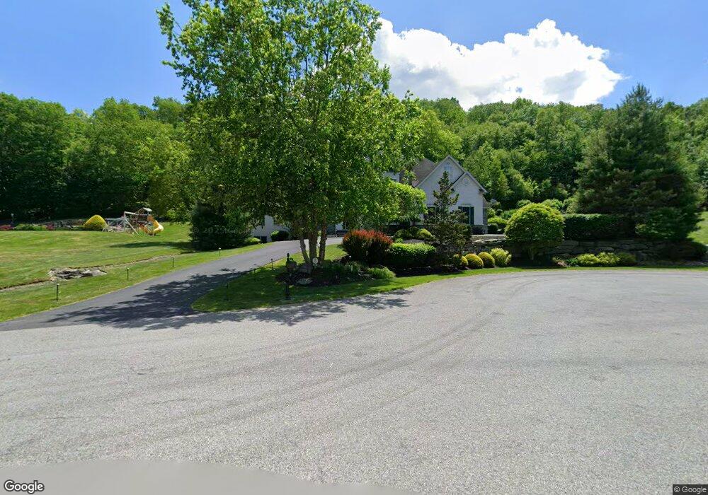
5680 Covered Bridge Cir Orefield, PA 18069
North Whitehall Township NeighborhoodEstimated Value: $1,017,330 - $1,205,000
4
Beds
4
Baths
5,136
Sq Ft
$211/Sq Ft
Est. Value
About This Home
This home is located at 5680 Covered Bridge Cir, Orefield, PA 18069 and is currently estimated at $1,083,777, approximately $211 per square foot. 5680 Covered Bridge Cir is a home located in Lehigh County with nearby schools including Parkland Kernsville Elementary School, Orefield Middle School, and Parkland High School.
Ownership History
Date
Name
Owned For
Owner Type
Purchase Details
Closed on
May 27, 2004
Sold by
Morgantown Homes Land Holding Inc
Bought by
Haddad Ii Alfred G and Haddad Jeanne M
Current Estimated Value
Home Financials for this Owner
Home Financials are based on the most recent Mortgage that was taken out on this home.
Original Mortgage
$600,000
Outstanding Balance
$121,390
Interest Rate
3.25%
Mortgage Type
Purchase Money Mortgage
Estimated Equity
$962,387
Purchase Details
Closed on
Dec 7, 1984
Bought by
Jaindl Fred J
Create a Home Valuation Report for This Property
The Home Valuation Report is an in-depth analysis detailing your home's value as well as a comparison with similar homes in the area
Home Values in the Area
Average Home Value in this Area
Purchase History
| Date | Buyer | Sale Price | Title Company |
|---|---|---|---|
| Haddad Ii Alfred G | $815,878 | -- | |
| Jaindl Fred J | $548,600 | -- |
Source: Public Records
Mortgage History
| Date | Status | Borrower | Loan Amount |
|---|---|---|---|
| Open | Haddad Ii Alfred G | $600,000 | |
| Closed | Haddad Ii Alfred G | $134,000 |
Source: Public Records
Tax History Compared to Growth
Tax History
| Year | Tax Paid | Tax Assessment Tax Assessment Total Assessment is a certain percentage of the fair market value that is determined by local assessors to be the total taxable value of land and additions on the property. | Land | Improvement |
|---|---|---|---|---|
| 2025 | $13,378 | $602,600 | $79,900 | $522,700 |
| 2024 | $12,582 | $602,600 | $79,900 | $522,700 |
| 2023 | $12,221 | $602,600 | $79,900 | $522,700 |
| 2022 | $12,167 | $602,600 | $522,700 | $79,900 |
| 2021 | $12,167 | $602,600 | $79,900 | $522,700 |
| 2020 | $12,167 | $602,600 | $79,900 | $522,700 |
| 2019 | $11,847 | $602,600 | $79,900 | $522,700 |
| 2018 | $11,612 | $602,600 | $79,900 | $522,700 |
| 2017 | $11,443 | $602,600 | $79,900 | $522,700 |
| 2016 | -- | $602,600 | $79,900 | $522,700 |
| 2015 | -- | $602,600 | $79,900 | $522,700 |
| 2014 | -- | $602,600 | $79,900 | $522,700 |
Source: Public Records
Map
Nearby Homes
- 3063 Jordan Rd
- 3054 Jordan Rd
- 5934 Kernsville Rd
- 2695 Apple Valley Estates Dr
- 2811 Apple Valley Estates Dr
- 6428-6436 Horseshoe Rd
- 3256 Woodlea Rd
- 2845 Pacific Ave
- 3741 Weidasville Rd
- 2423 Post Rd
- 6365 Constitution Rd
- 2010 Hickory Ln
- 4403 Wolfs Crossing Rd
- 2784 Township Line Rd
- 3541 Lumar St
- 3413 Cougar Cir
- 3461 Wolf Pack Dr
- 3739 Lindy Dr
- 4277 Somerset Rd
- 3486 Lil Wolf Dr
- 5620 Covered Bridge Cir
- 5620 Covered Bridge Cir
- 5699 Covered Bridge Cir
- 5691 Covered Bridge Cir
- 5651 Covered Bridge Cir
- 5745 Horseshoe Rd
- 5601 Covered Bridge Cir
- 5571 Covered Bridge Cir
- 5693 Kernsville Rd
- 3190 Jordan Rd
- 5615 Kernsville Rd
- 5665 Kernsville Rd
- 5585 Kernsville Rd
- 3174 Jordan Rd
- 5687 Kernsville Rd
- 3134 Jordan Rd
- 5690 Kernsville Rd
- 3208 Jordan Rd
- 5747 Kernsville Rd
- 5753 Kernsville Rd