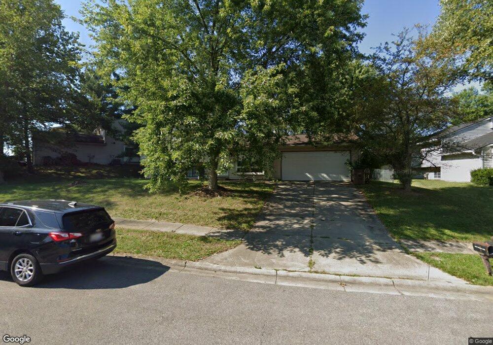
5680 Smoketree Dr Columbus, IN 47201
Estimated Value: $230,000 - $241,000
4
Beds
2
Baths
1,813
Sq Ft
$130/Sq Ft
Est. Value
About This Home
This home is located at 5680 Smoketree Dr, Columbus, IN 47201 and is currently estimated at $235,826, approximately $130 per square foot. 5680 Smoketree Dr is a home located in Bartholomew County with nearby schools including Mount Healthy Elementary School, Central Middle School, and Columbus East High School.
Ownership History
Date
Name
Owned For
Owner Type
Purchase Details
Closed on
Jan 12, 2011
Sold by
Not Provided
Bought by
Tertocha Lavon
Current Estimated Value
Purchase Details
Closed on
Jan 7, 2011
Sold by
Bennett Michael E
Bought by
Tertocha Lavon
Purchase Details
Closed on
Feb 17, 2003
Sold by
Secretary Of Housing & Urban
Bought by
Bennett Michael E
Purchase Details
Closed on
Jul 29, 2002
Sold by
Washington Mutual Bank F A
Bought by
Secretary Of Housing & Urban Develo
Purchase Details
Closed on
Apr 23, 2002
Sold by
Anderson Michael L and Anderson Theresa R
Bought by
Washington Mutual Bank F A
Create a Home Valuation Report for This Property
The Home Valuation Report is an in-depth analysis detailing your home's value as well as a comparison with similar homes in the area
Home Values in the Area
Average Home Value in this Area
Purchase History
| Date | Buyer | Sale Price | Title Company |
|---|---|---|---|
| Tertocha Lavon | $100,000 | -- | |
| Tertocha Lavon | $100,000 | New Hope Title | |
| Tertocha Lavon | $100,000 | New Hope Title | |
| Tertocha Lavon | $100,000 | New Hope Title | |
| Tertocha Lavon | -- | Attorney | |
| Bennett Michael E | -- | -- | |
| Secretary Of Housing & Urban Develo | -- | -- | |
| Washington Mutual Bank F A | -- | -- |
Source: Public Records
Tax History Compared to Growth
Tax History
| Year | Tax Paid | Tax Assessment Tax Assessment Total Assessment is a certain percentage of the fair market value that is determined by local assessors to be the total taxable value of land and additions on the property. | Land | Improvement |
|---|---|---|---|---|
| 2024 | $1,589 | $148,500 | $36,500 | $112,000 |
| 2023 | $1,464 | $141,500 | $36,500 | $105,000 |
| 2022 | $1,492 | $138,200 | $36,500 | $101,700 |
| 2021 | $1,400 | $130,900 | $24,500 | $106,400 |
| 2020 | $1,007 | $106,600 | $16,300 | $90,300 |
| 2019 | $840 | $98,600 | $16,300 | $82,300 |
| 2018 | $779 | $97,000 | $16,300 | $80,700 |
| 2017 | $831 | $97,900 | $16,300 | $81,600 |
| 2016 | $772 | $96,200 | $16,300 | $79,900 |
| 2014 | $776 | $95,300 | $16,300 | $79,000 |
Source: Public Records
Map
Nearby Homes
- 1691 Wrenwood Dr
- 619 Falcon Dr
- 1951 Creek Bank Dr
- 467 Dawson St
- 2128 Creekstone Dr
- 2436 Creek Bank Dr
- 141 Dawson St
- 2437 Creekland Dr
- 2017 Shadow Creek Blvd
- 1994 Shadow Creek Blvd
- 2323 Shadow Bend Dr
- 234 Lincoln St
- 1950 Lakecrest Dr
- 2498 Shadow Bend Dr
- 3044 Rolling Hill Dr
- 2187 Rolling Hill Ct
- 2369 Orchard Creek Dr
- 2509 Orchard Creek Dr
- 2125 Lakecrest Dr
- 2439 Orchard Creek Dr
- 5770 Smoketree Dr
- 5640 Smoketree Dr
- 5550 Smoketree Dr
- 1750 W Deaver Rd
- 5790 Smoketree Dr
- 5641 Smoketree Dr
- 5681 Smoketree Dr
- 5561 Smoketree Dr
- 1310 Brookside Dr
- 1780 W Deaver Rd
- 5540 Smoketree Dr
- 5551 Smoketree Dr
- 5791 Smoketree Dr
- 5531 Smoketree Dr
- 1800 W Deaver Rd
- 5530 Smoketree Dr
- 5511 Smoketree Dr
- 1491 Brookside Ct N
- 1501 Brookside Ct N
- 1481 Brookside Ct N