Estimated Value: $312,249 - $345,000
3
Beds
2
Baths
1,866
Sq Ft
$177/Sq Ft
Est. Value
About This Home
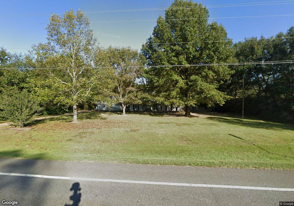
This home is located at 5687 Highway 4, Baker, FL 32531 and is currently estimated at $329,812, approximately $176 per square foot. 5687 Highway 4 is a home with nearby schools including Baker School.
Ownership History
Date
Name
Owned For
Owner Type
Purchase Details
Closed on
Dec 13, 2016
Sold by
Arnett William H
Bought by
Hilburn Jason and Hilburn Amanda
Current Estimated Value
Home Financials for this Owner
Home Financials are based on the most recent Mortgage that was taken out on this home.
Original Mortgage
$176,767
Outstanding Balance
$141,692
Interest Rate
3.54%
Mortgage Type
New Conventional
Estimated Equity
$188,120
Purchase Details
Closed on
Aug 19, 2004
Sold by
Hunt Helen Sue Reed and Hunt Helen Sue
Bought by
Arnett William H
Home Financials for this Owner
Home Financials are based on the most recent Mortgage that was taken out on this home.
Original Mortgage
$133,000
Interest Rate
5.96%
Mortgage Type
Purchase Money Mortgage
Create a Home Valuation Report for This Property
The Home Valuation Report is an in-depth analysis detailing your home's value as well as a comparison with similar homes in the area
Purchase History
| Date | Buyer | Sale Price | Title Company |
|---|---|---|---|
| Hilburn Jason | $175,000 | The Main Street Land Title C | |
| Arnett William H | $190,000 | First National Land Title Co |
Source: Public Records
Mortgage History
| Date | Status | Borrower | Loan Amount |
|---|---|---|---|
| Open | Hilburn Jason | $176,767 | |
| Previous Owner | Arnett William H | $133,000 |
Source: Public Records
Tax History
| Year | Tax Paid | Tax Assessment Tax Assessment Total Assessment is a certain percentage of the fair market value that is determined by local assessors to be the total taxable value of land and additions on the property. | Land | Improvement |
|---|---|---|---|---|
| 2025 | $2,174 | $216,072 | $32,286 | $183,786 |
| 2024 | $1,989 | $206,131 | $29,351 | $176,780 |
| 2023 | $1,989 | $205,365 | $27,430 | $177,935 |
| 2022 | $1,858 | $190,526 | $25,635 | $164,891 |
| 2021 | $1,626 | $151,288 | $24,401 | $126,887 |
| 2020 | $1,528 | $140,772 | $23,922 | $116,850 |
| 2019 | $1,472 | $133,933 | $23,922 | $110,011 |
| 2018 | $1,446 | $129,407 | $0 | $0 |
| 2017 | $1,401 | $122,806 | $0 | $0 |
| 2016 | $1,340 | $118,291 | $0 | $0 |
| 2015 | $1,343 | $114,869 | $0 | $0 |
| 2014 | $1,341 | $113,354 | $0 | $0 |
Source: Public Records
Map
Nearby Homes
- 1330 Jackson St
- 1332 Jackson St
- 1509 Long Needle Ct
- TBD Will Henry Ln
- 6064 Buck Ward Rd
- 5609 Price Plantation Rd
- 5620 Price Plantation Rd
- 5671 Grandsons Way
- 5811 Monroe St
- 1401 Greenwood Rd
- 5427 Torchwood Dr
- 5429 Torchwood Dr
- 5432 Torchwood Dr
- 5433 Torchwood Dr
- 5435 Torchwood Dr
- 1488 Mill Creek Dr
- 3.6 +/- AC Charlie Day Rd
- 5+/- AC Charlie Day Rd
- A & B Charlie Day Rd
- The Cali Plan at Charlie Day Estates
Your Personal Tour Guide
Ask me questions while you tour the home.