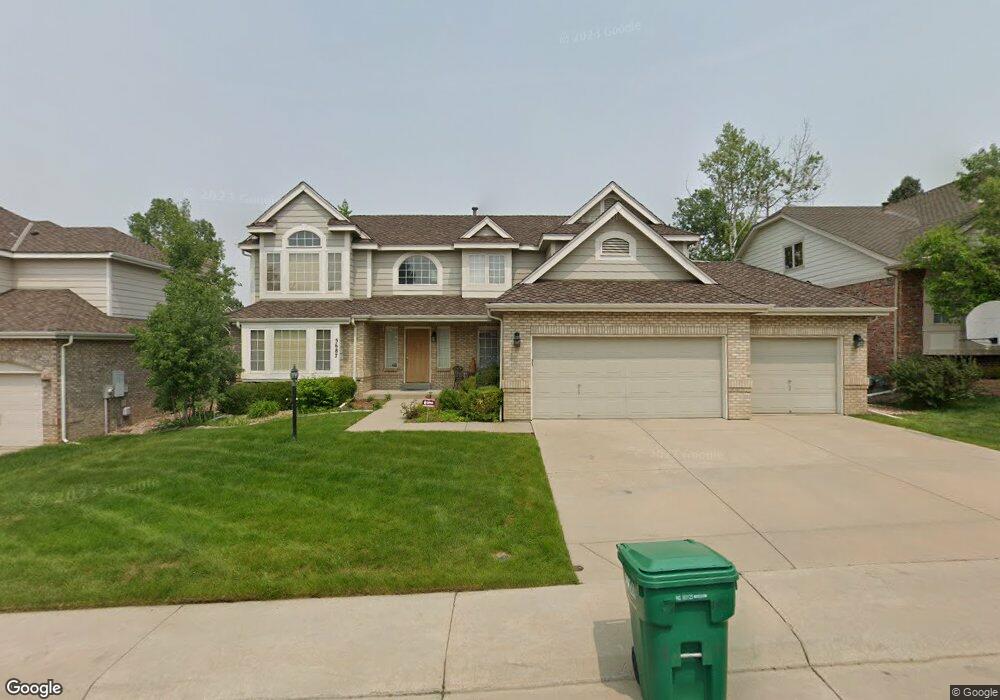
5687 S Rifle Ct Centennial, CO 80015
Piney Creek NeighborhoodEstimated Value: $706,000 - $785,000
4
Beds
3
Baths
2,941
Sq Ft
$249/Sq Ft
Est. Value
About This Home
This home is located at 5687 S Rifle Ct, Centennial, CO 80015 and is currently estimated at $731,330, approximately $248 per square foot. 5687 S Rifle Ct is a home located in Arapahoe County with nearby schools including Trails West Elementary School, Falcon Creek Middle School, and Grandview High School.
Ownership History
Date
Name
Owned For
Owner Type
Purchase Details
Closed on
Mar 22, 1993
Sold by
Richmond American Homes Of Colorado Inc
Bought by
O'Connell Richard J and O'Connell Leslie J
Current Estimated Value
Purchase Details
Closed on
Dec 29, 1989
Sold by
Richmond American Homes Of Colorado Inc
Bought by
Richmond American Homes Of Colorado Inc
Purchase Details
Closed on
Dec 28, 1989
Sold by
Richmond American Homes Of Colorado Inc
Bought by
Richmond American Homes Of Colorado Inc
Purchase Details
Closed on
Oct 3, 1989
Sold by
Conversion Arapco
Bought by
Richmond American Homes Of Colorado Inc
Purchase Details
Closed on
Nov 1, 1985
Sold by
Conversion Arapco
Bought by
Conversion Arapco
Purchase Details
Closed on
Sep 1, 1984
Bought by
Conversion Arapco
Create a Home Valuation Report for This Property
The Home Valuation Report is an in-depth analysis detailing your home's value as well as a comparison with similar homes in the area
Home Values in the Area
Average Home Value in this Area
Purchase History
| Date | Buyer | Sale Price | Title Company |
|---|---|---|---|
| O'Connell Richard J | -- | -- | |
| Richmond American Homes Of Colorado Inc | -- | -- | |
| Richmond American Homes Of Colorado Inc | -- | -- | |
| Richmond American Homes Of Colorado Inc | -- | -- | |
| Conversion Arapco | -- | -- | |
| Conversion Arapco | -- | -- |
Source: Public Records
Tax History Compared to Growth
Tax History
| Year | Tax Paid | Tax Assessment Tax Assessment Total Assessment is a certain percentage of the fair market value that is determined by local assessors to be the total taxable value of land and additions on the property. | Land | Improvement |
|---|---|---|---|---|
| 2024 | $3,853 | $46,920 | -- | -- |
| 2023 | $3,853 | $46,920 | $0 | $0 |
| 2022 | $2,818 | $34,479 | $0 | $0 |
| 2021 | $2,830 | $34,479 | $0 | $0 |
| 2020 | $2,745 | $34,385 | $0 | $0 |
| 2019 | $2,678 | $34,385 | $0 | $0 |
| 2018 | $2,639 | $31,126 | $0 | $0 |
| 2017 | $3,347 | $31,126 | $0 | $0 |
| 2016 | $3,445 | $30,487 | $0 | $0 |
| 2015 | $3,330 | $30,487 | $0 | $0 |
| 2014 | -- | $27,399 | $0 | $0 |
| 2013 | -- | $25,920 | $0 | $0 |
Source: Public Records
Map
Nearby Homes
- 17223 E Ida Place
- 17793 E Ida Ave
- 5603 S Pagosa Ct
- 17717 E Crestridge Place
- 5561 S Telluride Ct
- 5766 S Truckee Ct
- 17352 E Lake Ln
- 16776 E Prentice Cir
- 16639 E Berry Ln
- 16893 E Lake Place
- 17037 E Progress Cir S
- 5204 S Richfield St
- 5317 S Truckee Ct
- 18337 E Powers Place
- 5229 S Pagosa Way
- 16955 E Progress Cir S
- 5161 S Richfield St
- 6043 S Waco St
- 18450 E Powers Place
- 17954 E Progress Place
- 5677 S Rifle Ct
- 5697 S Rifle Ct
- 17339 E Dorado Dr
- 5667 S Rifle Ct
- 17432 E Powers Dr
- 5688 S Rifle Ct
- 5678 S Rifle Ct
- 17402 E Powers Dr
- 5698 S Rifle Ct
- 5657 S Rifle Ct
- 17452 E Powers Dr
- 17340 E Dorado Dr
- 17350 E Dorado Dr
- 17360 E Dorado Dr
- 17462 E Powers Dr
- 5658 S Rifle Ct
- 17330 E Dorado Dr
- 17370 E Dorado Dr
- 5647 S Rifle Ct
- 17380 E Dorado Dr