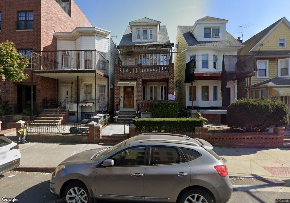
569 Dahill Rd Brooklyn, NY 11218
Borough Park NeighborhoodEstimated Value: $1,209,000 - $1,772,000
--
Bed
--
Bath
1,820
Sq Ft
$833/Sq Ft
Est. Value
About This Home
This home is located at 569 Dahill Rd, Brooklyn, NY 11218 and is currently estimated at $1,516,752, approximately $833 per square foot. 569 Dahill Rd is a home located in Kings County with nearby schools including P.S./I.S. 192 Magnet School For Math And Science Inquiry, I.S. 223 The Montauk, and Franklin Delano Roosevelt High School.
Ownership History
Date
Name
Owned For
Owner Type
Purchase Details
Closed on
Jul 15, 2010
Sold by
Merlin Aron and Merlin Miriam
Bought by
Merlin Miriam
Current Estimated Value
Purchase Details
Closed on
May 19, 2004
Sold by
Merlin Aron
Bought by
Merlin Aron and Merlin Miriam
Purchase Details
Closed on
Jun 4, 2001
Sold by
Feferkorn Abraham
Bought by
Merlin Aron
Create a Home Valuation Report for This Property
The Home Valuation Report is an in-depth analysis detailing your home's value as well as a comparison with similar homes in the area
Home Values in the Area
Average Home Value in this Area
Purchase History
| Date | Buyer | Sale Price | Title Company |
|---|---|---|---|
| Merlin Miriam | -- | -- | |
| Merlin Miriam | -- | -- | |
| Merlin Aron | -- | -- | |
| Merlin Aron | -- | -- | |
| Merlin Aron | -- | -- | |
| Merlin Aron | -- | -- |
Source: Public Records
Tax History Compared to Growth
Tax History
| Year | Tax Paid | Tax Assessment Tax Assessment Total Assessment is a certain percentage of the fair market value that is determined by local assessors to be the total taxable value of land and additions on the property. | Land | Improvement |
|---|---|---|---|---|
| 2025 | $7,197 | $72,360 | $25,020 | $47,340 |
| 2024 | $7,197 | $61,740 | $25,020 | $36,720 |
| 2023 | $7,277 | $54,540 | $25,020 | $29,520 |
| 2022 | $7,032 | $56,880 | $25,020 | $31,860 |
| 2021 | $6,994 | $62,400 | $25,020 | $37,380 |
| 2020 | $3,280 | $67,260 | $25,020 | $42,240 |
| 2019 | $6,246 | $67,260 | $25,020 | $42,240 |
| 2018 | $6,087 | $29,859 | $14,444 | $15,415 |
| 2017 | $5,984 | $29,354 | $16,676 | $12,678 |
| 2016 | $5,536 | $27,693 | $13,522 | $14,171 |
| 2015 | $3,120 | $26,126 | $16,064 | $10,062 |
| 2014 | $3,120 | $24,883 | $17,779 | $7,104 |
Source: Public Records
Map
Nearby Homes
- 819 McDonald Ave
- 755 McDonald Ave
- 751 McDonald Ave
- 302 Ditmas Ave
- 304 Ditmas Ave
- 311 Ditmas Ave
- 649 E 3rd St
- 734 E 5th St Unit 4L
- 1553 39th St
- 1551 39th St
- 570 Ocean Pkwy Unit 4E
- 540 Ocean Pkwy Unit 4H
- 510 Ocean Pkwy Unit 3J
- 510 Ocean Pkwy Unit 4J
- 525 Ocean Pkwy Unit 4J
- 702 Ocean Pkwy Unit 1B
- 640 Ditmas Ave Unit 16
- 275 Webster Ave Unit 2K
- 275 Webster Ave Unit 5I
- 275 Webster Ave Unit 4-I
- 565 Dahill Rd
- 573 Dahill Rd
- 563 Dahill Rd
- 563 Dahill Rd Unit 3
- 563 Dahill Rd Unit 2
- 563 Dahill Rd Unit 1
- 575 Dahill Rd
- 830 McDonald Ave
- 557 Dahill Rd
- 577 Dahill Rd
- 555 Dahill Rd
- 581 Dahill Rd
- 832 McDonald Ave
- 824 McDonald Ave Unit 2B
- 824 McDonald Ave
- 822 McDonald Ave
- 834-836 McDonald Ave
- 583 Dahill Rd
- 820 McDonald Ave
- 553 Dahill Rd