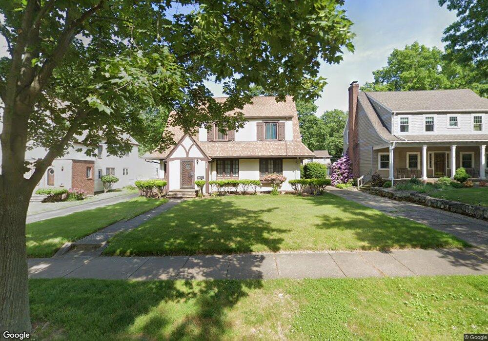
569 Dorchester Rd Akron, OH 44320
West Akron NeighborhoodEstimated Value: $198,000 - $226,000
3
Beds
3
Baths
2,435
Sq Ft
$90/Sq Ft
Est. Value
About This Home
This home is located at 569 Dorchester Rd, Akron, OH 44320 and is currently estimated at $218,602, approximately $89 per square foot. 569 Dorchester Rd is a home located in Summit County with nearby schools including Summit Academy School, Julie Billiart School Akron, and St. Sebastian Parish School.
Ownership History
Date
Name
Owned For
Owner Type
Purchase Details
Closed on
Jul 22, 2005
Sold by
Majors Karl
Bought by
Majors Karl and Majors Kendra Ann
Current Estimated Value
Purchase Details
Closed on
Jun 20, 1997
Sold by
Norwood Gregory J
Bought by
Majors Karl
Home Financials for this Owner
Home Financials are based on the most recent Mortgage that was taken out on this home.
Original Mortgage
$93,405
Interest Rate
8.01%
Mortgage Type
FHA
Create a Home Valuation Report for This Property
The Home Valuation Report is an in-depth analysis detailing your home's value as well as a comparison with similar homes in the area
Home Values in the Area
Average Home Value in this Area
Purchase History
| Date | Buyer | Sale Price | Title Company |
|---|---|---|---|
| Majors Karl | -- | -- | |
| Majors Karl | $94,000 | -- |
Source: Public Records
Mortgage History
| Date | Status | Borrower | Loan Amount |
|---|---|---|---|
| Previous Owner | Majors Karl | $93,405 |
Source: Public Records
Tax History Compared to Growth
Tax History
| Year | Tax Paid | Tax Assessment Tax Assessment Total Assessment is a certain percentage of the fair market value that is determined by local assessors to be the total taxable value of land and additions on the property. | Land | Improvement |
|---|---|---|---|---|
| 2025 | $2,936 | $54,800 | $12,019 | $42,781 |
| 2024 | $2,936 | $54,800 | $12,019 | $42,781 |
| 2023 | $2,936 | $54,800 | $12,019 | $42,781 |
| 2022 | $2,542 | $37,031 | $8,124 | $28,907 |
| 2021 | $2,545 | $37,031 | $8,124 | $28,907 |
| 2020 | $2,573 | $37,030 | $8,120 | $28,910 |
| 2019 | $2,693 | $35,290 | $7,310 | $27,980 |
| 2018 | $2,658 | $35,290 | $7,310 | $27,980 |
| 2017 | $2,345 | $35,290 | $7,310 | $27,980 |
| 2016 | $2,347 | $30,410 | $7,310 | $23,100 |
| 2015 | $2,345 | $30,410 | $7,310 | $23,100 |
| 2014 | $1,652 | $30,410 | $7,310 | $23,100 |
| 2013 | $2,222 | $30,430 | $7,310 | $23,120 |
Source: Public Records
Map
Nearby Homes
- 601 Glendora Ave
- 589 Glendora Ave
- 616 Dorchester Rd
- 560 Mineola Ave
- 527 Moreley Ave
- 617 Moreley Ave
- 571 Crestview Ave
- 695 Dorchester Rd
- 739 Roslyn Ave
- 650 Sunset View Dr
- 419 Dorchester Rd
- 515 Sunset View Dr
- 530 Storer Ave
- 687 Moreley Ave
- 1390 Delia Ave
- 405 Mineola Ave
- S/L 12 W Sunrise View Dr
- 829 S Hawkins Ave
- 632 Orlando Ave
- 808 S Hawkins Ave
- 563 Dorchester Rd
- 575 Dorchester Rd
- 557 Dorchester Rd
- 628 Glendora Ave
- 581 Dorchester Rd
- 632 Glendora Ave
- 624 Glendora Ave
- 636 Glendora Ave
- 640 Glendora Ave
- 587 Dorchester Rd
- 618 Glendora Ave
- 644 Glendora Ave
- 570 Dorchester Rd
- 576 Dorchester Rd
- 564 Dorchester Rd
- 648 Glendora Ave
- 558 Dorchester Rd
- 582 Dorchester Rd
- 547 Dorchester Rd
- 593 Dorchester Rd