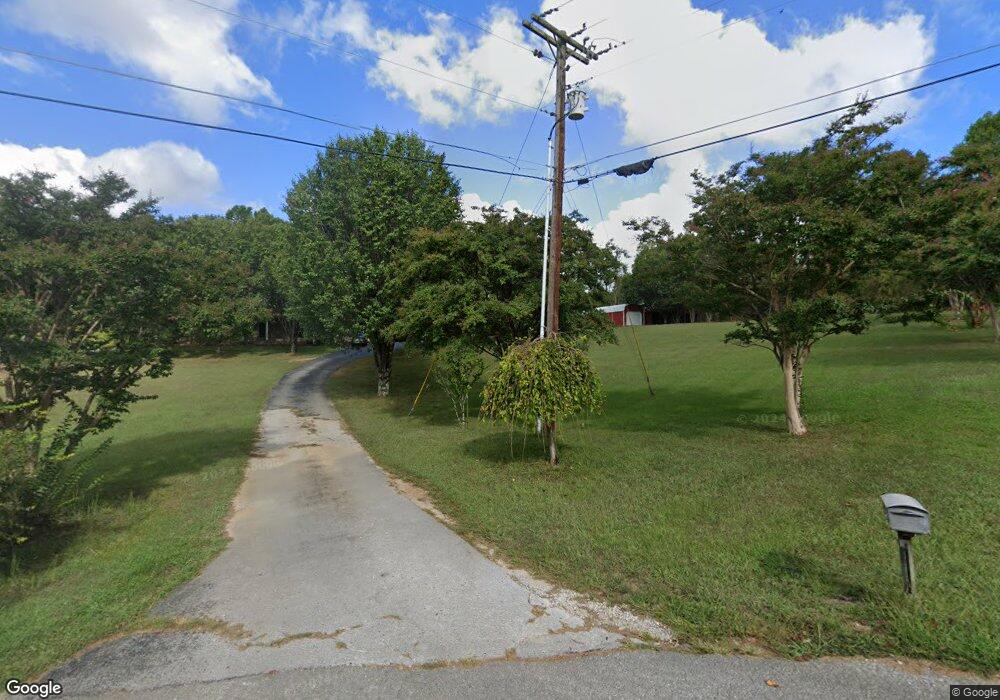
569 Edgewood Dr Cookeville, TN 38501
Estimated Value: $378,000 - $493,000
--
Bed
3
Baths
2,897
Sq Ft
$152/Sq Ft
Est. Value
About This Home
This home is located at 569 Edgewood Dr, Cookeville, TN 38501 and is currently estimated at $440,883, approximately $152 per square foot. 569 Edgewood Dr is a home located in Putnam County with nearby schools including Cookeville High School, Jere Whitson Elementary School, and Avery Trace Middle School.
Ownership History
Date
Name
Owned For
Owner Type
Purchase Details
Closed on
Nov 11, 2022
Sold by
Phy J D
Bought by
Orrand Christian C and Orrand Macie L
Current Estimated Value
Home Financials for this Owner
Home Financials are based on the most recent Mortgage that was taken out on this home.
Original Mortgage
$211,910
Interest Rate
6.58%
Mortgage Type
New Conventional
Purchase Details
Closed on
May 20, 1999
Bought by
Phy J D J and Phy Gladys
Purchase Details
Closed on
Apr 23, 1980
Bought by
Phillips Larry
Create a Home Valuation Report for This Property
The Home Valuation Report is an in-depth analysis detailing your home's value as well as a comparison with similar homes in the area
Home Values in the Area
Average Home Value in this Area
Purchase History
| Date | Buyer | Sale Price | Title Company |
|---|---|---|---|
| Orrand Christian C | $351,200 | -- | |
| Phy J D J | $94,000 | -- | |
| Phillips Larry | -- | -- |
Source: Public Records
Mortgage History
| Date | Status | Borrower | Loan Amount |
|---|---|---|---|
| Previous Owner | Orrand Christian C | $211,910 |
Source: Public Records
Tax History Compared to Growth
Tax History
| Year | Tax Paid | Tax Assessment Tax Assessment Total Assessment is a certain percentage of the fair market value that is determined by local assessors to be the total taxable value of land and additions on the property. | Land | Improvement |
|---|---|---|---|---|
| 2024 | $1,936 | $72,800 | $9,700 | $63,100 |
| 2023 | $1,996 | $75,050 | $9,700 | $65,350 |
| 2022 | $1,855 | $75,050 | $9,700 | $65,350 |
| 2021 | $1,800 | $72,800 | $9,700 | $63,100 |
| 2020 | $1,404 | $72,800 | $9,700 | $63,100 |
| 2019 | $1,404 | $47,975 | $9,700 | $38,275 |
| 2018 | $1,310 | $47,975 | $9,700 | $38,275 |
| 2017 | $1,310 | $47,975 | $9,700 | $38,275 |
| 2016 | $1,310 | $47,975 | $9,700 | $38,275 |
| 2015 | $1,346 | $47,975 | $9,700 | $38,275 |
| 2014 | $1,240 | $44,209 | $0 | $0 |
Source: Public Records
Map
Nearby Homes
- 00 Dodson Branch Rd
- 1069 Mcgregor Ln
- 1190 N Allen Rd
- 5757 Emerald Rd
- 5546 Emerald Rd
- 4882 Emerald Rd
- 5585 Emerald Rd
- 5557 Emerald Rd
- 1058 Mcgregor Ln
- 155 Kinniard Rd
- 727 Hutcheson Rd
- 1398 Shipley Rd
- 3579 Hilham Rd
- 2760 Shipley Church Rd
- 2280 Woodland Heights
- 435 Juniper Dr
- 411 Juniper Dr
- 3073 Fisk Rd
- 332 Hemlock Cir
- 342 Hemlock Cir
- 587 Edgewood Dr
- 543 Edgewood Dr
- 611 Edgewood Dr
- 586 Edgewood Dr
- 639 Edgewood Dr
- 515 Edgewood Dr
- 630 Edgewood Dr
- 502 Edgewood Dr
- 663 Edgewood Dr
- 483 Edgewood Dr
- 664 Edgewood Dr
- 474 Edgewood Dr
- 687 Edgewood Dr
- 690 Edgewood Dr
- 450 Edgewood Dr
- 703 Edgewood Dr
- 790 Edgewood Dr
- 428 Edgewood Dr
- 717 Edgewood Dr
- 406 Edgewood Dr
