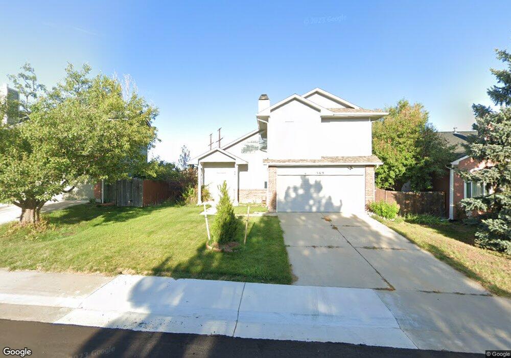
569 Howe St Castle Rock, CO 80104
Founders Village NeighborhoodEstimated Value: $503,000 - $519,011
4
Beds
3
Baths
1,608
Sq Ft
$318/Sq Ft
Est. Value
About This Home
This home is located at 569 Howe St, Castle Rock, CO 80104 and is currently estimated at $511,003, approximately $317 per square foot. 569 Howe St is a home located in Douglas County with nearby schools including Rock Ridge Elementary School, Mesa Middle School, and Douglas County High School.
Ownership History
Date
Name
Owned For
Owner Type
Purchase Details
Closed on
Mar 29, 2019
Sold by
Mellett Kristyne M
Bought by
Perry Robert Michael and Perry Jessica Lynn
Current Estimated Value
Home Financials for this Owner
Home Financials are based on the most recent Mortgage that was taken out on this home.
Original Mortgage
$276,000
Outstanding Balance
$242,653
Interest Rate
4.3%
Mortgage Type
New Conventional
Estimated Equity
$268,350
Purchase Details
Closed on
Mar 25, 2014
Sold by
Marx Mary E
Bought by
Mellett Kristyne M
Home Financials for this Owner
Home Financials are based on the most recent Mortgage that was taken out on this home.
Original Mortgage
$220,924
Interest Rate
4.25%
Mortgage Type
FHA
Purchase Details
Closed on
May 11, 2012
Sold by
Schoffstall Karl and Schoffstall Jennifer
Bought by
Marx Mary E
Home Financials for this Owner
Home Financials are based on the most recent Mortgage that was taken out on this home.
Original Mortgage
$155,944
Interest Rate
3.75%
Mortgage Type
FHA
Purchase Details
Closed on
May 12, 2006
Sold by
Jacobx Michael David and Jacobs Stacie Ann
Bought by
Schoffstall Karl and Schoffstall Jennifer
Home Financials for this Owner
Home Financials are based on the most recent Mortgage that was taken out on this home.
Original Mortgage
$171,920
Interest Rate
6.5%
Mortgage Type
Purchase Money Mortgage
Purchase Details
Closed on
Aug 6, 2003
Sold by
Jacobs Michael David
Bought by
Jacobs Michael David and Jacobs Stacie Ann
Home Financials for this Owner
Home Financials are based on the most recent Mortgage that was taken out on this home.
Original Mortgage
$189,805
Interest Rate
5.35%
Mortgage Type
FHA
Purchase Details
Closed on
May 19, 2000
Sold by
Perilstein Robert M Perilstein
Bought by
Jacobs Michael David
Home Financials for this Owner
Home Financials are based on the most recent Mortgage that was taken out on this home.
Original Mortgage
$156,442
Interest Rate
8.19%
Mortgage Type
FHA
Purchase Details
Closed on
Oct 25, 1989
Sold by
Haugen Carl I and Haugen Ann E
Bought by
Perilstein Robert M and Perilstein Cindy M
Purchase Details
Closed on
Apr 24, 1986
Sold by
Nash Phillips Copus Inc
Bought by
Chesher John M and Chesher Penny L
Create a Home Valuation Report for This Property
The Home Valuation Report is an in-depth analysis detailing your home's value as well as a comparison with similar homes in the area
Home Values in the Area
Average Home Value in this Area
Purchase History
| Date | Buyer | Sale Price | Title Company |
|---|---|---|---|
| Perry Robert Michael | $345,000 | First Alliance Title | |
| Mellett Kristyne M | $225,000 | First American | |
| Marx Mary E | $160,000 | First American | |
| Schoffstall Karl | $214,900 | Land Title Guarantee Company | |
| Jacobs Michael David | -- | First American Heritage Titl | |
| Jacobs Michael David | $157,500 | Land Title | |
| Perilstein Robert M | $38,700 | -- | |
| Perilstein Robert M | $47,300 | -- | |
| Chesher John M | $85,700 | -- |
Source: Public Records
Mortgage History
| Date | Status | Borrower | Loan Amount |
|---|---|---|---|
| Open | Perry Robert Michael | $276,000 | |
| Previous Owner | Mellett Kristyne M | $220,924 | |
| Previous Owner | Marx Mary E | $155,944 | |
| Previous Owner | Schoffstall Karl | $171,920 | |
| Previous Owner | Jacobs Michael David | $189,805 | |
| Previous Owner | Jacobs Michael David | $156,442 |
Source: Public Records
Tax History Compared to Growth
Tax History
| Year | Tax Paid | Tax Assessment Tax Assessment Total Assessment is a certain percentage of the fair market value that is determined by local assessors to be the total taxable value of land and additions on the property. | Land | Improvement |
|---|---|---|---|---|
| 2024 | $5,409 | $36,610 | $8,550 | $28,060 |
| 2023 | $5,441 | $36,610 | $8,550 | $28,060 |
| 2022 | $3,878 | $24,490 | $6,330 | $18,160 |
| 2021 | $3,952 | $24,490 | $6,330 | $18,160 |
| 2020 | $3,696 | $23,590 | $5,860 | $17,730 |
| 2019 | $3,698 | $23,590 | $5,860 | $17,730 |
| 2018 | $3,047 | $19,290 | $4,540 | $14,750 |
| 2017 | $2,933 | $19,290 | $4,540 | $14,750 |
| 2016 | $2,451 | $16,830 | $4,430 | $12,400 |
| 2015 | $2,482 | $16,830 | $4,430 | $12,400 |
| 2014 | $2,048 | $13,330 | $3,940 | $9,390 |
Source: Public Records
Map
Nearby Homes
- 535 Howe St
- 612 Blue Teal Dr
- 650 Howe Cir
- 718 Blue Teal Dr
- 5326 E Howe St
- 364 N Willow St
- 5323 E Sandpiper Ave
- 5521 Spruce Ave
- 950 Sundown Dr
- 330 N Wagonwheel Trail
- 613 N Brentwood Ct
- 5617 E Prescott Ave
- 5086 Basalt Ridge Cir
- 176 S Pembrook St
- 109 N Quicksilver Ave
- 5939 Still Meadow Place
- 5938 Still Meadow Place
- 1255 Basalt Ridge Loop
- 4365 Hidden Gulch Rd
- 487 Hideaway Ct