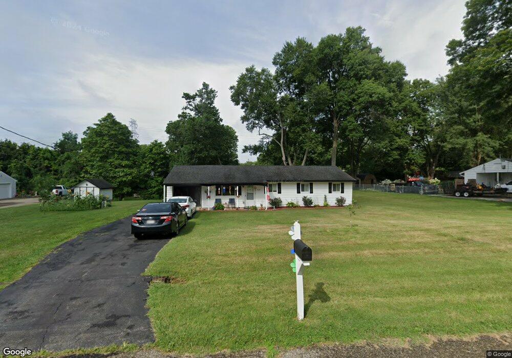
569 Marilyn Ln Cincinnati, OH 45255
Estimated Value: $210,705 - $277,000
4
Beds
2
Baths
1,170
Sq Ft
$196/Sq Ft
Est. Value
About This Home
This home is located at 569 Marilyn Ln, Cincinnati, OH 45255 and is currently estimated at $229,676, approximately $196 per square foot. 569 Marilyn Ln is a home located in Clermont County with nearby schools including Withamsville-Tobasco Elementary School, West Clermont Middle School, and West Clermont High School.
Ownership History
Date
Name
Owned For
Owner Type
Purchase Details
Closed on
Nov 16, 2001
Sold by
Partack David R
Bought by
Partack Donald J
Current Estimated Value
Home Financials for this Owner
Home Financials are based on the most recent Mortgage that was taken out on this home.
Original Mortgage
$70,400
Outstanding Balance
$27,455
Interest Rate
6.69%
Mortgage Type
New Conventional
Estimated Equity
$202,221
Purchase Details
Closed on
Dec 17, 1993
Create a Home Valuation Report for This Property
The Home Valuation Report is an in-depth analysis detailing your home's value as well as a comparison with similar homes in the area
Home Values in the Area
Average Home Value in this Area
Purchase History
| Date | Buyer | Sale Price | Title Company |
|---|---|---|---|
| Partack Donald J | $70,400 | -- | |
| -- | -- | -- |
Source: Public Records
Mortgage History
| Date | Status | Borrower | Loan Amount |
|---|---|---|---|
| Open | Partack Donald J | $70,400 |
Source: Public Records
Tax History
| Year | Tax Paid | Tax Assessment Tax Assessment Total Assessment is a certain percentage of the fair market value that is determined by local assessors to be the total taxable value of land and additions on the property. | Land | Improvement |
|---|---|---|---|---|
| 2024 | $2,768 | $54,880 | $15,260 | $39,620 |
| 2023 | $2,772 | $54,880 | $15,260 | $39,620 |
| 2022 | $2,421 | $41,550 | $11,550 | $30,000 |
| 2021 | $2,431 | $41,550 | $11,550 | $30,000 |
| 2020 | $2,434 | $41,550 | $11,550 | $30,000 |
| 2019 | $1,620 | $32,350 | $11,030 | $21,320 |
| 2018 | $1,637 | $32,350 | $11,030 | $21,320 |
| 2017 | $1,722 | $32,350 | $11,030 | $21,320 |
| 2016 | $1,722 | $30,800 | $10,500 | $20,300 |
| 2015 | $1,672 | $30,800 | $10,500 | $20,300 |
| 2014 | $1,671 | $30,800 | $10,500 | $20,300 |
| 2013 | $1,787 | $32,590 | $9,800 | $22,790 |
Source: Public Records
Map
Nearby Homes
- 3892 Michael Dr
- 602 Legendary Ln
- 637 Ellen Dr
- 595 Davis Rd
- 537 Davis Rd
- 541 Davis Rd
- 496 Mapleleaf Dr
- 492 Mapleleaf Dr
- 718 E Levitt Place
- 4047 Mclean Dr
- 736 Mccormick Ln
- 553 Marions Way
- 686 Loda Dr
- 771 Regent Rd
- 4077 Mclean Dr
- 8590 Trillium Ridge Ln
- 735 Loda Dr
- 551 Hal Cor Ln
- 4133 Brandonmore Dr
- 710 Wilfert Dr
- 571 Marilyn Ln
- 567 Marilyn Ln
- 3912 Michael Dr
- 568 Marilyn Ln
- 573 Marilyn Ln
- 3910 Michael Dr
- 3914 Michael Dr
- 3914 Michael Dr Unit 87
- 566 Marilyn Ln
- 563 Marilyn Ln
- 564 Marilyn Ln
- 570 Marilyn Ln
- 3908 Michael Dr
- 572 Marilyn Ln
- 3916 Michael Dr
- 3904 Michael Dr
- 559 Marilyn Ln
- 3902 Michael Dr
- 3909 Michael Dr
- 555 Marilyn Ln
Your Personal Tour Guide
Ask me questions while you tour the home.