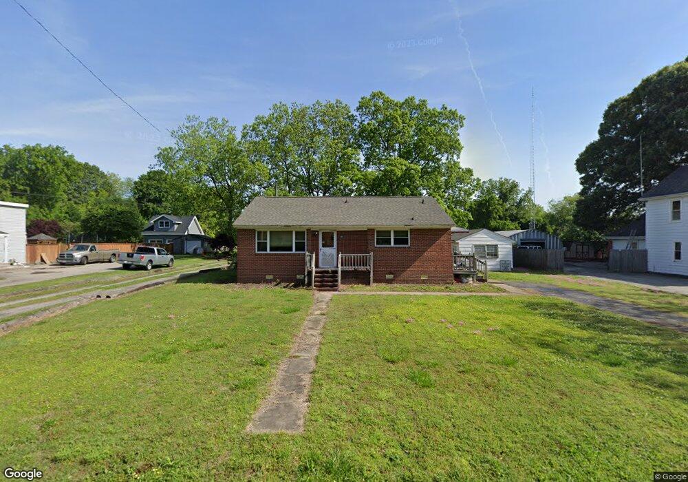
569 Old Point Ave Hampton, VA 23663
Phoebus NeighborhoodEstimated Value: $245,000 - $270,000
3
Beds
2
Baths
1,094
Sq Ft
$236/Sq Ft
Est. Value
About This Home
This home is located at 569 Old Point Ave, Hampton, VA 23663 and is currently estimated at $257,677, approximately $235 per square foot. 569 Old Point Ave is a home located in Hampton City with nearby schools including Capt. John Smith Elementary School, C. Alton Lindsay Middle School, and Phoebus High School.
Ownership History
Date
Name
Owned For
Owner Type
Purchase Details
Closed on
Sep 16, 2009
Sold by
Suggs Fanning Linda L
Bought by
Bartlett George
Current Estimated Value
Home Financials for this Owner
Home Financials are based on the most recent Mortgage that was taken out on this home.
Original Mortgage
$161,397
Outstanding Balance
$106,035
Interest Rate
5.28%
Mortgage Type
VA
Estimated Equity
$151,642
Create a Home Valuation Report for This Property
The Home Valuation Report is an in-depth analysis detailing your home's value as well as a comparison with similar homes in the area
Home Values in the Area
Average Home Value in this Area
Purchase History
| Date | Buyer | Sale Price | Title Company |
|---|---|---|---|
| Bartlett George | $158,000 | -- |
Source: Public Records
Mortgage History
| Date | Status | Borrower | Loan Amount |
|---|---|---|---|
| Open | Bartlett George | $161,397 |
Source: Public Records
Tax History
| Year | Tax Paid | Tax Assessment Tax Assessment Total Assessment is a certain percentage of the fair market value that is determined by local assessors to be the total taxable value of land and additions on the property. | Land | Improvement |
|---|---|---|---|---|
| 2025 | $148 | $241,600 | $102,500 | $139,100 |
| 2024 | $2,744 | $238,600 | $102,500 | $136,100 |
| 2023 | $2,749 | $237,000 | $102,500 | $134,500 |
| 2022 | $2,379 | $201,600 | $92,300 | $109,300 |
| 2021 | $130 | $165,900 | $77,900 | $88,000 |
| 2020 | $1,907 | $153,800 | $77,900 | $75,900 |
| 2019 | $1,879 | $151,500 | $77,900 | $73,600 |
| 2018 | $94 | $159,100 | $77,900 | $81,200 |
| 2017 | $94 | $0 | $0 | $0 |
| 2016 | $94 | $157,900 | $0 | $0 |
| 2015 | $94 | $0 | $0 | $0 |
| 2014 | $2,156 | $167,100 | $77,900 | $89,200 |
Source: Public Records
Map
Nearby Homes
- 573 Old Point Ave
- 105 Prentiss Ln
- LOT 17 Prentiss Ln
- 7 S Cypress St
- 1002 E Pembroke Ave
- 16 S Cypress St
- 51 Calhoun St
- 15 Gayle St
- 55 Calhoun St
- 168 Woodland Rd
- 122 Chichester Ave
- 208 Woodland Rd
- 1307 Colebrook Dr
- 816 Old Point Ave
- 124 Southerland Dr
- 11 Sherazi Dr
- 31 Scotland Rd
- 1314 Saxton Dr
- 20 Scotland Rd
- 64 Ireland St
- 571 Old Point Ave
- 553 Old Point Ave
- 545 Old Point Ave
- 539 Old Point Ave
- 600 Old Point Ave
- 602 Old Point Ave
- 537 Old Point Ave
- 320 E Mercury Blvd
- 12 Theodore St
- 0 Old Point Ave Unit REIN0206013
- 1122 E Pembroke Ave
- 1124 E Pembroke Ave
- 533 Old Point Ave
- 1126 E Pembroke Ave
- 1116 E Pembroke Ave
- 103 Prentiss Ln
- 1128 E Pembroke Ave
- 6 Theodore St
- 6 Theodore St Unit St.
- 1132 E Pembroke Ave
Your Personal Tour Guide
Ask me questions while you tour the home.