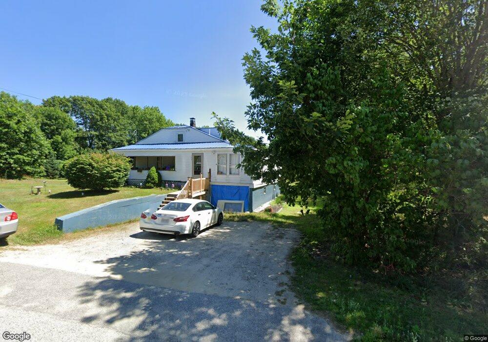
569 Sabattus Rd Sabattus, ME 04280
Estimated Value: $238,000 - $294,000
3
Beds
1
Bath
960
Sq Ft
$275/Sq Ft
Est. Value
About This Home
This home is located at 569 Sabattus Rd, Sabattus, ME 04280 and is currently estimated at $264,207, approximately $275 per square foot. 569 Sabattus Rd is a home with nearby schools including Sabattus Primary School, Libby-Tozier School, and Carrie Ricker School.
Create a Home Valuation Report for This Property
The Home Valuation Report is an in-depth analysis detailing your home's value as well as a comparison with similar homes in the area
Home Values in the Area
Average Home Value in this Area
Tax History Compared to Growth
Tax History
| Year | Tax Paid | Tax Assessment Tax Assessment Total Assessment is a certain percentage of the fair market value that is determined by local assessors to be the total taxable value of land and additions on the property. | Land | Improvement |
|---|---|---|---|---|
| 2024 | $2,508 | $131,300 | $32,200 | $99,100 |
| 2023 | $2,396 | $131,300 | $32,200 | $99,100 |
| 2022 | $2,186 | $131,300 | $32,200 | $99,100 |
| 2021 | $2,061 | $131,300 | $32,200 | $99,100 |
| 2020 | $2,185 | $123,100 | $32,200 | $90,900 |
| 2019 | $2,185 | $123,100 | $32,200 | $90,900 |
| 2018 | $2,185 | $123,100 | $32,200 | $90,900 |
| 2017 | $2,185 | $123,100 | $32,200 | $90,900 |
| 2016 | $2,308 | $123,100 | $32,200 | $90,900 |
| 2014 | $2,191 | $123,100 | $32,200 | $90,900 |
| 2013 | $2,013 | $123,100 | $32,200 | $90,900 |
Source: Public Records
Map
Nearby Homes
- 63 Riley Rd
- 22 Woodside Dr
- 49 Hemlock St
- 83 Phelan St
- 147 Greene St
- 41 Hidden Pond Rd
- 325 Middle Rd
- 148 School Rd
- 18 Terrace View
- 65 Autumn Ridge
- 71 5th Ave Unit 15
- 88 Barnard Cove Rd
- 466 Middle Rd
- 26 Fox Run Dr
- 18 Waters Edge Dr
- 1 Fox Run Dr
- R01L73 & M8l32 Marsh Rd
- 6 Pond Ridge Dr
- 10 Village Dr
- 25 Village Dr