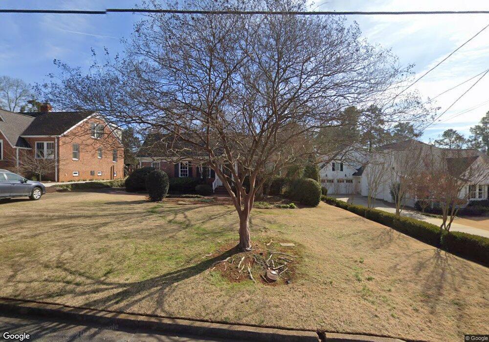
569 W Cloverhurst Ave Athens, GA 30606
Five Points NeighborhoodEstimated Value: $965,000 - $1,254,000
3
Beds
3
Baths
2,590
Sq Ft
$441/Sq Ft
Est. Value
About This Home
This home is located at 569 W Cloverhurst Ave, Athens, GA 30606 and is currently estimated at $1,141,639, approximately $440 per square foot. 569 W Cloverhurst Ave is a home located in Clarke County with nearby schools including Barrow Elementary School, Clarke Middle School, and Clarke Central High School.
Ownership History
Date
Name
Owned For
Owner Type
Purchase Details
Closed on
Oct 30, 2009
Sold by
Moody Daryl
Bought by
Moody Virginia
Current Estimated Value
Purchase Details
Closed on
Jun 25, 2007
Sold by
Not Provided
Bought by
Moody Virginia
Purchase Details
Closed on
Apr 17, 2000
Sold by
Liles Andrew R and Kayo Ono
Bought by
Hughes Amy
Purchase Details
Closed on
Jun 25, 1997
Sold by
Mccarty John E and Mccarty Valerie G
Bought by
Liles Andrew R and Kayo Ono
Purchase Details
Closed on
Nov 22, 1996
Sold by
Joyner Joseph W and Joyner Elizabeth P
Bought by
Mccarty John E and Mccarty Valerie G
Purchase Details
Closed on
Mar 22, 1994
Sold by
Mcdonald Alice R
Bought by
Joyner Joseph W and Joyne Elizabeth P
Create a Home Valuation Report for This Property
The Home Valuation Report is an in-depth analysis detailing your home's value as well as a comparison with similar homes in the area
Home Values in the Area
Average Home Value in this Area
Purchase History
| Date | Buyer | Sale Price | Title Company |
|---|---|---|---|
| Moody Virginia | -- | -- | |
| Moody Virginia | $395,000 | -- | |
| Hughes Amy | $243,000 | -- | |
| Liles Andrew R | $209,000 | -- | |
| Mccarty John E | $199,000 | -- | |
| Joyner Joseph W | $152,400 | -- |
Source: Public Records
Tax History Compared to Growth
Tax History
| Year | Tax Paid | Tax Assessment Tax Assessment Total Assessment is a certain percentage of the fair market value that is determined by local assessors to be the total taxable value of land and additions on the property. | Land | Improvement |
|---|---|---|---|---|
| 2025 | $12,868 | $414,428 | $88,800 | $325,628 |
| 2024 | $11,070 | $354,236 | $88,800 | $265,436 |
| 2023 | $11,070 | $324,204 | $88,800 | $235,404 |
| 2022 | $9,506 | $297,981 | $86,400 | $211,581 |
| 2021 | $8,696 | $258,027 | $86,400 | $171,627 |
| 2020 | $8,430 | $250,142 | $86,400 | $163,742 |
| 2019 | $8,051 | $237,132 | $86,400 | $150,732 |
| 2018 | $6,491 | $191,192 | $72,000 | $119,192 |
| 2017 | $6,374 | $187,754 | $72,000 | $115,754 |
| 2016 | $6,173 | $181,840 | $72,000 | $109,840 |
| 2015 | $6,019 | $177,040 | $67,200 | $109,840 |
| 2014 | $6,028 | $177,040 | $67,200 | $109,840 |
Source: Public Records
Map
Nearby Homes
- 577 W Cloverhurst Ave
- 1055 Baxter St Unit 504
- 338 Springdale St
- 495 Woodlawn Ave
- 169 Fortson Cir
- 206 Fortson Dr
- 265 Springdale St
- 224 Fortson Dr
- 490 Mcwhorter Dr
- 590 Highland Ave
- 997 S Milledge Ave Unit 2
- 997 S Milledge Ave Unit 3
- 997 S Milledge Ave Unit 1
- 997 S Milledge Ave Unit 4
- 255 Bloomfield St
- 597 Dearing St
- 50 Springdale St
- 175 Tillman Ln
- 1226 W Broad St
- 1398 W Hancock Ave
- 565 W Cloverhurst Ave
- 555 W Cloverhurst Ave
- 585 W Cloverhurst Ave
- 540 W Rutherford St
- 545 W Cloverhurst Ave
- 530 W Rutherford St
- 560 W Cloverhurst Ave
- 195 Mcwhorter Dr
- 550 W Cloverhurst Ave
- 590 W Cloverhurst Ave
- 535 W Cloverhurst Ave
- 520 W Rutherford St
- 630 W Cloverhurst Ave
- W W Cloverhurst Ave
- 540 W Cloverhurst Ave
- 625 W Cloverhurst Ave
- 288 Stanton Way
- 525 W Cloverhurst Ave
- 530 W Cloverhurst Ave
- 280 Stanton Way