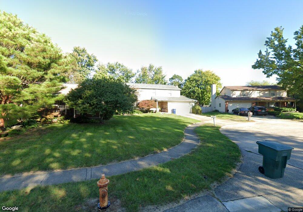
5695 Payton Way Columbus, OH 43235
Misty Meadows NeighborhoodEstimated Value: $393,133 - $429,000
4
Beds
3
Baths
1,908
Sq Ft
$218/Sq Ft
Est. Value
About This Home
This home is located at 5695 Payton Way, Columbus, OH 43235 and is currently estimated at $415,283, approximately $217 per square foot. 5695 Payton Way is a home located in Franklin County with nearby schools including Daniel Wright Elementary School, Ann Simpson Davis Middle School, and Dublin Scioto High School.
Ownership History
Date
Name
Owned For
Owner Type
Purchase Details
Closed on
Feb 21, 1996
Sold by
Snodgrass Lowell E
Bought by
Phillips Darryl W and Phillips Cheryl N
Current Estimated Value
Home Financials for this Owner
Home Financials are based on the most recent Mortgage that was taken out on this home.
Original Mortgage
$112,000
Interest Rate
7.16%
Mortgage Type
New Conventional
Purchase Details
Closed on
Jun 4, 1993
Purchase Details
Closed on
Jul 1, 1979
Create a Home Valuation Report for This Property
The Home Valuation Report is an in-depth analysis detailing your home's value as well as a comparison with similar homes in the area
Home Values in the Area
Average Home Value in this Area
Purchase History
| Date | Buyer | Sale Price | Title Company |
|---|---|---|---|
| Phillips Darryl W | $123,000 | -- | |
| -- | $109,900 | -- | |
| -- | $62,900 | -- |
Source: Public Records
Mortgage History
| Date | Status | Borrower | Loan Amount |
|---|---|---|---|
| Previous Owner | Phillips Darryl W | $112,000 |
Source: Public Records
Tax History Compared to Growth
Tax History
| Year | Tax Paid | Tax Assessment Tax Assessment Total Assessment is a certain percentage of the fair market value that is determined by local assessors to be the total taxable value of land and additions on the property. | Land | Improvement |
|---|---|---|---|---|
| 2024 | $6,271 | $103,680 | $31,260 | $72,420 |
| 2023 | $6,182 | $103,680 | $31,260 | $72,420 |
| 2022 | $5,258 | $81,940 | $27,300 | $54,640 |
| 2021 | $5,343 | $81,940 | $27,300 | $54,640 |
| 2020 | $5,311 | $81,940 | $27,300 | $54,640 |
| 2019 | $4,615 | $63,040 | $21,000 | $42,040 |
| 2018 | $4,557 | $63,040 | $21,000 | $42,040 |
| 2017 | $4,357 | $63,040 | $21,000 | $42,040 |
| 2016 | $4,453 | $61,880 | $17,080 | $44,800 |
| 2015 | $4,481 | $61,880 | $17,080 | $44,800 |
| 2014 | $4,485 | $61,880 | $17,080 | $44,800 |
| 2013 | $2,169 | $58,940 | $16,275 | $42,665 |
Source: Public Records
Map
Nearby Homes
- 5646 Dorsey Dr
- 2579 Trotterslane Dr
- 2622 Trottersway Dr
- 2560 Trotterslane Dr
- 2585 Trottersway Dr Unit 2585
- 2540 Dahlia Way Unit 26D
- 5850 Meadowhurst Way
- 2970 Black Kettle Trail
- 5672 Barry Trace Unit 5672
- 5657 Barry Trace
- 2744 Greystone Dr Unit E
- 2491 Calais Way
- 5322 Darlington Rd Unit E
- 2260 Lila Way Unit 62D
- 3158 Kingsmead Trace Unit 3158
- 3087 Strathaven Ct
- 5624 Wigmore Dr Unit 50B
- 2229 Teardrop Ave Unit 35E
- 5294 Brandy Oaks Ln
- 5273 Brandy Oaks Ln
- 5703 Payton Way
- 5687 Payton Way
- 5700 Langhorn Dr
- 5710 Langhorn Dr
- 5679 Payton Way
- 5726 Dorsey Dr
- 5696 Langhorn Dr
- 5717 Bangor Ct
- 5720 Dorsey Dr
- 5671 Payton Way
- 5692 Langhorn Dr
- 5705 Dorsey Dr
- 5718 Langhorn Dr
- 5672 Payton Way
- 5725 Bangor Ct
- 5714 Dorsey Dr
- 5686 Langhorn Dr
- 5711 Langhorn Dr
- 5663 Payton Way
- 5697 Dorsey Dr