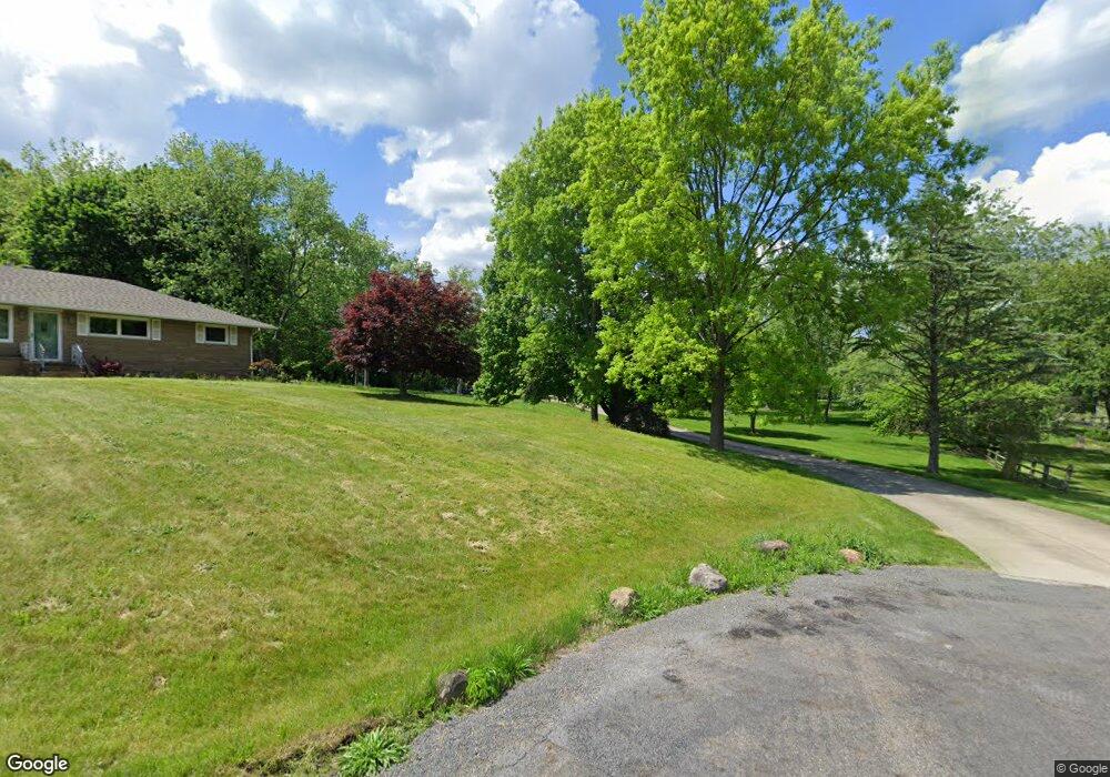
5696 Canterbury Rd New Franklin, OH 44319
Estimated Value: $352,000 - $596,813
5
Beds
3
Baths
2,618
Sq Ft
$181/Sq Ft
Est. Value
About This Home
This home is located at 5696 Canterbury Rd, New Franklin, OH 44319 and is currently estimated at $474,703, approximately $181 per square foot. 5696 Canterbury Rd is a home located in Summit County.
Ownership History
Date
Name
Owned For
Owner Type
Purchase Details
Closed on
Feb 2, 2006
Sold by
Harvey Timothy S and Harvey Deanna Jean
Bought by
Harvey Deanna J and Trust Agreement Of Deanna J Harvey
Current Estimated Value
Create a Home Valuation Report for This Property
The Home Valuation Report is an in-depth analysis detailing your home's value as well as a comparison with similar homes in the area
Home Values in the Area
Average Home Value in this Area
Purchase History
| Date | Buyer | Sale Price | Title Company |
|---|---|---|---|
| Harvey Deanna J | -- | None Available |
Source: Public Records
Tax History Compared to Growth
Tax History
| Year | Tax Paid | Tax Assessment Tax Assessment Total Assessment is a certain percentage of the fair market value that is determined by local assessors to be the total taxable value of land and additions on the property. | Land | Improvement |
|---|---|---|---|---|
| 2025 | $8,613 | $172,162 | $33,719 | $138,443 |
| 2024 | $8,613 | $172,162 | $33,719 | $138,443 |
| 2023 | $8,613 | $172,162 | $33,719 | $138,443 |
| 2022 | $7,975 | $124,258 | $23,916 | $100,342 |
| 2021 | $8,003 | $124,258 | $23,916 | $100,342 |
| 2020 | $7,865 | $124,260 | $23,920 | $100,340 |
| 2019 | $8,283 | $117,210 | $33,480 | $83,730 |
| 2018 | $7,148 | $117,210 | $33,480 | $83,730 |
| 2017 | $7,016 | $117,210 | $33,480 | $83,730 |
| 2016 | $6,933 | $104,190 | $33,480 | $70,710 |
| 2015 | $7,016 | $104,190 | $33,480 | $70,710 |
| 2014 | $6,963 | $104,190 | $33,480 | $70,710 |
| 2013 | $7,461 | $112,490 | $33,480 | $79,010 |
Source: Public Records
Map
Nearby Homes
- 451 Yager Rd
- 6407 Southview Dr
- 427 Center Rd
- 5776 Harter Home Dr
- 715 Highland Park Dr
- 781 Leeman Dr
- 899 Loway Dr
- S/L 14,15 Shakes Hotel Dr
- 0 W Comet Rd Unit 5079117
- 6090 Manchester Rd Unit 6096
- 4831 Christman Rd
- 4 Shrakes Hotel Dr
- 6 Shrakes Hotel Dr
- 7 Shrakes Hotel Dr
- 4881 S Main St
- 5 Shrakes Hotel Dr
- 3 Shrakes Hotel Dr
- 7060 Manchester Rd
- 860 Killinger Rd
- 4944 Coleman Dr
- 5702 Canterbury Rd
- 5695 Canterbury Rd
- 5749 Memory Dr
- 5722 Canterbury Rd
- 5726 S Main St
- 5715 Canterbury Rd
- 200 S Messner Rd
- 5725 Canterbury Rd
- 115 Lester Rd
- 5742 Canterbury Rd
- 5742 Canterbury Rd
- 127 Lester Rd
- 5777 Memory Dr
- 5734 S Main St
- 141 Lester Rd
- 5746 Memory Dr
- 5735 Canterbury Rd
- 5789 Memory Dr
- 185 N Messner Rd
- 5747 Canterbury Rd