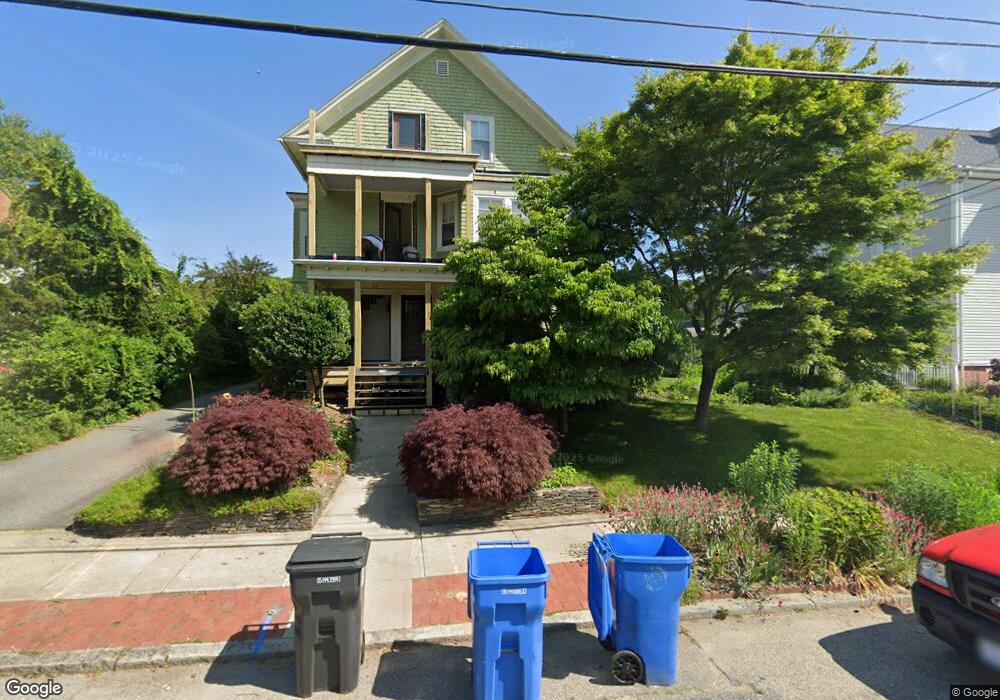
57 Arnold Ave Cranston, RI 02905
Edgewood NeighborhoodEstimated Value: $330,000 - $532,000
2
Beds
1
Bath
1,428
Sq Ft
$289/Sq Ft
Est. Value
About This Home
This home is located at 57 Arnold Ave, Cranston, RI 02905 and is currently estimated at $412,397, approximately $288 per square foot. 57 Arnold Ave is a home located in Providence County with nearby schools including Edward S. Rhodes School, Park View Middle School, and Cranston High School East.
Ownership History
Date
Name
Owned For
Owner Type
Purchase Details
Closed on
Sep 21, 2007
Sold by
Gilbert Eric and Laninf Richard
Bought by
Rockwell John E and Lapierre Christine
Current Estimated Value
Home Financials for this Owner
Home Financials are based on the most recent Mortgage that was taken out on this home.
Original Mortgage
$213,750
Interest Rate
6.63%
Mortgage Type
Purchase Money Mortgage
Purchase Details
Closed on
Dec 7, 2006
Sold by
Chan Ellen Li-Ping
Bought by
Broomfield Michele D
Home Financials for this Owner
Home Financials are based on the most recent Mortgage that was taken out on this home.
Original Mortgage
$191,750
Interest Rate
6.4%
Mortgage Type
Purchase Money Mortgage
Create a Home Valuation Report for This Property
The Home Valuation Report is an in-depth analysis detailing your home's value as well as a comparison with similar homes in the area
Home Values in the Area
Average Home Value in this Area
Purchase History
| Date | Buyer | Sale Price | Title Company |
|---|---|---|---|
| Rockwell John E | $237,500 | -- | |
| Broomfield Michele D | $232,000 | -- |
Source: Public Records
Mortgage History
| Date | Status | Borrower | Loan Amount |
|---|---|---|---|
| Open | Broomfield Michele D | $200,000 | |
| Closed | Broomfield Michele D | $213,750 | |
| Previous Owner | Broomfield Michele D | $191,750 | |
| Previous Owner | Broomfield Michele D | $100,000 |
Source: Public Records
Tax History Compared to Growth
Tax History
| Year | Tax Paid | Tax Assessment Tax Assessment Total Assessment is a certain percentage of the fair market value that is determined by local assessors to be the total taxable value of land and additions on the property. | Land | Improvement |
|---|---|---|---|---|
| 2025 | $4,007 | $288,700 | $0 | $288,700 |
| 2024 | $3,929 | $288,700 | $0 | $288,700 |
| 2023 | $4,090 | $216,400 | $0 | $216,400 |
| 2022 | $4,006 | $216,400 | $0 | $216,400 |
| 2021 | $3,895 | $216,400 | $0 | $216,400 |
| 2020 | $4,110 | $197,900 | $0 | $197,900 |
| 2019 | $4,110 | $197,900 | $0 | $197,900 |
| 2018 | $4,015 | $197,900 | $0 | $197,900 |
| 2017 | $4,540 | $197,900 | $0 | $197,900 |
| 2016 | $4,443 | $197,900 | $0 | $197,900 |
| 2015 | $4,443 | $197,900 | $0 | $197,900 |
| 2014 | $4,392 | $192,300 | $0 | $192,300 |
Source: Public Records
Map
Nearby Homes
- 1291 Narragansett Blvd Unit 4
- 15 Wheeler Ave
- 73 Shaw Ave
- 164 Norwood Ave
- 126 Columbia Ave
- 88 Wentworth Ave
- 2 Kensington Rd
- 154 Armington St
- 177 Arnold Ave
- 1732 Broad St
- 163 Bluff Ave
- 172 Bluff Ave
- 19 Warwick Ave
- 15 Kent Place
- 300 Northup St
- 102 Betsey Williams Dr
- 321 Smith St
- 356 Smith St
- 82 Sefton Dr
- 183 Alabama Ave
- 57 Arnold Ave Unit 1
- 59 Arnold Ave Unit 2
- 59 Arnold Ave Unit 3
- 65 Arnold Ave
- 1235 Narragansett Blvd
- 1231 Narragansett Blvd
- 1229 Narragansett Blvd
- 69 Arnold Ave
- 58 Arnold Ave
- 74 Norwood Ave
- 66 Arnold Ave
- 68 Norwood Ave
- 78 Norwood Ave
- 72 Norwood Ave
- 1243 Narragansett Blvd
- 70 Arnold Ave
- 1221 Narragansett Blvd
- 75 Arnold Ave
- 45 Arnold Ave
- 1232 Narragansett Blvd