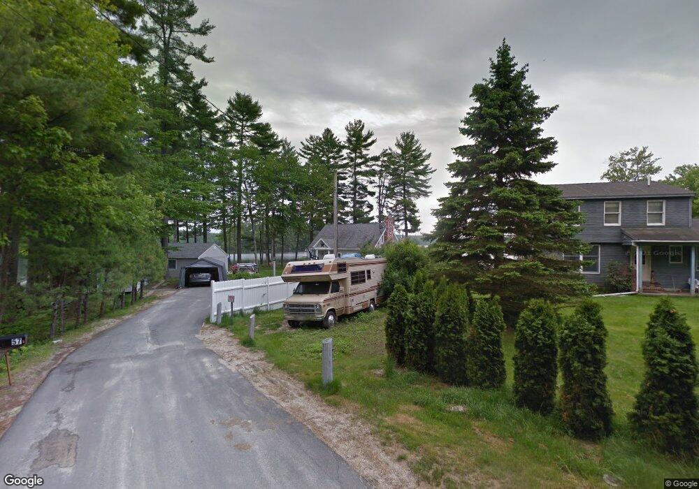
57 Arundel Rd Raymond, ME 04071
Estimated Value: $943,000 - $1,133,738
2
Beds
2
Baths
1,360
Sq Ft
$786/Sq Ft
Est. Value
About This Home
This home is located at 57 Arundel Rd, Raymond, ME 04071 and is currently estimated at $1,069,579, approximately $786 per square foot. 57 Arundel Rd is a home located in Cumberland County with nearby schools including Gray-New Gloucester High School.
Ownership History
Date
Name
Owned For
Owner Type
Purchase Details
Closed on
Jan 6, 2014
Sold by
Luce David C and Luce Debora L
Bought by
Luce David C and Luce Debora L
Current Estimated Value
Purchase Details
Closed on
Mar 18, 2011
Sold by
Luce Debora L and Luce David C
Bought by
Luce Debora L and Luce David C
Create a Home Valuation Report for This Property
The Home Valuation Report is an in-depth analysis detailing your home's value as well as a comparison with similar homes in the area
Home Values in the Area
Average Home Value in this Area
Purchase History
| Date | Buyer | Sale Price | Title Company |
|---|---|---|---|
| Luce David C | -- | -- | |
| Luce Debora L | -- | -- |
Source: Public Records
Tax History Compared to Growth
Tax History
| Year | Tax Paid | Tax Assessment Tax Assessment Total Assessment is a certain percentage of the fair market value that is determined by local assessors to be the total taxable value of land and additions on the property. | Land | Improvement |
|---|---|---|---|---|
| 2025 | $10,342 | $1,068,400 | $740,000 | $328,400 |
| 2024 | $10,363 | $1,068,400 | $740,000 | $328,400 |
| 2023 | $9,381 | $618,000 | $370,000 | $248,000 |
| 2022 | $8,621 | $618,000 | $370,000 | $248,000 |
| 2021 | $8,537 | $584,300 | $370,000 | $214,300 |
| 2020 | $8,618 | $584,300 | $370,000 | $214,300 |
| 2019 | $8,618 | $584,300 | $370,000 | $214,300 |
| 2018 | $8,180 | $584,300 | $370,000 | $214,300 |
| 2017 | $6,870 | $380,600 | $228,000 | $152,600 |
| 2016 | $6,965 | $380,600 | $228,000 | $152,600 |
| 2015 | $6,912 | $379,800 | $228,000 | $151,800 |
| 2014 | $6,912 | $379,800 | $228,000 | $151,800 |
| 2012 | $5,989 | $377,855 | $228,000 | $149,855 |
Source: Public Records
Map
Nearby Homes
- M011-006 Westwood Rd
- 11-007 Westwood Rd
- 21 Westwood Rd
- 56 Qualey Rd
- 7 Gore Rd
- 0 Heidi Way
- 74 May Meadow Dr
- 12 Presidential View
- 24 Suckerville Rd
- 157 Egypt Rd
- 15 May Meadow Dr
- 15 Worcester Dr
- 4 Chelsey Ln
- 00 N Shore Rd
- 35 Webbs Mills Rd
- 20 Ramsdell Rd
- 18 Ramsdell Rd
- 107 Harvest Hill Rd
- 7 Salmon Run
- 127 Shaker Rd Unit 41
- 55 Arundel Rd
- 133 Johnson Rd
- 53 Arundel Rd
- 51 Arundel Rd
- 52 Arundel Rd
- 49 Arundel Rd
- 129 Johnson Rd
- 127 Johnson Rd
- 47 Arundel Rd
- 50 Arundel Rd
- 2 Beaver Cove Rd
- 45 Arundel Rd
- 43 Arundel Rd
- 2 Collins Point Rd
- 5 Kentwood Rd
- 41 Arundel Rd
- 7 Kentwood Rd
- 4 Collins Point Rd
- 4 Beaver Cove Rd
- 1 Collins Point Rd