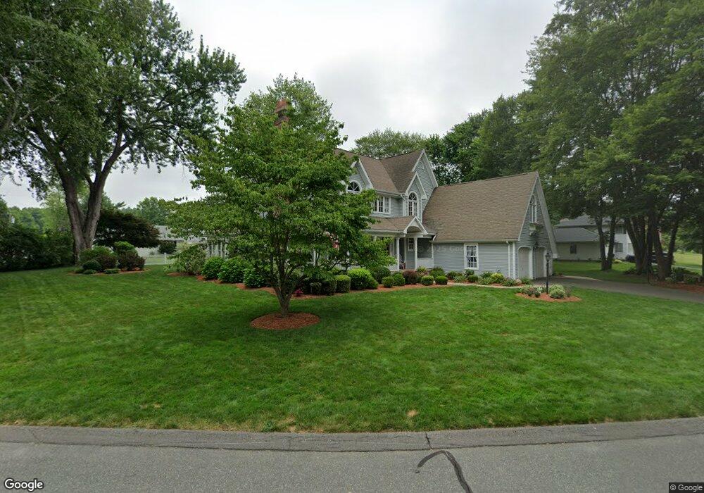
57 Brookside Dr Suffield, CT 06078
Estimated Value: $596,000 - $675,000
4
Beds
3
Baths
2,522
Sq Ft
$250/Sq Ft
Est. Value
About This Home
This home is located at 57 Brookside Dr, Suffield, CT 06078 and is currently estimated at $630,534, approximately $250 per square foot. 57 Brookside Dr is a home located in Hartford County with nearby schools including A. Ward Spaulding School, Mcalister Intermediate School, and Suffield Middle School.
Ownership History
Date
Name
Owned For
Owner Type
Purchase Details
Closed on
Sep 8, 1993
Sold by
Rossi Louis and Rossi Rita
Bought by
Wardwell Edwin and Wardwell Ellen
Current Estimated Value
Create a Home Valuation Report for This Property
The Home Valuation Report is an in-depth analysis detailing your home's value as well as a comparison with similar homes in the area
Home Values in the Area
Average Home Value in this Area
Purchase History
| Date | Buyer | Sale Price | Title Company |
|---|---|---|---|
| Wardwell Edwin | $75,000 | -- |
Source: Public Records
Mortgage History
| Date | Status | Borrower | Loan Amount |
|---|---|---|---|
| Closed | Wardwell Edwin | $42,000 | |
| Closed | Wardwell Edwin | $20,000 | |
| Closed | Wardwell Edwin | $131,400 | |
| Closed | Wardwell Edwin | $31,000 |
Source: Public Records
Tax History
| Year | Tax Paid | Tax Assessment Tax Assessment Total Assessment is a certain percentage of the fair market value that is determined by local assessors to be the total taxable value of land and additions on the property. | Land | Improvement |
|---|---|---|---|---|
| 2025 | $9,316 | $397,950 | $82,180 | $315,770 |
| 2024 | $9,006 | $397,950 | $82,180 | $315,770 |
| 2023 | $8,043 | $281,120 | $82,250 | $198,870 |
| 2022 | $8,043 | $281,120 | $82,250 | $198,870 |
| 2021 | $8,051 | $281,120 | $82,250 | $198,870 |
| 2020 | $8,051 | $281,120 | $82,250 | $198,870 |
| 2019 | $8,074 | $281,120 | $82,250 | $198,870 |
| 2018 | $8,045 | $274,400 | $77,560 | $196,840 |
| 2017 | $7,927 | $274,400 | $77,560 | $196,840 |
| 2016 | $7,738 | $274,400 | $77,560 | $196,840 |
| 2015 | $7,623 | $274,400 | $77,560 | $196,840 |
| 2014 | $7,442 | $274,400 | $77,560 | $196,840 |
Source: Public Records
Map
Nearby Homes
- 1 E Elaine Dr
- 0 Suffield St Unit 24093452
- 0 Suffield St Unit 24057050
- 18 Daniel Cir Unit 18
- 0 Stone St S Unit 24039713
- 278 Thompsonville Rd
- 424 Bridge St
- 392 Boston Neck Rd
- 713 Thrall Ave
- Lot 54 North St
- 779 Bridge St
- 98 1st St
- 1054 Mountain Rd
- 72 Spencer St
- 4 Pebblestone Cir
- 3 Pebblestone Cir Unit 3
- 45 Douglas St
- 24 Pebblestone Cir Unit 24
- 147 W Grayling Ln
- 687 East St S
- 65 Brookside Dr
- 153 Marbern Dr
- 145 Marbern Dr
- 165 Marbern Dr
- 1 E Elaine Dr Unit Lot 6
- 50 Brookside Dr
- 60 Brookside Dr
- 135 Marbern Dr
- 602 Quarry Rd
- 0 Suffield St Unit G490008
- 0 0 Unit G531458
- 0 Spruce Colson & Ratley Unit G569655
- 0 Suffield St Unit G572094
- m24lot Hale St
- 0 Spruce Colson & Ratley Unit G600730
- 00 Remington St -Taintor- Mountain Rd
- 0 Main St-Barry Place Unit G675297
- rear South St
- 00 River Blvd
- 00 Halladay Ave
Your Personal Tour Guide
Ask me questions while you tour the home.