Estimated Value: $700,000 - $967,000
4
Beds
5
Baths
3,060
Sq Ft
$268/Sq Ft
Est. Value
About This Home
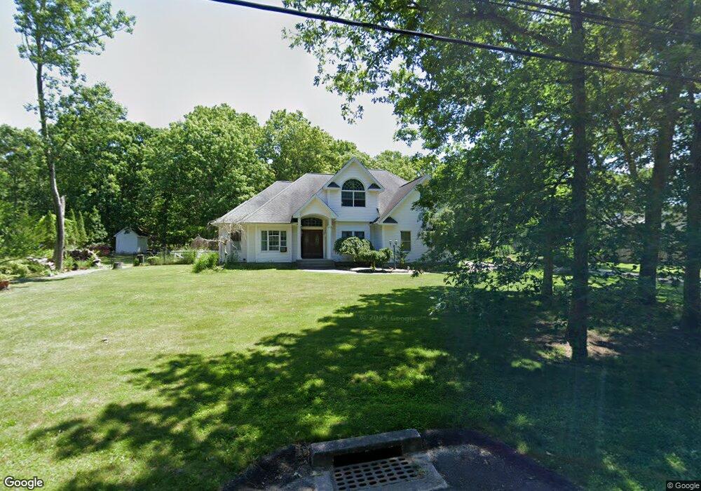
This home is located at 57 E Margin Rd, Ridge, NY 11961 and is currently estimated at $820,317, approximately $268 per square foot. 57 E Margin Rd is a home located in Suffolk County with nearby schools including Longwood Junior High School, Longwood Middle School, and Longwood Senior High School.
Ownership History
Date
Name
Owned For
Owner Type
Purchase Details
Closed on
Mar 20, 2017
Sold by
James Ralph B and James Marie
Bought by
Breaux Charles and Breaux Janet
Current Estimated Value
Home Financials for this Owner
Home Financials are based on the most recent Mortgage that was taken out on this home.
Original Mortgage
$424,800
Interest Rate
4.15%
Mortgage Type
VA
Purchase Details
Closed on
Jun 20, 2013
Sold by
James Ralph B and James Marie
Bought by
James Ralph B and James Marie
Home Financials for this Owner
Home Financials are based on the most recent Mortgage that was taken out on this home.
Original Mortgage
$198,100
Interest Rate
3.59%
Mortgage Type
New Conventional
Purchase Details
Closed on
Aug 21, 2002
Sold by
Neidhart Thomas J and Neidhart Angelique
Bought by
James Ralph B and Loria Marie
Home Financials for this Owner
Home Financials are based on the most recent Mortgage that was taken out on this home.
Original Mortgage
$364,000
Interest Rate
6.36%
Mortgage Type
Purchase Money Mortgage
Purchase Details
Closed on
Feb 5, 1997
Sold by
Andreula Domenick and Andreula Rosetta
Bought by
Neidhart Thomas J and Neidhart Angelique
Create a Home Valuation Report for This Property
The Home Valuation Report is an in-depth analysis detailing your home's value as well as a comparison with similar homes in the area
Home Values in the Area
Average Home Value in this Area
Purchase History
| Date | Buyer | Sale Price | Title Company |
|---|---|---|---|
| Breaux Charles | $472,000 | None Available | |
| James Ralph B | -- | -- | |
| James Ralph B | $455,000 | -- | |
| Neidhart Thomas J | $44,500 | Commonwealth Land Title Ins |
Source: Public Records
Mortgage History
| Date | Status | Borrower | Loan Amount |
|---|---|---|---|
| Previous Owner | Breaux Charles | $424,800 | |
| Previous Owner | James Ralph B | $198,100 | |
| Previous Owner | James Ralph B | $364,000 |
Source: Public Records
Tax History
| Year | Tax Paid | Tax Assessment Tax Assessment Total Assessment is a certain percentage of the fair market value that is determined by local assessors to be the total taxable value of land and additions on the property. | Land | Improvement |
|---|---|---|---|---|
| 2024 | $15,122 | $3,575 | $300 | $3,275 |
| 2023 | $15,122 | $3,575 | $300 | $3,275 |
| 2022 | $13,683 | $3,575 | $300 | $3,275 |
| 2021 | $13,683 | $3,575 | $300 | $3,275 |
| 2020 | $13,961 | $3,575 | $300 | $3,275 |
| 2019 | $13,961 | $0 | $0 | $0 |
| 2018 | $14,197 | $3,575 | $300 | $3,275 |
| 2017 | $14,197 | $3,575 | $300 | $3,275 |
| 2016 | $12,863 | $3,575 | $300 | $3,275 |
| 2015 | -- | $3,575 | $300 | $3,275 |
| 2014 | -- | $3,725 | $300 | $3,425 |
Source: Public Records
Map
Nearby Homes
- 44 E Margin Rd
- 43 Madeline Rd
- 10 Silver Ct
- 0 Tarkill Rd
- 55 Newcomb Trail
- 4 Wyandanch Trail
- 28 Francis Mooney Dr
- 0 Corchaug Trail Unit KEY847995
- 27 Forest Trail
- 126 Wauwepex Trail
- 15 Corchaug Trail
- 63 Lakeside Trail
- 41 Woodbrook Dr
- 37 Pond Ln
- 18 Woodbrook Dr
- 7 Woodbrook Dr
- 359 Randall Rd
- 180 Lakeside Trail
- 33 Highview Ln
- 10 Sally Ln
- 59 E Margin Rd
- 55 E Margin Rd
- 63 E Margin Rd
- 54 E Margin Rd
- 61 E Margin Rd
- 52 E Margin Rd
- 65 E Margin Rd
- 1 Toussie Ct
- 2 Marginwood Dr
- 4 Marginwood Dr
- 3 Toussie Ct
- 99 Madeline Rd
- 62 E Margin Rd
- 6 Marginwood Dr
- 66 E Margin Rd Unit 66
- 5 Toussie Ct
- 7 Toussie Ct
- 7 Toussie Ct
- 42 E Margin Rd
- 44 E Margin Rd
Your Personal Tour Guide
Ask me questions while you tour the home.