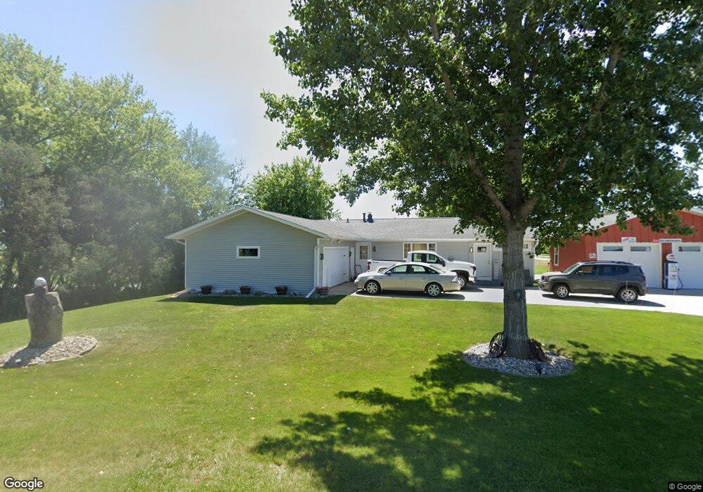
57 Greenview Dr West Branch, IA 52358
Estimated Value: $252,000 - $331,707
3
Beds
1
Bath
2,545
Sq Ft
$115/Sq Ft
Est. Value
About This Home
This home is located at 57 Greenview Dr, West Branch, IA 52358 and is currently estimated at $291,427, approximately $114 per square foot. 57 Greenview Dr is a home located in Cedar County with nearby schools including Hoover Elementary School, West Branch Middle School, and West Branch High School.
Ownership History
Date
Name
Owned For
Owner Type
Purchase Details
Closed on
Apr 27, 2011
Sold by
Artist Craig G and Artist Rhonda J
Bought by
Oneil Patrick W and Oneil Katharine J
Current Estimated Value
Home Financials for this Owner
Home Financials are based on the most recent Mortgage that was taken out on this home.
Original Mortgage
$25,800
Outstanding Balance
$1,000
Interest Rate
4.88%
Mortgage Type
Credit Line Revolving
Estimated Equity
$290,427
Create a Home Valuation Report for This Property
The Home Valuation Report is an in-depth analysis detailing your home's value as well as a comparison with similar homes in the area
Home Values in the Area
Average Home Value in this Area
Purchase History
| Date | Buyer | Sale Price | Title Company |
|---|---|---|---|
| Oneil Patrick W | $172,000 | None Available |
Source: Public Records
Mortgage History
| Date | Status | Borrower | Loan Amount |
|---|---|---|---|
| Open | Oneil Patrick W | $25,800 | |
| Open | Oneil Patrick W | $137,600 |
Source: Public Records
Tax History Compared to Growth
Tax History
| Year | Tax Paid | Tax Assessment Tax Assessment Total Assessment is a certain percentage of the fair market value that is determined by local assessors to be the total taxable value of land and additions on the property. | Land | Improvement |
|---|---|---|---|---|
| 2025 | $4,840 | $307,320 | $34,500 | $272,820 |
| 2024 | $4,840 | $295,150 | $34,500 | $260,650 |
| 2023 | $4,568 | $282,580 | $34,500 | $248,080 |
| 2022 | $4,256 | $229,020 | $32,030 | $196,990 |
| 2021 | $3,980 | $229,020 | $32,030 | $196,990 |
| 2020 | $3,852 | $205,310 | $27,100 | $178,210 |
| 2019 | $3,404 | $195,140 | $0 | $0 |
| 2018 | $3,328 | $195,140 | $0 | $0 |
| 2017 | $3,328 | $184,250 | $0 | $0 |
| 2016 | $3,328 | $184,250 | $0 | $0 |
| 2015 | $3,260 | $179,910 | $0 | $0 |
| 2014 | $3,260 | $179,910 | $0 | $0 |
Source: Public Records
Map
Nearby Homes
- 122 acres m/l Cedar Johnson Rd
- 2 Greenview Dr
- 1 Ember Ln
- 2 Lazy Brook Dr
- 4 Lazy Brook Dr
- 436 Dawson Dr
- Lot 17 the Meadows Subdivision Part 5
- 817 Prairie View Dr
- 0 122 Acres M L Cedar Johnson Rd
- Lot 17 Meadows Subdivision Part 5
- 719 Sullivan St
- Lot 4 Meadows Subdivision Part 6
- Lot 12 Meadows Subdivision Part 6
- Lot 10 Meadows Subdivision Part 6
- Lot 15 Meadows Subdivision Part 6
- Lot 6 Meadows Subdivision Part 6
- Lot 9 Meadows Subdivision Part 6
- Lot 8 Meadows Subdivision Part 6
- Lot 18 Meadows Subdivision Part 6
- Lot 7 Meadows Subdivision Part 6
- 42 Greenview Dr
- 43 Greenview Dr
- 11 Serenity Cir
- 1 Greenview Dr
- 10 Serenity Cir Unit Lot 10
- 10 Serenity Cir
- 10 Serenity Cir
- 10 Serenity Cir
- 707 Cedar Johnson Rd
- 101 Bickford Dr
- 1 Serenity Cir Unit Lot 1
- 1 Serenity Cir
- 1 Serenity Cir
- 1 Serenity Cir
- 851 Cedar Johnson Rd Unit Lot 12
- 41 Greenview Dr
- 9 Serenity Cir Unit Lot 9
- 9 Serenity Cir
- 9 Serenity Cir
- 9 Serenity Cir