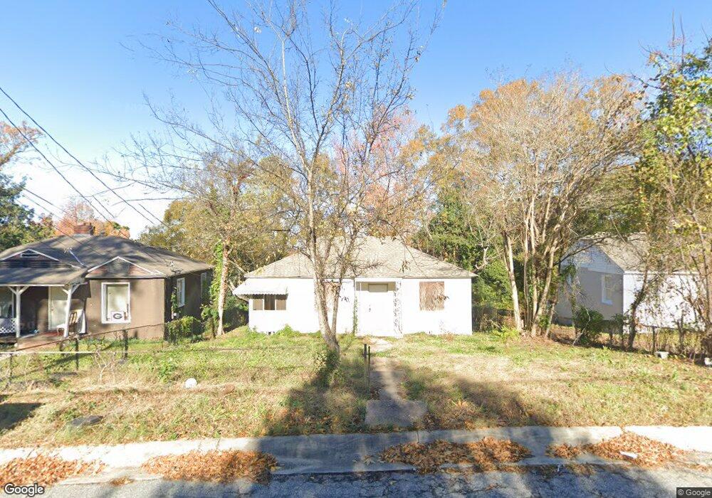
57 Mathews St Columbus, GA 31903
South Columbus NeighborhoodEstimated Value: $22,000 - $69,696
2
Beds
1
Bath
1,080
Sq Ft
$48/Sq Ft
Est. Value
About This Home
This home is located at 57 Mathews St, Columbus, GA 31903 and is currently estimated at $52,232, approximately $48 per square foot. 57 Mathews St is a home located in Muscogee County with nearby schools including South Columbus Elementary School, Eddy Middle School, and Spencer High School.
Ownership History
Date
Name
Owned For
Owner Type
Purchase Details
Closed on
Sep 18, 2023
Sold by
Trending Floors Llc
Bought by
Loredo Miguel Delgadillo
Current Estimated Value
Purchase Details
Closed on
Jun 14, 2022
Sold by
Herber Cisneros
Bought by
Trending Floors Llc
Purchase Details
Closed on
Apr 19, 2018
Sold by
Gill Karen
Bought by
Cisneros Heber
Purchase Details
Closed on
Dec 19, 2013
Sold by
Gill Fam Cornerstone Tr
Bought by
The Vine Trust
Purchase Details
Closed on
Dec 18, 2013
Sold by
Harbison B Real Estate Hol
Bought by
Gill Fam Cornerstone Trust
Create a Home Valuation Report for This Property
The Home Valuation Report is an in-depth analysis detailing your home's value as well as a comparison with similar homes in the area
Home Values in the Area
Average Home Value in this Area
Purchase History
| Date | Buyer | Sale Price | Title Company |
|---|---|---|---|
| Loredo Miguel Delgadillo | -- | None Listed On Document | |
| Trending Floors Llc | -- | Meyerson Law Firm | |
| Cisneros Heber | -- | -- | |
| The Vine Trust | -- | -- | |
| The Vine Trust | -- | -- | |
| Gill Fam Cornerstone Trust | -- | -- |
Source: Public Records
Tax History
| Year | Tax Paid | Tax Assessment Tax Assessment Total Assessment is a certain percentage of the fair market value that is determined by local assessors to be the total taxable value of land and additions on the property. | Land | Improvement |
|---|---|---|---|---|
| 2025 | $471 | $12,040 | $4,372 | $7,668 |
| 2024 | $440 | $11,252 | $3,228 | $8,024 |
| 2023 | $378 | $11,252 | $3,228 | $8,024 |
| 2022 | $378 | $9,252 | $3,228 | $6,024 |
| 2021 | $348 | $7,652 | $3,228 | $4,424 |
| 2020 | $313 | $7,652 | $3,228 | $4,424 |
| 2019 | $156 | $3,800 | $1,600 | $2,200 |
| 2018 | $317 | $7,732 | $3,228 | $4,504 |
| 2017 | $318 | $7,732 | $3,228 | $4,504 |
| 2016 | $249 | $6,047 | $1,778 | $4,269 |
| 2015 | $100 | $6,047 | $1,778 | $4,269 |
| 2014 | $198 | $11,943 | $1,778 | $10,165 |
| 2013 | -- | $11,943 | $1,778 | $10,165 |
Source: Public Records
Map
Nearby Homes
- 55 Mathews St
- 59 Mathews St
- 146 Torch Hill Rd
- 53 Mathews St
- 144 Torch Hill Rd
- 148 Torch Hill Rd
- 51 Mathews St
- 142 Torch Hill Rd
- 56 Mathews St
- 49 Mathews St
- 48 Mathews St
- 140 Torch Hill Rd
- 60 Mathews St
- 43 Mason Dr
- 62 Mathews St
- 45 Mason Dr
- 147 Torch Hill Rd
- 145 Torch Hill Rd
- 149 Torch Hill Rd
- 138 Torch Hill Rd
Your Personal Tour Guide
Ask me questions while you tour the home.