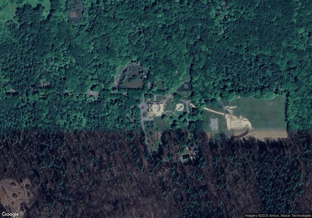
57 Mt Tom Rd Out of Area, CT 06068
Estimated Value: $3,712,000
9
Beds
13
Baths
22,282
Sq Ft
$167/Sq Ft
Est. Value
About This Home
This home is located at 57 Mt Tom Rd, Out of Area, CT 06068 and is currently estimated at $3,712,000, approximately $166 per square foot. 57 Mt Tom Rd is a home located in Litchfield County with nearby schools including Housatonic Valley Regional High School.
Ownership History
Date
Name
Owned For
Owner Type
Purchase Details
Closed on
Dec 30, 1996
Sold by
Est Salisbury Harrison and Curto Anthony V
Bought by
Robert Boyett Jr Tr
Current Estimated Value
Purchase Details
Closed on
Jun 20, 1996
Sold by
Salisbury Harrison Est and Salisbury
Bought by
Robert Boyett Jr Trust
Home Financials for this Owner
Home Financials are based on the most recent Mortgage that was taken out on this home.
Original Mortgage
$1,100,000
Interest Rate
8.21%
Mortgage Type
Purchase Money Mortgage
Create a Home Valuation Report for This Property
The Home Valuation Report is an in-depth analysis detailing your home's value as well as a comparison with similar homes in the area
Home Values in the Area
Average Home Value in this Area
Purchase History
| Date | Buyer | Sale Price | Title Company |
|---|---|---|---|
| Robert Boyett Jr Tr | $325,000 | -- | |
| Robert Boyett Jr Tr | $325,000 | -- | |
| Robert Boyett Jr Trust | $750,000 | -- | |
| Robert Boyett Jr Trust | $750,000 | -- |
Source: Public Records
Mortgage History
| Date | Status | Borrower | Loan Amount |
|---|---|---|---|
| Previous Owner | Robert Boyett Jr Trust | $1,100,000 |
Source: Public Records
Tax History Compared to Growth
Tax History
| Year | Tax Paid | Tax Assessment Tax Assessment Total Assessment is a certain percentage of the fair market value that is determined by local assessors to be the total taxable value of land and additions on the property. | Land | Improvement |
|---|---|---|---|---|
| 2025 | $113,699 | $10,336,310 | $1,947,010 | $8,389,300 |
| 2024 | $112,730 | $10,248,210 | $1,947,010 | $8,301,200 |
| 2023 | $112,730 | $10,248,210 | $1,947,010 | $8,301,200 |
| 2022 | $112,730 | $10,248,210 | $1,947,010 | $8,301,200 |
| 2021 | $112,730 | $10,248,210 | $1,947,010 | $8,301,200 |
| 2020 | $93,214 | $8,035,710 | $1,736,610 | $6,299,100 |
| 2019 | $93,214 | $8,035,710 | $1,736,610 | $6,299,100 |
| 2018 | $90,804 | $8,035,710 | $1,736,610 | $6,299,100 |
| 2017 | $89,196 | $8,035,710 | $1,736,610 | $6,299,100 |
| 2016 | $85,982 | $8,035,710 | $1,736,610 | $6,299,100 |
| 2015 | $74,119 | $6,927,010 | $1,795,410 | $5,131,600 |
| 2014 | $65,540 | $6,241,910 | $1,795,410 | $4,446,500 |
Source: Public Records
Map
Nearby Homes
- 1669 Silver St
- 353 Twin Lakes Rd
- 1166 Rannapo Rd
- 1180 Ashley Falls Rd Unit A,B,C,D,E
- 102 S Shore Rd
- 48 Preston Ln
- 1460 Ashley Falls Rd
- 26 Preston Ln
- 182 Church St
- 153 E Main St
- 41 Prospect St
- 76 Washinee Heights Rd
- 277 Ashley Falls Rd
- 856 Barnum St
- 118 Washinee Heights Rd
- 36 Furnace Brook Rd
- 91 Main St
- 33 Granite Ave
- 338 Salisbury Rd
- 65 Hammertown Rd
- 57 Mount Tom Rd
- 61 Mount Tom Rd
- 78 Mount Tom Rd
- 57 Cooper Hill Rd
- 848 Cooper Hill Rd
- 48 O Hara Ln
- 45 Cooper Hill Rd
- 689 Cooper Hill Rd
- 60 O Hara Ln
- 44 O Hara Ln
- 43 O Hara Ln
- 275 Twin Lakes Rd
- 277 Twin Lakes Rd
- 273 Twin Lakes Rd
- 599 Cooper Hill Rd
- 297 Twin Lakes Rd
- 637 Cooper Hill Rd
- 301 Twin Lakes Rd
- 331 Twin Lakes Rd
- 351 Twin Lakes Rd