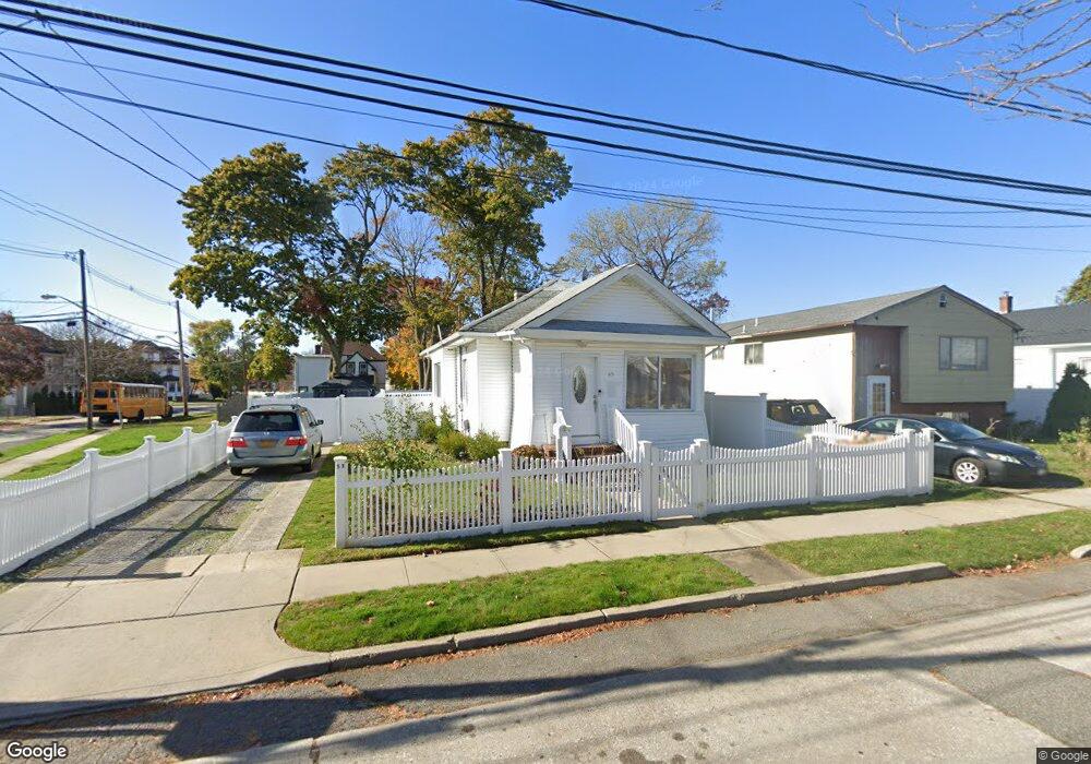
57 Rutland Rd Freeport, NY 11520
Estimated Value: $403,000 - $561,024
2
Beds
2
Baths
921
Sq Ft
$523/Sq Ft
Est. Value
About This Home
This home is located at 57 Rutland Rd, Freeport, NY 11520 and is currently estimated at $482,012, approximately $523 per square foot. 57 Rutland Rd is a home located in Nassau County with nearby schools including Columbus Avenue School, Caroline G. Atkinson Intermediate School, and John W Dodd Middle School.
Ownership History
Date
Name
Owned For
Owner Type
Purchase Details
Closed on
Nov 18, 2016
Sold by
Lopez Williams R and Lopez Yolanda A
Bought by
Peralta Linnette A and Rodriguez Miguel E
Current Estimated Value
Home Financials for this Owner
Home Financials are based on the most recent Mortgage that was taken out on this home.
Original Mortgage
$216,015
Outstanding Balance
$177,144
Interest Rate
4.12%
Mortgage Type
FHA
Estimated Equity
$304,868
Purchase Details
Closed on
Jun 22, 2000
Purchase Details
Closed on
Apr 21, 1998
Sold by
Opel Equities Inc
Bought by
Ramirez Gilberto and Ramirez Candida
Purchase Details
Closed on
Jun 19, 1997
Sold by
Smith Ethel Marjorie
Bought by
Opel Equities Inc
Create a Home Valuation Report for This Property
The Home Valuation Report is an in-depth analysis detailing your home's value as well as a comparison with similar homes in the area
Home Values in the Area
Average Home Value in this Area
Purchase History
| Date | Buyer | Sale Price | Title Company |
|---|---|---|---|
| Peralta Linnette A | $220,000 | Eagle Abstract Corp | |
| -- | -- | -- | |
| Ramirez Gilberto | $105,000 | -- | |
| Opel Equities Inc | $55,000 | -- |
Source: Public Records
Mortgage History
| Date | Status | Borrower | Loan Amount |
|---|---|---|---|
| Open | Peralta Linnette A | $216,015 |
Source: Public Records
Tax History
| Year | Tax Paid | Tax Assessment Tax Assessment Total Assessment is a certain percentage of the fair market value that is determined by local assessors to be the total taxable value of land and additions on the property. | Land | Improvement |
|---|---|---|---|---|
| 2025 | $7,202 | $334 | $121 | $213 |
| 2024 | $730 | $334 | $121 | $213 |
| 2023 | $6,939 | $334 | $121 | $213 |
| 2022 | $6,939 | $334 | $121 | $213 |
| 2021 | $10,036 | $320 | $116 | $204 |
| 2020 | $6,653 | $407 | $225 | $182 |
| 2019 | $5,990 | $407 | $225 | $182 |
| 2018 | $5,893 | $407 | $0 | $0 |
| 2017 | $4,898 | $407 | $225 | $182 |
| 2016 | $5,509 | $407 | $202 | $205 |
| 2015 | $621 | $430 | $214 | $216 |
| 2014 | $621 | $430 | $214 | $216 |
| 2013 | $618 | $453 | $225 | $228 |
Source: Public Records
Map
Nearby Homes
- 58 Rutland Rd
- 58 Shonnard Ave
- 96 N Columbus Ave
- 98 N Columbus Ave
- 26 Rosedale Ave
- 33 Willow Ave
- 241 Commercial St
- 67 E Dean St
- 101 Harris Ave
- 173 E Seaman Ave
- 247 N Columbus Ave
- 70 S Main St Unit 307-PH
- 70 N Grove St Unit 1N
- 70 N Grove St Unit 1R
- 85 Bedford Ave
- 63 E Seaman Ave
- 398 Babylon Turnpike
- 99 Randall Ave Unit 1Q
- 115 N Bergen Place
- 35 W Seaman Ave
- 61 Rutland Rd
- 65 Rutland Rd
- 45 Rutland Rd
- 31 Parsons Ave
- 69 Rutland Rd
- 82 N Columbus Ave
- 72 Rutland Rd
- 88 N Columbus Ave Unit 1Floor
- 88 N Columbus Ave Unit Garage
- 10 Parsons Ave
- 64 Rutland Rd
- 78 Rutland Rd
- 41 Rutland Rd
- 73 Rutland Rd
- 80 Rutland Rd
- 78 N Columbus Ave
- 37 Rutland Rd
- 52 Rutland Rd
- 88 Rutland Rd
- 63 Shonnard Ave
Your Personal Tour Guide
Ask me questions while you tour the home.