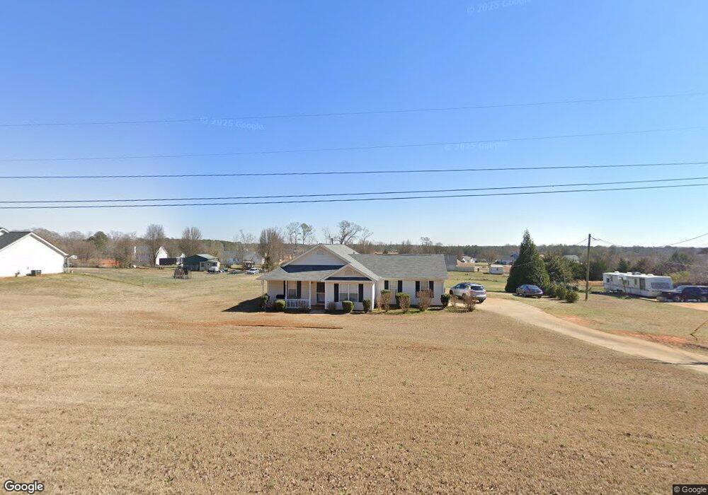
57 S Barnes Dr Locust Grove, GA 30248
Estimated Value: $256,000 - $274,000
3
Beds
2
Baths
1,411
Sq Ft
$187/Sq Ft
Est. Value
About This Home
This home is located at 57 S Barnes Dr, Locust Grove, GA 30248 and is currently estimated at $263,864, approximately $187 per square foot. 57 S Barnes Dr is a home located in Henry County with nearby schools including Locust Grove Elementary School, Locust Grove Middle School, and Locust Grove High School.
Ownership History
Date
Name
Owned For
Owner Type
Purchase Details
Closed on
Jun 25, 1999
Sold by
Bunn Andrew C and Bunn Jeannie M
Bought by
Relford Stephen K and Relford Elleen M
Current Estimated Value
Home Financials for this Owner
Home Financials are based on the most recent Mortgage that was taken out on this home.
Original Mortgage
$97,198
Outstanding Balance
$26,100
Interest Rate
7.27%
Mortgage Type
FHA
Estimated Equity
$237,765
Purchase Details
Closed on
Feb 3, 1998
Sold by
Bunn Andrew Carey
Bought by
Bunn Andrew Carey and Bunn Jeannie M
Create a Home Valuation Report for This Property
The Home Valuation Report is an in-depth analysis detailing your home's value as well as a comparison with similar homes in the area
Home Values in the Area
Average Home Value in this Area
Purchase History
| Date | Buyer | Sale Price | Title Company |
|---|---|---|---|
| Relford Stephen K | $98,000 | -- | |
| Bunn Andrew Carey | $10,800 | -- |
Source: Public Records
Mortgage History
| Date | Status | Borrower | Loan Amount |
|---|---|---|---|
| Open | Relford Stephen K | $97,198 |
Source: Public Records
Tax History Compared to Growth
Tax History
| Year | Tax Paid | Tax Assessment Tax Assessment Total Assessment is a certain percentage of the fair market value that is determined by local assessors to be the total taxable value of land and additions on the property. | Land | Improvement |
|---|---|---|---|---|
| 2025 | $2,752 | $105,320 | $15,400 | $89,920 |
| 2024 | $2,752 | $101,640 | $13,920 | $87,720 |
| 2023 | $2,241 | $97,640 | $13,400 | $84,240 |
| 2022 | $2,163 | $72,640 | $12,360 | $60,280 |
| 2021 | $1,910 | $61,800 | $10,600 | $51,200 |
| 2020 | $1,752 | $55,120 | $10,000 | $45,120 |
| 2019 | $1,721 | $52,880 | $9,480 | $43,400 |
| 2018 | $1,427 | $44,680 | $8,760 | $35,920 |
| 2016 | $1,151 | $36,040 | $6,760 | $29,280 |
| 2015 | $1,041 | $32,600 | $7,600 | $25,000 |
| 2014 | $875 | $28,240 | $7,600 | $20,640 |
Source: Public Records
Map
Nearby Homes
- 143 Massey Ln
- 231 Ferguson Ave
- 239 Ferguson Ave
- 1064 Lear Dr
- 565 Carleton Place
- 50 Grove Rd
- 501 Grove Park Dr
- 4 Skyland Dr W
- 1537 Jackson St
- 65 Grove Creek Dr
- 0 Locust Rd Unit 10495072
- 0 Locust Rd Unit 19967321
- 150 Aster Ave
- Cali Plan at Cedar Ridge - Locust Grove Station
- Belfort Plan at Cedar Ridge - Locust Grove Station
- Galen Plan at Cedar Ridge - Locust Grove Station
- Hayden Plan at Cedar Ridge - Locust Grove Station
- Packard Plan at Cedar Ridge - Locust Grove Station
- Flora Plan at Cedar Ridge - Locust Grove Station
- Penwell Plan at Cedar Ridge - Locust Grove Station
- 59 S Barnes Dr
- 55 S Barnes Dr
- S S Barnes Dr
- 114 Massey Ln
- 112 Massey Ln
- 116 Massey Ln
- 66 S Barnes Dr
- 61 S Barnes Dr
- 108 Massey Ln
- 96 S Barnes Dr
- 53 S Barnes Dr
- 124 Massey Ln
- 142 Massey Ln
- 140 Massey Ln
- 120 Massey Ln Unit BS LOT 2
- 120 Massey Ln Unit BS-2
- 142 Massey Ln Unit LOT 07
- 140 Massey Ln Unit LOT 06
- 138 Massey Ln Unit LOT 5
- 124 Massey Ln Unit LOT 3