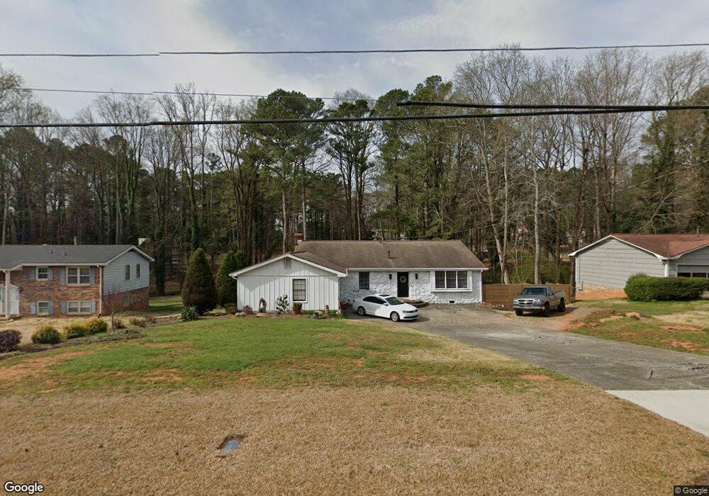
57 Simpson Dr NE Kennesaw, GA 30144
Estimated Value: $296,000 - $380,142
4
Beds
3
Baths
1,672
Sq Ft
$210/Sq Ft
Est. Value
About This Home
This home is located at 57 Simpson Dr NE, Kennesaw, GA 30144 and is currently estimated at $350,786, approximately $209 per square foot. 57 Simpson Dr NE is a home located in Cobb County with nearby schools including Blackwell Elementary School, McCleskey Middle School, and Kell High School.
Ownership History
Date
Name
Owned For
Owner Type
Purchase Details
Closed on
Aug 14, 2009
Sold by
Corn Christine A
Bought by
Corn William T
Current Estimated Value
Home Financials for this Owner
Home Financials are based on the most recent Mortgage that was taken out on this home.
Original Mortgage
$141,391
Outstanding Balance
$92,423
Interest Rate
5.26%
Mortgage Type
FHA
Estimated Equity
$258,363
Purchase Details
Closed on
Nov 8, 2007
Sold by
Jp Morgan Chase Bk
Bought by
Corn Christine
Purchase Details
Closed on
Aug 7, 2007
Sold by
Layne Earl L and Layne Janet G
Bought by
Jp Morgan Chase Bk
Create a Home Valuation Report for This Property
The Home Valuation Report is an in-depth analysis detailing your home's value as well as a comparison with similar homes in the area
Home Values in the Area
Average Home Value in this Area
Purchase History
| Date | Buyer | Sale Price | Title Company |
|---|---|---|---|
| Corn William T | $144,000 | -- | |
| Corn Christine | $129,000 | -- | |
| Jp Morgan Chase Bk | $137,590 | -- |
Source: Public Records
Mortgage History
| Date | Status | Borrower | Loan Amount |
|---|---|---|---|
| Open | Corn William T | $141,391 |
Source: Public Records
Tax History Compared to Growth
Tax History
| Year | Tax Paid | Tax Assessment Tax Assessment Total Assessment is a certain percentage of the fair market value that is determined by local assessors to be the total taxable value of land and additions on the property. | Land | Improvement |
|---|---|---|---|---|
| 2024 | $2,933 | $121,920 | $30,000 | $91,920 |
| 2023 | $2,501 | $126,996 | $26,000 | $100,996 |
| 2022 | $2,711 | $110,728 | $18,000 | $92,728 |
| 2021 | $2,232 | $88,840 | $18,000 | $70,840 |
| 2020 | $2,016 | $78,984 | $18,000 | $60,984 |
| 2019 | $1,569 | $60,720 | $18,000 | $42,720 |
| 2018 | $1,569 | $60,720 | $18,000 | $42,720 |
| 2017 | $1,573 | $63,644 | $12,000 | $51,644 |
| 2016 | $1,574 | $63,644 | $12,000 | $51,644 |
| 2015 | $1,169 | $48,520 | $10,000 | $38,520 |
| 2014 | $1,179 | $48,520 | $0 | $0 |
Source: Public Records
Map
Nearby Homes
- 95 Simpson Dr NE
- 297 Shallowford Rd NW
- 4228 Pentworth Ln NW
- 4110 Oak Ferry Dr NE
- 559 Farmbrook Trail NE
- 4699 N View Rd NW Unit 1
- 4699 N View Rd NW
- 0 Lake Latimer Dr NE Unit 10506857
- 44 Lake Latimer Dr NE
- 46 Lake Latimer Dr NE
- 48 Lake Latimer Dr NE
- 0 Lake Latimer Dr NE Unit 7564947
- 338 Bramford Way NW
- 412 Monroe Way NW Unit 2
- 496 Bottesford Dr NW
- 0 Watkins Glen Dr NE Unit 10506865
- 0 Watkins Glen Dr NE Unit 7564156
- 4393 Laurian Dr NW
- 4065 Maxanne Dr NW
- 597 Farmbrook Trail NE
- 45 Simpson Dr NE
- 69 Simpson Dr NE
- 91 Keith Ln NW Unit 3
- 35 Simpson Dr NE Unit 3
- 75 Simpson Dr NE
- 4440 Scott Dr NW
- 56 Simpson Dr NE Unit 3
- 81 Keith Ln NW Unit 3
- 101 Keith Ln NW
- 70 Simpson Dr NE
- 42 Simpson Dr NE
- 27 Simpson Dr NE
- 87 Simpson Dr NE
- 4450 Scott Dr NW
- 0 Scott Dr Unit 7254468
- 0 Scott Dr Unit 7009483
- 0 Scott Dr Unit 3233052
- 100 Keith Ln NW
- 30 Simpson Dr NE
- 4431 Myrtle Hill Rd NE